Trail Walking Municipality of Ierapetra - lac ierapetra - Photo
© OpenStreetMap contributors
Length
Length
23 km
Max alt
Max alt
98 m
Uphill gradient
Uphill gradient
243 m
Km-Effort
Km-Effort  
26 km
Min alt
Min alt
-4 m
Downhill gradient
Downhill gradient
243 m
Boucle
Boucle
Yes
Creation date :
2021-10-07 06:39:38.268
Updated on :
2021-10-07 12:13:02.98

(0 Reviews)

Walking
Walking
5h30
Difficulty : Medium

Scan this QR Code to open this trail in the SityTrail application

FREE GPS app for hiking

Logo SityTrail SityTrail

IGN / Geographical institutes

Download SityTrail from the App Store Download SityTrail from Google Play

Logo SityTrail SityTrail World

The world is yours!

Download SityTrail from the App Store Download SityTrail from Google Play Download SityTrail on Huawei AppGallery

About

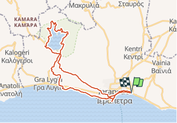
Trail Walking of 23 km to be discovered at Region of Crete, Lasithi Regional Unit, Municipality of Ierapetra. This trail is proposed by mitch1915.

Elevation profile

Photos

Positioning

Country:
Greece
Region :
Region of Crete
Department/Province :
Lasithi Regional Unit
Municipality :
Municipality of Ierapetra
Location:
Unknown
Start:(UTM)
386059 ; 3874836 (35S) N.

Trails nearby

Trail Walking Municipality of Ierapetra - crête cascade  - Photo
Walking
mitch1915

Walking

Very difficult
Municipality of Ierapetra, Region of Crete, Lasithi Regional Unit, Greece
26 km | 31 km-effort
6h 21min
Yes


Close
My subscriptions