![](/images/other/stat-length.png)
![Trail Walking Saint-Sauveur-de-Cruzières - Saint Sauveur de Cruzières - Photo](https://media.geolcdn.com/t/1900/400/ext.pjpeg?maxdim=2&url=https%3A%2F%2Fstatic1.geolcdn.com%2Fsiteimages%2Fupload%2Ffiles%2F1553511878bg_sport_marche.png)
Saint Sauveur de Cruzières
Did JP
User
![Length](/images/other/stat-length.png)
Length
5.9 km
![Max alt](https://static1.geolcdn.com/siteimages/upload/files/1508320355ic_sort_altitude_max_24dp.png)
Max alt
355 m
![Uphill gradient](https://static1.geolcdn.com/siteimages/upload/files/1508320355ic_sort_den_pos_24dp.png)
Uphill gradient
239 m
![Km-Effort](/images/other/stat-length.png)
Km-Effort
9.1 km
![Min alt](https://static1.geolcdn.com/siteimages/upload/files/1508320355ic_sort_altitude_min_24dp.png)
Min alt
135 m
![Downhill gradient](https://static1.geolcdn.com/siteimages/upload/files/1508320355ic_sort_den_neg_24dp.png)
Downhill gradient
239 m
![Boucle](https://static1.geolcdn.com/siteimages/upload/files/16400158638029165_repeat_loop_refresh_sync_direction_icon.png)
Boucle
Yes
Creation date :
2021-10-06 19:53:26.885
Updated on :
2021-10-06 19:53:28.505
![Walking](https://static1.geolcdn.com/sitytour/trail-icons/101.png)
1h40
Difficulty : Medium
![Scan this QR Code to open this trail in the SityTrail application](https://capi.geolives.com/qq0zvz2zws4bq2lad0pu/sitytour/trails/2960831/qr.png?size=200)
FREE GPS app for hiking
About
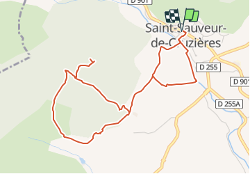
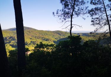
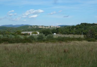
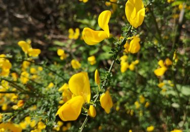
Trail Walking of 5.9 km to be discovered at Auvergne-Rhône-Alpes, Ardèche, Saint-Sauveur-de-Cruzières. This trail is proposed by Did JP.
Description
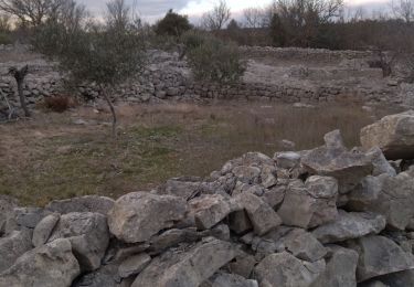
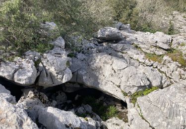
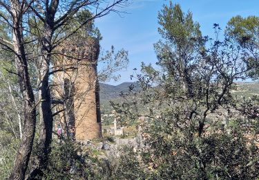
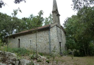
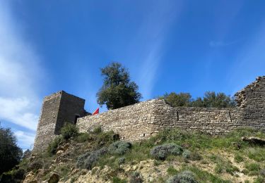
Petite randonnée panoramique jusqu'à la table d'orientation de la chapelle St.Privas. Passage dans les vignes, les oliveraies, la garrigue et le long de la Claysse.
Positioning
Country:
France
Region :
Auvergne-Rhône-Alpes
Department/Province :
Ardèche
Municipality :
Saint-Sauveur-de-Cruzières
Location:
Unknown
Start:(Dec)
Start:(UTM)
599956 ; 4905944 (31T) N.
Comments
Trails nearby
![Trail Walking Bessas - Le Puy Lacher par les crêtes - Photo](https://media.geolcdn.com/t/375/260/ext.jpg?maxdim=2&url=https%3A%2F%2Fstatic1.geolcdn.com%2Fsiteimages%2Fupload%2Ffiles%2F1553511878bg_sport_marche.png)
![Walking Walking](https://static1.geolcdn.com/sitytour/trail-icons/101.png)
Le Puy Lacher par les crêtes
Walking
Difficult
(2)
Bessas,
Auvergne-Rhône-Alpes,
Ardèche,
France
![](/images/other/stat-length.png)
10.2 km | 16.3 km-effort
3h 10min
![](https://static1.geolcdn.com/siteimages/upload/files/16400158638029165_repeat_loop_refresh_sync_direction_icon.png)
Yes
![Trail Walking Saint-André-de-Cruzières - CHADOUILLET - Photo](https://media.geolcdn.com/t/375/260/ext.jpg?maxdim=2&url=https%3A%2F%2Fmedia.geolcdn.com%2Ff%2F772623f8-cb56-4d04-9b3d-145b33c03c4b.jpeg)
![Walking Walking](https://static1.geolcdn.com/sitytour/trail-icons/101.png)
CHADOUILLET
Walking
Medium
Saint-André-de-Cruzières,
Auvergne-Rhône-Alpes,
Ardèche,
France
![](/images/other/stat-length.png)
7.8 km | 9.4 km-effort
2h 8min
![](https://static1.geolcdn.com/siteimages/upload/files/16400158638029165_repeat_loop_refresh_sync_direction_icon.png)
Yes
![Trail Walking Saint-Ambroix - Autour de St Ambroix - Photo](https://media.geolcdn.com/t/375/260/ext.jpg?maxdim=2&url=https%3A%2F%2Fmedia.geolcdn.com%2Ff%2F82ff88e1-535b-48d4-a2a3-cbd68a960bf2.jpg)
![Walking Walking](https://static1.geolcdn.com/sitytour/trail-icons/101.png)
Autour de St Ambroix
Walking
Medium
Saint-Ambroix,
Occitania,
Gard,
France
![](/images/other/stat-length.png)
18.6 km | 27 km-effort
5h 39min
![](https://static1.geolcdn.com/siteimages/upload/files/16400158638029165_repeat_loop_refresh_sync_direction_icon.png)
Yes
![Trail Walking Saint-André-de-Cruzières - 07 chandouillet grotte cotepatiere sauvas peyrejol - Photo](https://media.geolcdn.com/t/375/260/ext.jpg?maxdim=2&url=https%3A%2F%2Fmedia.geolcdn.com%2Ff%2Ff87b5d53-f27e-44e1-a082-e539e9102b98.jpg)
![Walking Walking](https://static1.geolcdn.com/sitytour/trail-icons/101.png)
07 chandouillet grotte cotepatiere sauvas peyrejol
Walking
Medium
Saint-André-de-Cruzières,
Auvergne-Rhône-Alpes,
Ardèche,
France
![](/images/other/stat-length.png)
17.8 km | 24 km-effort
7h 47min
![](https://static1.geolcdn.com/siteimages/upload/files/16400158638029165_repeat_loop_refresh_sync_direction_icon.png)
Yes
![Trail Nordic walking Saint-Ambroix - 24.05.20 montèze - Photo](https://media.geolcdn.com/t/375/260/ext.jpg?maxdim=2&url=https%3A%2F%2Fmedia.geolcdn.com%2Ff%2F10bdb4ea-d96a-491f-8780-6b95f3222b15.jpg)
![Nordic walking Nordic walking](https://static1.geolcdn.com/sitytour/trail-icons/102.png)
24.05.20 montèze
Nordic walking
Very easy
Saint-Ambroix,
Occitania,
Gard,
France
![](/images/other/stat-length.png)
7.4 km | 11.3 km-effort
2h 9min
![](https://static1.geolcdn.com/siteimages/upload/files/16400158638029165_repeat_loop_refresh_sync_direction_icon.png)
No
![Trail Walking Bessas - Le Puy Lacher - Bessas - Photo](https://media.geolcdn.com/t/375/260/ext.jpg?maxdim=2&url=https%3A%2F%2Fservices.sitytrail.com%2FGeolivesWS%2FDownloadMedia.ashx%3FTrailID%3D317233%26Media%3D16412_6.jpg)
![Walking Walking](https://static1.geolcdn.com/sitytour/trail-icons/101.png)
Le Puy Lacher - Bessas
Walking
Medium
Bessas,
Auvergne-Rhône-Alpes,
Ardèche,
France
![](/images/other/stat-length.png)
18.3 km | 27 km-effort
5h 0min
![](https://static1.geolcdn.com/siteimages/upload/files/16400158638029165_repeat_loop_refresh_sync_direction_icon.png)
Yes
![Trail Walking Saint-André-de-Cruzières - Montagne de la Serre - Saint André de Cruzières - Photo](https://media.geolcdn.com/t/375/260/ext.jpg?maxdim=2&url=https%3A%2F%2Fservices.sitytrail.com%2FGeolivesWS%2FDownloadMedia.ashx%3FTrailID%3D317001%26Media%3D16134_6.jpg)
![Walking Walking](https://static1.geolcdn.com/sitytour/trail-icons/101.png)
Montagne de la Serre - Saint André de Cruzières
Walking
Difficult
Saint-André-de-Cruzières,
Auvergne-Rhône-Alpes,
Ardèche,
France
![](/images/other/stat-length.png)
17.9 km | 25 km-effort
5h 0min
![](https://static1.geolcdn.com/siteimages/upload/files/16400158638029165_repeat_loop_refresh_sync_direction_icon.png)
Yes
![Trail Walking Saint-Ambroix - Saint Ambroix - Photo](https://media.geolcdn.com/t/375/260/ext.jpg?maxdim=2&url=https%3A%2F%2Fmedia.geolcdn.com%2Ff%2F32fe2a3c-cd11-4d0a-b728-f780d5f26d6d.jpg)
![Walking Walking](https://static1.geolcdn.com/sitytour/trail-icons/101.png)
Saint Ambroix
Walking
Very difficult
Saint-Ambroix,
Occitania,
Gard,
France
![](/images/other/stat-length.png)
16.7 km | 24 km-effort
6h 26min
![](https://static1.geolcdn.com/siteimages/upload/files/16400158638029165_repeat_loop_refresh_sync_direction_icon.png)
No
![Trail Nordic walking Saint-Ambroix - montalet - Photo](https://media.geolcdn.com/t/375/260/ext.jpg?maxdim=2&url=https%3A%2F%2Fmedia.geolcdn.com%2Ff%2Fc7c7ad35-4788-46f3-91f6-8a5c18aa9d17.jpg)
![Nordic walking Nordic walking](https://static1.geolcdn.com/sitytour/trail-icons/102.png)
montalet
Nordic walking
Very easy
Saint-Ambroix,
Occitania,
Gard,
France
![](/images/other/stat-length.png)
6.8 km | 10.6 km-effort
2h 31min
![](https://static1.geolcdn.com/siteimages/upload/files/16400158638029165_repeat_loop_refresh_sync_direction_icon.png)
No