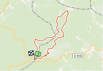
![](/images/other/stat-length.png)
![Trail Walking Arbéost - Le lac de Soum - Photo](https://media.geolcdn.com/t/1900/400/2d31835a-aa7c-4998-b8ad-5e5c90f5381f.jpg&format=pjpeg&maxdim=2)
Le lac de Soum
micheldutilleul
User
![Length](/images/other/stat-length.png)
![Max alt](https://static1.geolcdn.com/siteimages/upload/files/1508320355ic_sort_altitude_max_24dp.png)
![Uphill gradient](https://static1.geolcdn.com/siteimages/upload/files/1508320355ic_sort_den_pos_24dp.png)
![Km-Effort](/images/other/stat-length.png)
![Min alt](https://static1.geolcdn.com/siteimages/upload/files/1508320355ic_sort_altitude_min_24dp.png)
![Downhill gradient](https://static1.geolcdn.com/siteimages/upload/files/1508320355ic_sort_den_neg_24dp.png)
![Boucle](https://static1.geolcdn.com/siteimages/upload/files/16400158638029165_repeat_loop_refresh_sync_direction_icon.png)
![Walking](https://static1.geolcdn.com/sitytour/trail-icons/101.png)
2h01
Difficulty : Easy
![Scan this QR Code to open this trail in the SityTrail application](https://capi.geolives.com/qq0zvz2zws4bq2lad0pu/sitytour/trails/2960320/qr.png?size=200)
FREE GPS app for hiking
About
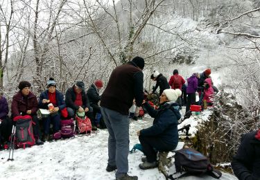
Trail Walking of 8.2 km to be discovered at Occitania, Hautespyrenees, Arbéost. This trail is proposed by micheldutilleul.
Description
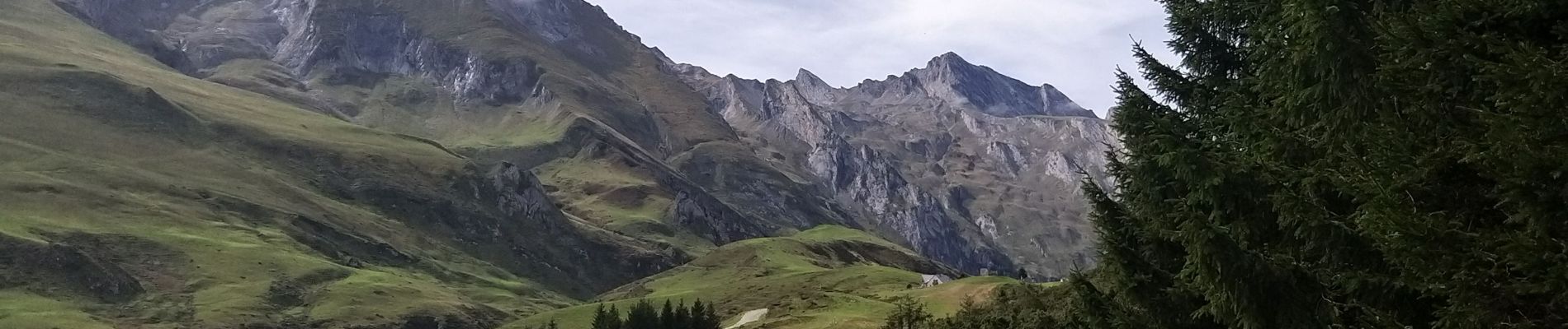
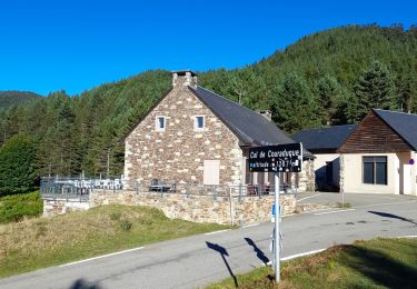
Au départ du col de Soulor, direction le lac de Soum en passant par la plaine d'Août et le col de Mauben (GR101). Arrivé au lac de Soum, aller jusqu'à la cabane de Cantau et y admirer le point de vue. Puis continuer la boucle pour revenir près du lac. Descendre la montagne à flanc, au dessus de Port Carré, vers le col du Soulor.
Positioning
Comments
Trails nearby
![Trail On foot Arbéost - SityTrail - Arbeost le tour des quartiers d'Arbeost fait - Photo](https://media.geolcdn.com/t/375/260/ext.jpg?maxdim=2&url=https%3A%2F%2Fstatic1.geolcdn.com%2Fsiteimages%2Fupload%2Ffiles%2F1545311037marcheuse_200dpi.jpg)
![On foot On foot](https://static1.geolcdn.com/sitytour/trail-icons/100.png)
On foot
![](/images/other/stat-length.png)
![](https://static1.geolcdn.com/siteimages/upload/files/16400158638029165_repeat_loop_refresh_sync_direction_icon.png)
![Trail Snowshoes Aucun - Le Soum de Berducou - Photo](https://media.geolcdn.com/t/375/260/ext.jpg?maxdim=2&url=https%3A%2F%2Fservices.sitytrail.com%2FGeolivesWS%2FDownloadMedia.ashx%3FTrailID%3D110337%26Media%3D5784_1.jpg)
![Snowshoes Snowshoes](https://static1.geolcdn.com/sitytour/trail-icons/504.png)
Snowshoes
![](/images/other/stat-length.png)
![](https://static1.geolcdn.com/siteimages/upload/files/16400158638029165_repeat_loop_refresh_sync_direction_icon.png)
![Trail Walking Arrens-Marsous - ARRENS MARSOUS Le Turon des aulhes 2906361 - Photo](https://media.geolcdn.com/t/375/260/11ee13f3-f703-440e-9be7-4acb8ea55d91.jpg&format=jpg&maxdim=2)
![Walking Walking](https://static1.geolcdn.com/sitytour/trail-icons/101.png)
Walking
![](/images/other/stat-length.png)
![](https://static1.geolcdn.com/siteimages/upload/files/16400158638029165_repeat_loop_refresh_sync_direction_icon.png)
![Trail Winter sports Aucun - couraduc soulor - Photo](https://media.geolcdn.com/t/375/260/ext.jpg?maxdim=2&url=https%3A%2F%2Fstatic1.geolcdn.com%2Fsiteimages%2Fupload%2Ffiles%2F1524743153ski.jpg)
![Winter sports Winter sports](https://static1.geolcdn.com/sitytour/trail-icons/500.png)
Winter sports
![](/images/other/stat-length.png)
![](https://static1.geolcdn.com/siteimages/upload/files/16400158638029165_repeat_loop_refresh_sync_direction_icon.png)
![Trail Winter sports Aucun - Bazes soulor - Photo](https://media.geolcdn.com/t/375/260/ext.jpg?maxdim=2&url=https%3A%2F%2Fstatic1.geolcdn.com%2Fsiteimages%2Fupload%2Ffiles%2F1524743153ski.jpg)
![Winter sports Winter sports](https://static1.geolcdn.com/sitytour/trail-icons/500.png)
Winter sports
![](/images/other/stat-length.png)
![](https://static1.geolcdn.com/siteimages/upload/files/16400158638029165_repeat_loop_refresh_sync_direction_icon.png)
![Trail Walking Arrens-Marsous - col de soulor, lac de soum, col de bazes, col de soulor - Photo](https://media.geolcdn.com/t/375/260/9c3094c8-45a9-4b5a-9dd6-274e8c565d12.jpg&format=jpg&maxdim=2)
![Walking Walking](https://static1.geolcdn.com/sitytour/trail-icons/101.png)
Walking
![](/images/other/stat-length.png)
![](https://static1.geolcdn.com/siteimages/upload/files/16400158638029165_repeat_loop_refresh_sync_direction_icon.png)
![Trail Walking Aucun - Lac de Soum depuis Col de Couraduque en boucle - Photo](https://media.geolcdn.com/t/375/260/796fccc8-4f12-43e4-93ad-e83b0e4ee94e.jpg&format=jpg&maxdim=2)
![Walking Walking](https://static1.geolcdn.com/sitytour/trail-icons/101.png)
Walking
![](/images/other/stat-length.png)
![](https://static1.geolcdn.com/siteimages/upload/files/16400158638029165_repeat_loop_refresh_sync_direction_icon.png)
![Trail Walking Arbéost - G3arbeost le tour fait 2022 - Photo](https://media.geolcdn.com/t/375/260/48356084-36bc-465f-b160-a49039e9ce27.jpg&format=jpg&maxdim=2)
![Walking Walking](https://static1.geolcdn.com/sitytour/trail-icons/101.png)
Walking
![](/images/other/stat-length.png)
![](https://static1.geolcdn.com/siteimages/upload/files/16400158638029165_repeat_loop_refresh_sync_direction_icon.png)
![Trail Walking Arrens-Marsous - ARRENS-MARSOUS le chemin de la mine G4 3059377 - Photo](https://media.geolcdn.com/t/375/260/518ded4d-66a4-45f9-be9c-992637e83008.jpg&format=jpg&maxdim=2)
![Walking Walking](https://static1.geolcdn.com/sitytour/trail-icons/101.png)
Walking
![](/images/other/stat-length.png)
![](https://static1.geolcdn.com/siteimages/upload/files/16400158638029165_repeat_loop_refresh_sync_direction_icon.png)