


Mad Fuerte Survol Séville

jmheydorff
User
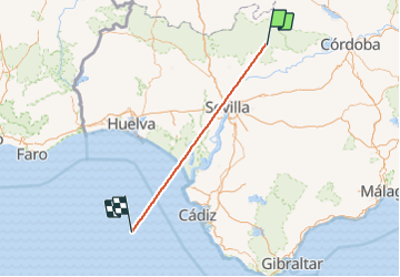

Length
203 km

Max alt
684 m

Uphill gradient
1562 m
Km-Effort
226 km

Min alt
-4 m

Downhill gradient
2180 m
Boucle
No
Creation date :
2021-10-02 06:37:04.943
Updated on :
2021-10-02 08:21:36.414
14m
Difficulty : Very easy

FREE GPS app for hiking
 SityTrail
IGN / Geographical institutes
SityTrail World
The world is yours!
About
Trail Plane of 203 km to be discovered at Andalusia, Sevilla, Constantina. This trail is proposed by jmheydorff.
Positioning
Country:
Spain
Region :
Andalusia
Department/Province :
Sevilla
Municipality :
Constantina
Location:
Unknown
Start:(Dec)
Start:(UTM)
271313 ; 4196131 (30S) N.
Comments
Trails nearby