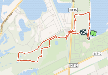
![](/images/other/stat-length.png)
![Trail Walking Mol - 2021-09-29_15h22m36_Sun parc Kempense Meren 01 - Photo](https://media.geolcdn.com/t/1900/400/3cc67463-7b57-4172-992b-cc542ae8eb39.jpg&format=pjpeg&maxdim=2)
2021-09-29_15h22m36_Sun parc Kempense Meren 01
Mudry
User
![Length](/images/other/stat-length.png)
Length
5.3 km
![Max alt](https://static1.geolcdn.com/siteimages/upload/files/1508320355ic_sort_altitude_max_24dp.png)
Max alt
47 m
![Uphill gradient](https://static1.geolcdn.com/siteimages/upload/files/1508320355ic_sort_den_pos_24dp.png)
Uphill gradient
46 m
![Km-Effort](/images/other/stat-length.png)
Km-Effort
5.9 km
![Min alt](https://static1.geolcdn.com/siteimages/upload/files/1508320355ic_sort_altitude_min_24dp.png)
Min alt
28 m
![Downhill gradient](https://static1.geolcdn.com/siteimages/upload/files/1508320355ic_sort_den_neg_24dp.png)
Downhill gradient
46 m
![Boucle](https://static1.geolcdn.com/siteimages/upload/files/16400158638029165_repeat_loop_refresh_sync_direction_icon.png)
Boucle
Yes
Creation date :
2021-09-29 13:22:37.267
Updated on :
2021-09-29 13:41:18.873
![Walking](https://static1.geolcdn.com/sitytour/trail-icons/101.png)
1h20
Difficulty : Easy
![Scan this QR Code to open this trail in the SityTrail application](https://capi.geolives.com/qq0zvz2zws4bq2lad0pu/sitytour/trails/2953525/qr.png?size=200)
FREE GPS app for hiking
About
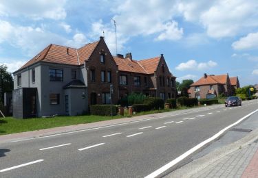
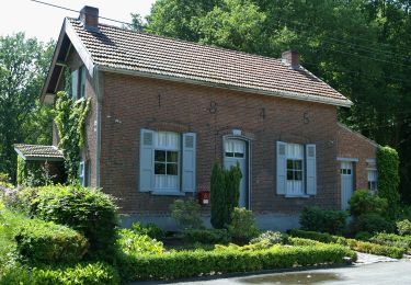
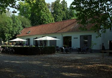
Trail Walking of 5.3 km to be discovered at Flanders, Antwerp, Mol. This trail is proposed by Mudry.
Description
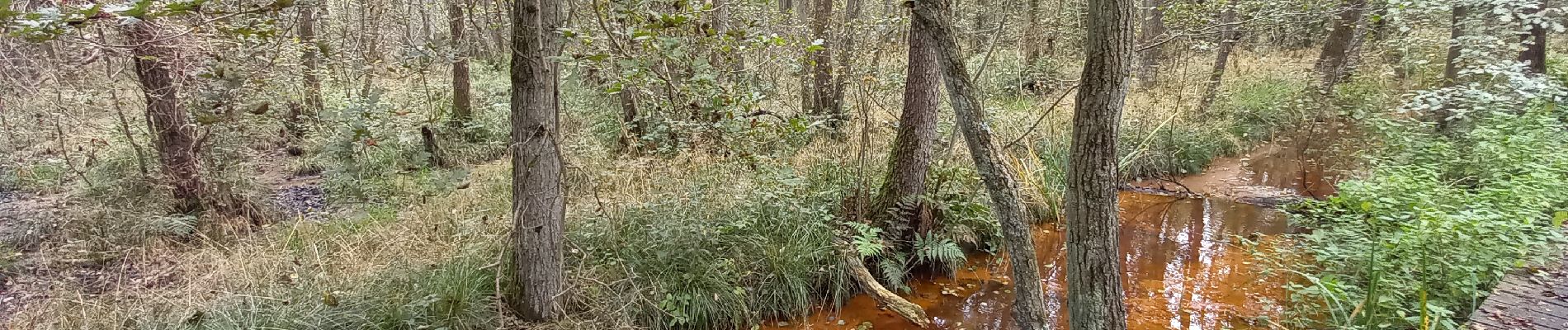
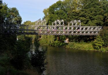
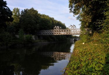
Promenade balisée au départ du Sun Park. Balisage top. Un dépliant papier est disponible à l'accueil du Sun Park. Pas de difficulté majeure mais le parcours le long du cours d'eau est parfois un peu glissant et...mouillé...
Positioning
Country:
Belgium
Region :
Flanders
Department/Province :
Antwerp
Municipality :
Mol
Location:
Unknown
Start:(Dec)
Start:(UTM)
652812 ; 5676297 (31U) N.
Comments
Trails nearby
![Trail On foot Mol - Merenpad 7km - Photo](https://media.geolcdn.com/t/375/260/4f059d46-9351-4bfb-b85c-d0034645b3fe.jpeg&format=jpg&maxdim=2)
![On foot On foot](https://static1.geolcdn.com/sitytour/trail-icons/100.png)
![Trail On foot Mol - Galbergenpad - Photo](https://media.geolcdn.com/t/375/260/ac6c45ad-0a3f-46f0-8730-3bf99148b3e6.jpeg&format=jpg&maxdim=2)
![On foot On foot](https://static1.geolcdn.com/sitytour/trail-icons/100.png)
![Trail On foot Mol - Netepad - Photo](https://media.geolcdn.com/t/375/260/b8d824ab-b7ec-46ac-901d-e1a19a60eee0.jpeg&format=jpg&maxdim=2)
![On foot On foot](https://static1.geolcdn.com/sitytour/trail-icons/100.png)
![Trail On foot Mol - Merenpad - Photo](https://media.geolcdn.com/t/375/260/03f8c97e-ed17-4356-a72b-3f3c82846f0d.jpeg&format=jpg&maxdim=2)
![On foot On foot](https://static1.geolcdn.com/sitytour/trail-icons/100.png)
![Trail On foot Lommel - Blauwe Kei Rode driehoek - Photo](https://media.geolcdn.com/t/375/260/9bca7f32-27e0-4e61-aadd-7c6bcb57fbd7.jpeg&format=jpg&maxdim=2)
![On foot On foot](https://static1.geolcdn.com/sitytour/trail-icons/100.png)
Blauwe Kei Rode driehoek
On foot
Easy
Lommel,
Flanders,
Limburg,
Belgium
![](/images/other/stat-length.png)
11.4 km | 12.2 km-effort
2h 47min
![](https://static1.geolcdn.com/siteimages/upload/files/16400158638029165_repeat_loop_refresh_sync_direction_icon.png)
Yes
![Trail On foot Lommel - Blauwe Kei Groene rechthoek - Photo](https://media.geolcdn.com/t/375/260/9bca7f32-27e0-4e61-aadd-7c6bcb57fbd7.jpeg&format=jpg&maxdim=2)
![On foot On foot](https://static1.geolcdn.com/sitytour/trail-icons/100.png)
Blauwe Kei Groene rechthoek
On foot
Easy
Lommel,
Flanders,
Limburg,
Belgium
![](/images/other/stat-length.png)
4.9 km | 5.3 km-effort
1h 11min
![](https://static1.geolcdn.com/siteimages/upload/files/16400158638029165_repeat_loop_refresh_sync_direction_icon.png)
Yes
![Trail On foot Lommel - Blauwe Kei Gele zeshoek - Photo](https://media.geolcdn.com/t/375/260/c27b7662-6e94-4e29-b3cf-5c4fe5dc9647.jpeg&format=jpg&maxdim=2)
![On foot On foot](https://static1.geolcdn.com/sitytour/trail-icons/100.png)
Blauwe Kei Gele zeshoek
On foot
Easy
Lommel,
Flanders,
Limburg,
Belgium
![](/images/other/stat-length.png)
8.8 km | 9.6 km-effort
2h 10min
![](https://static1.geolcdn.com/siteimages/upload/files/16400158638029165_repeat_loop_refresh_sync_direction_icon.png)
Yes
![Trail On foot Lommel - De Maat blauwe vlam - Photo](https://media.geolcdn.com/t/375/260/feb75399-7b57-4327-8c6f-945ea77a910c.jpeg&format=jpg&maxdim=2)
![On foot On foot](https://static1.geolcdn.com/sitytour/trail-icons/100.png)
De Maat blauwe vlam
On foot
Easy
Lommel,
Flanders,
Limburg,
Belgium
![](/images/other/stat-length.png)
5.7 km | 6.1 km-effort
1h 23min
![](https://static1.geolcdn.com/siteimages/upload/files/16400158638029165_repeat_loop_refresh_sync_direction_icon.png)
Yes
![Trail On foot Mol - Den Diel - Photo](https://media.geolcdn.com/t/375/260/c27b7662-6e94-4e29-b3cf-5c4fe5dc9647.jpeg&format=jpg&maxdim=2)
![On foot On foot](https://static1.geolcdn.com/sitytour/trail-icons/100.png)