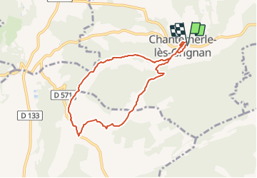
![](/images/other/stat-length.png)
![Trail Walking Chantemerle-lès-Grignan - Chantemerle Les crevasses 8km - Photo](https://media.geolcdn.com/t/1900/400/431d5085-52aa-456d-90d6-4dc31ac6daad.jpg&format=pjpeg&maxdim=2)
Chantemerle Les crevasses 8km
thonyc
User GUIDE
![Length](/images/other/stat-length.png)
![Max alt](https://static1.geolcdn.com/siteimages/upload/files/1508320355ic_sort_altitude_max_24dp.png)
![Uphill gradient](https://static1.geolcdn.com/siteimages/upload/files/1508320355ic_sort_den_pos_24dp.png)
![Km-Effort](/images/other/stat-length.png)
![Min alt](https://static1.geolcdn.com/siteimages/upload/files/1508320355ic_sort_altitude_min_24dp.png)
![Downhill gradient](https://static1.geolcdn.com/siteimages/upload/files/1508320355ic_sort_den_neg_24dp.png)
![Boucle](https://static1.geolcdn.com/siteimages/upload/files/16400158638029165_repeat_loop_refresh_sync_direction_icon.png)
![Walking](https://static1.geolcdn.com/sitytour/trail-icons/101.png)
2h04
Difficulty : Medium
![Scan this QR Code to open this trail in the SityTrail application](https://capi.geolives.com/qq0zvz2zws4bq2lad0pu/sitytour/trails/2948526/qr.png?size=200)
FREE GPS app for hiking
About
Trail Walking of 7.6 km to be discovered at Auvergne-Rhône-Alpes, Drôme, Chantemerle-lès-Grignan. This trail is proposed by thonyc.
Description
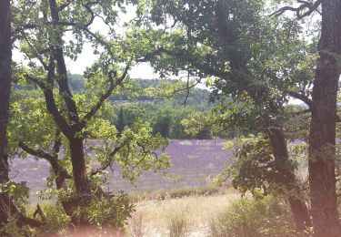
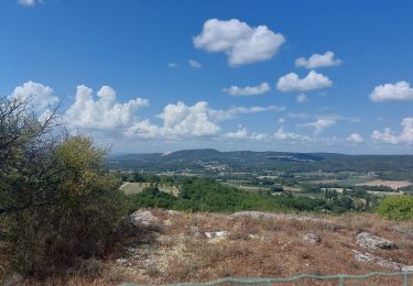
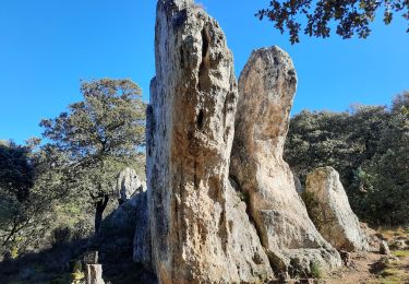
Belle rando tranquille avec passage sur le haut des crevasses qui offre de beaux coups d’œil sur les villages alentours et sur la plaine de Montélimar.
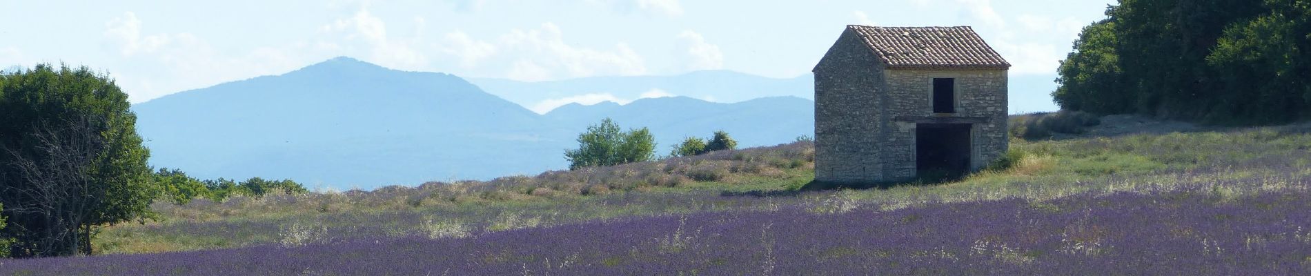
Le plateau du Rouvergue avec ses mas et ses lavandes est très joli.
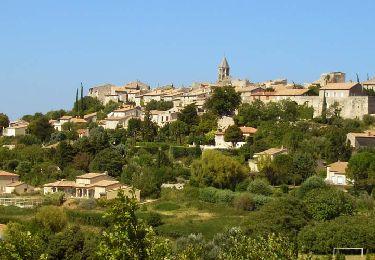
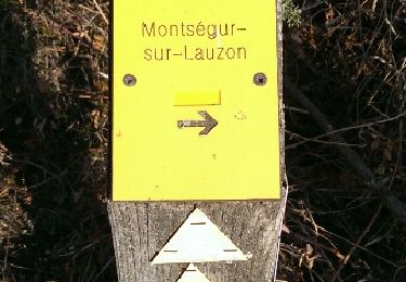
Ne pas hésiter à visiter le village de Chantemerle
Positioning
Comments
Trails nearby
![Trail Walking Clansayes - SityTrail - Clansayes Le Rouvergue 6km - Photo](https://media.geolcdn.com/t/375/260/de3feb6f-5587-4e87-a580-1261cf3df48e.jpg&format=jpg&maxdim=2)
![Walking Walking](https://static1.geolcdn.com/sitytour/trail-icons/101.png)
Walking
![](/images/other/stat-length.png)
![](https://static1.geolcdn.com/siteimages/upload/files/16400158638029165_repeat_loop_refresh_sync_direction_icon.png)
![Trail Walking Roussas - Roussas le Vernet 10km. - Photo](https://media.geolcdn.com/t/375/260/69de5ff3-2ab5-4bbd-b379-bc7253ad9aad.jpg&format=jpg&maxdim=2)
![Walking Walking](https://static1.geolcdn.com/sitytour/trail-icons/101.png)
Walking
![](/images/other/stat-length.png)
![](https://static1.geolcdn.com/siteimages/upload/files/16400158638029165_repeat_loop_refresh_sync_direction_icon.png)
![Trail Walking Chantemerle-lès-Grignan - 2022-09-02_11h45m28_Les crevasses Le Rouvergue 14km.gpx (1).xml - Photo](https://media.geolcdn.com/t/375/260/831a71a9-7103-4579-b58f-a481dab0e6f2.jpg&format=jpg&maxdim=2)
![Walking Walking](https://static1.geolcdn.com/sitytour/trail-icons/101.png)
Walking
![](/images/other/stat-length.png)
![](https://static1.geolcdn.com/siteimages/upload/files/16400158638029165_repeat_loop_refresh_sync_direction_icon.png)
![Trail Walking Réauville - Reauville Aiguebelle Cascacades 10km - Photo](https://media.geolcdn.com/t/375/260/c8066850-a8b6-4767-b8cc-00eee53525df.jpg&format=jpg&maxdim=2)
![Walking Walking](https://static1.geolcdn.com/sitytour/trail-icons/101.png)
Walking
![](/images/other/stat-length.png)
![](https://static1.geolcdn.com/siteimages/upload/files/16400158638029165_repeat_loop_refresh_sync_direction_icon.png)
![Trail Walking Chantemerle-lès-Grignan - Les Crevasses de Chantemerle Les Grignans 7Km5 - Photo](https://media.geolcdn.com/t/375/260/cedb0d20-c0ad-495a-acf8-00c291c6b1fd.jpg&format=jpg&maxdim=2)
![Walking Walking](https://static1.geolcdn.com/sitytour/trail-icons/101.png)
Walking
![](/images/other/stat-length.png)
![](https://static1.geolcdn.com/siteimages/upload/files/16400158638029165_repeat_loop_refresh_sync_direction_icon.png)
![Trail Walking Chantemerle-lès-Grignan - Chantemerle-Les Grignan Les jumelles du Rozet Clansayes 15km - Photo](https://media.geolcdn.com/t/375/260/e778a7ff-aae4-45e1-a529-5e7212fd1471.jpg&format=jpg&maxdim=2)
![Walking Walking](https://static1.geolcdn.com/sitytour/trail-icons/101.png)
Walking
![](/images/other/stat-length.png)
![](https://static1.geolcdn.com/siteimages/upload/files/16400158638029165_repeat_loop_refresh_sync_direction_icon.png)
![Trail Walking Roussas - Roussas Panassas 8 km - Photo](https://media.geolcdn.com/t/375/260/daa93b3b-e486-4ddd-9c21-8f099d0a496e.jpg&format=jpg&maxdim=2)
![Walking Walking](https://static1.geolcdn.com/sitytour/trail-icons/101.png)
Walking
![](/images/other/stat-length.png)
![](https://static1.geolcdn.com/siteimages/upload/files/16400158638029165_repeat_loop_refresh_sync_direction_icon.png)
![Trail Walking Montségur-sur-Lauzon - Bassin des druides. Montségur-lauzon - Photo](https://media.geolcdn.com/t/375/260/ext.jpg?maxdim=2&url=https%3A%2F%2Fservices.sitytrail.com%2FGeolivesWS%2FDownloadMedia.ashx%3FTrailID%3D892897%26Media%3Dfix__20180124152347.jpg)
![Walking Walking](https://static1.geolcdn.com/sitytour/trail-icons/101.png)
Walking
![](/images/other/stat-length.png)
![](https://static1.geolcdn.com/siteimages/upload/files/16400158638029165_repeat_loop_refresh_sync_direction_icon.png)
![Trail Walking Chantemerle-lès-Grignan - Crevasses de Chantemerle - Photo](https://media.geolcdn.com/t/375/260/ext.jpg?maxdim=2&url=https%3A%2F%2Fstatic1.geolcdn.com%2Fsiteimages%2Fupload%2Ffiles%2F1553511878bg_sport_marche.png)
![Walking Walking](https://static1.geolcdn.com/sitytour/trail-icons/101.png)
Walking
![](/images/other/stat-length.png)
![](https://static1.geolcdn.com/siteimages/upload/files/16400158638029165_repeat_loop_refresh_sync_direction_icon.png)