![](/images/other/stat-length.png)
![Trail Walking Villiers-sur-Loir - Randonnée à Villiers-sur-Loir - Photo](https://media.geolcdn.com/t/1900/400/9d560b2a-37ce-47eb-82e2-14ccac1a8b83.jpg&format=pjpeg&maxdim=2)
Randonnée à Villiers-sur-Loir
guydu41
User
![Length](/images/other/stat-length.png)
Length
9.7 km
![Max alt](https://static1.geolcdn.com/siteimages/upload/files/1508320355ic_sort_altitude_max_24dp.png)
Max alt
138 m
![Uphill gradient](https://static1.geolcdn.com/siteimages/upload/files/1508320355ic_sort_den_pos_24dp.png)
Uphill gradient
98 m
![Km-Effort](/images/other/stat-length.png)
Km-Effort
11 km
![Min alt](https://static1.geolcdn.com/siteimages/upload/files/1508320355ic_sort_altitude_min_24dp.png)
Min alt
72 m
![Downhill gradient](https://static1.geolcdn.com/siteimages/upload/files/1508320355ic_sort_den_neg_24dp.png)
Downhill gradient
96 m
![Boucle](https://static1.geolcdn.com/siteimages/upload/files/16400158638029165_repeat_loop_refresh_sync_direction_icon.png)
Boucle
Yes
Creation date :
2021-09-22 07:00:06.227
Updated on :
2021-09-23 04:03:17.399
![Walking](https://static1.geolcdn.com/sitytour/trail-icons/101.png)
3h06
Difficulty : Very easy
![Scan this QR Code to open this trail in the SityTrail application](https://capi.geolives.com/qq0zvz2zws4bq2lad0pu/sitytour/trails/2945279/qr.png?size=200)
FREE GPS app for hiking
About
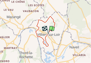
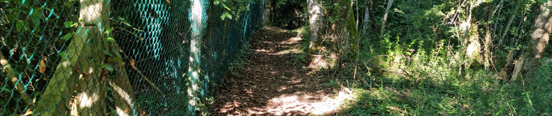
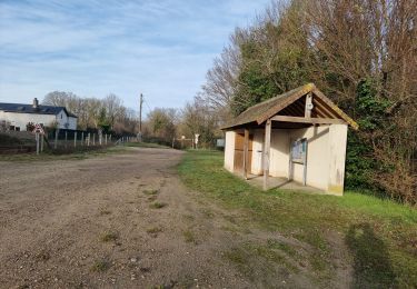
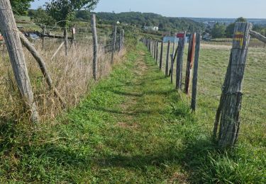
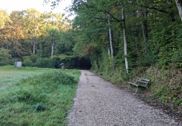
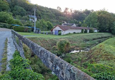
Trail Walking of 9.7 km to be discovered at Centre-Loire Valley, Loir-et-Cher, Villiers-sur-Loir. This trail is proposed by guydu41.
Description
Ce très beau parcours est un "Mix" entre le Circuit PR "Promenade et Randonnée" balisé jaune (voir trace correspondante sur ce site) et la "Randonnée des Coteaux" balisée bleu (voir trace sur ce site).
Départ/Arrivée : Parking devant la Mairie.
Positioning
Country:
France
Region :
Centre-Loire Valley
Department/Province :
Loir-et-Cher
Municipality :
Villiers-sur-Loir
Location:
Unknown
Start:(Dec)
Start:(UTM)
349865 ; 5296715 (31T) N.
Comments
Trails nearby
![Trail On foot Villiers-sur-Loir - Circuit des Côteaux - Photo](https://media.geolcdn.com/t/375/260/25cb373c-e85b-47b3-b4c8-0c4c4213b15c.jpeg&format=jpg&maxdim=2)
![On foot On foot](https://static1.geolcdn.com/sitytour/trail-icons/100.png)
Circuit des Côteaux
On foot
Easy
Villiers-sur-Loir,
Centre-Loire Valley,
Loir-et-Cher,
France
![](/images/other/stat-length.png)
9.4 km | 11 km-effort
2h 29min
![](https://static1.geolcdn.com/siteimages/upload/files/16400158638029165_repeat_loop_refresh_sync_direction_icon.png)
Yes
![Trail Walking Thoré-la-Rochette - Thoré-la-Rochette - Vallée et Coteaux du Loir - Photo](https://media.geolcdn.com/t/375/260/3f4c80d2-3437-4e69-84de-30a02f464543.jpg&format=jpg&maxdim=2)
![Walking Walking](https://static1.geolcdn.com/sitytour/trail-icons/101.png)
Thoré-la-Rochette - Vallée et Coteaux du Loir
Walking
Medium
Thoré-la-Rochette,
Centre-Loire Valley,
Loir-et-Cher,
France
![](/images/other/stat-length.png)
9.2 km | 11.6 km-effort
2h 38min
![](https://static1.geolcdn.com/siteimages/upload/files/16400158638029165_repeat_loop_refresh_sync_direction_icon.png)
Yes
![Trail Walking Marcilly-en-Beauce - Varennes - Photo](https://media.geolcdn.com/t/375/260/e5fe1065-d10c-4b43-96c8-69a926a5b2c1.jpg&format=jpg&maxdim=2)
![Walking Walking](https://static1.geolcdn.com/sitytour/trail-icons/101.png)
Varennes
Walking
Easy
Marcilly-en-Beauce,
Centre-Loire Valley,
Loir-et-Cher,
France
![](/images/other/stat-length.png)
7.9 km | 9.1 km-effort
2h 3min
![](https://static1.geolcdn.com/siteimages/upload/files/16400158638029165_repeat_loop_refresh_sync_direction_icon.png)
Yes
![Trail Walking Naveil - Naveil - Photo](https://media.geolcdn.com/t/375/260/37d67a4f-f628-4e03-8093-029fa7b56966.jpg&format=jpg&maxdim=2)
![Walking Walking](https://static1.geolcdn.com/sitytour/trail-icons/101.png)
Naveil
Walking
Easy
Naveil,
Centre-Loire Valley,
Loir-et-Cher,
France
![](/images/other/stat-length.png)
9.8 km | 11.3 km-effort
2h 33min
![](https://static1.geolcdn.com/siteimages/upload/files/16400158638029165_repeat_loop_refresh_sync_direction_icon.png)
Yes
![Trail Walking Mazangé - Bonaventure - Moulin de la Loupe - Photo](https://media.geolcdn.com/t/375/260/759d7924-4ccb-43c3-8104-ebc2f5335c97.jpg&format=jpg&maxdim=2)
![Walking Walking](https://static1.geolcdn.com/sitytour/trail-icons/101.png)
Bonaventure - Moulin de la Loupe
Walking
Medium
Mazangé,
Centre-Loire Valley,
Loir-et-Cher,
France
![](/images/other/stat-length.png)
8.3 km | 9.9 km-effort
2h 15min
![](https://static1.geolcdn.com/siteimages/upload/files/16400158638029165_repeat_loop_refresh_sync_direction_icon.png)
Yes
![Trail Walking Lunay - Château de la Mézière - Asnières - Photo](https://media.geolcdn.com/t/375/260/7020eb26-114b-4b8b-93d9-05c4bb72eb01.jpg&format=jpg&maxdim=2)
![Walking Walking](https://static1.geolcdn.com/sitytour/trail-icons/101.png)
Château de la Mézière - Asnières
Walking
Medium
Lunay,
Centre-Loire Valley,
Loir-et-Cher,
France
![](/images/other/stat-length.png)
7.4 km | 8.5 km-effort
1h 56min
![](https://static1.geolcdn.com/siteimages/upload/files/16400158638029165_repeat_loop_refresh_sync_direction_icon.png)
Yes
![Trail Walking Vendôme - Vendôme - Villiers-sur-Loir - Photo](https://media.geolcdn.com/t/375/260/e66027b3-088b-4b5f-b5f5-ac0b8671fb02.jpg&format=jpg&maxdim=2)
![Walking Walking](https://static1.geolcdn.com/sitytour/trail-icons/101.png)
Vendôme - Villiers-sur-Loir
Walking
Medium
Vendôme,
Centre-Loire Valley,
Loir-et-Cher,
France
![](/images/other/stat-length.png)
13.2 km | 15.6 km-effort
3h 32min
![](https://static1.geolcdn.com/siteimages/upload/files/16400158638029165_repeat_loop_refresh_sync_direction_icon.png)
Yes
![Trail Walking Vendôme - Vendôme Nord - Photo](https://media.geolcdn.com/t/375/260/8467046a-0d6b-4c3c-968e-b82cf7fdf11f.jpg&format=jpg&maxdim=2)
![Walking Walking](https://static1.geolcdn.com/sitytour/trail-icons/101.png)
Vendôme Nord
Walking
Medium
Vendôme,
Centre-Loire Valley,
Loir-et-Cher,
France
![](/images/other/stat-length.png)
9.6 km | 11.5 km-effort
2h 37min
![](https://static1.geolcdn.com/siteimages/upload/files/16400158638029165_repeat_loop_refresh_sync_direction_icon.png)
Yes
![Trail Walking Mazangé - Mazangé - Lavoir Coteaux Vallées - Photo](https://media.geolcdn.com/t/375/260/80592688-f9b6-4715-9b8f-004afd996a29.jpg&format=jpg&maxdim=2)
![Walking Walking](https://static1.geolcdn.com/sitytour/trail-icons/101.png)
Mazangé - Lavoir Coteaux Vallées
Walking
Medium
Mazangé,
Centre-Loire Valley,
Loir-et-Cher,
France
![](/images/other/stat-length.png)
9.4 km | 11.6 km-effort
2h 38min
![](https://static1.geolcdn.com/siteimages/upload/files/16400158638029165_repeat_loop_refresh_sync_direction_icon.png)
Yes