


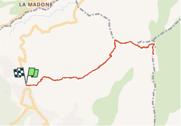

19.6 km | 37 km-effort


User


FREE GPS app for hiking
 SityTrail
IGN / Geographical institutes
SityTrail World
The world is yours!
Trail Walking of 11.2 km to be discovered at Provence-Alpes-Côte d'Azur, Maritime Alps, Levens. This trail is proposed by bozo1970.
Départ de Levens balise 250
Montée en 2h agréable sentier bien marqué
Par le col de Fuont Blanca col du Dragon
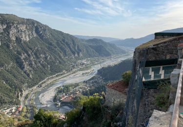
Très belle vue d'ensemble CORSE

Walking

On foot

On foot

Walking

Walking
Walking

Walking
Walking
Walking