Lac de Coiselet
lascaux
User
Length
13.5 km
Max alt
338 m
Uphill gradient
197 m
Km-Effort
16.1 km
Min alt
302 m
Downhill gradient
196 m
Boucle
Yes
Creation date :
2021-09-17 10:45:58.822
Updated on :
2021-09-17 14:47:45.328
3h49
Difficulty : Easy
FREE GPS app for hiking
About
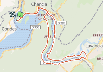
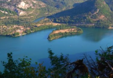
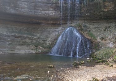
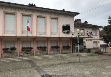
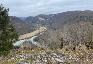
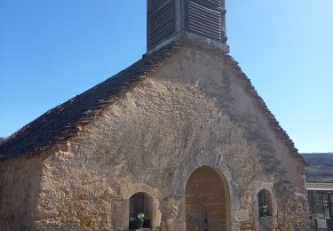
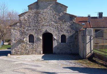
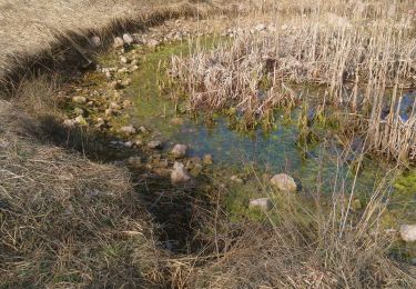
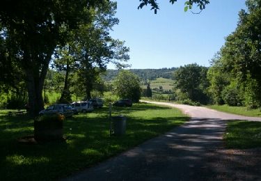
Trail Walking of 13.5 km to be discovered at Bourgogne-Franche-Comté, Jura, Chancia. This trail is proposed by lascaux.
Description
Ballade facile en sous bois, au bord du lac et le long de la rivière La Bienne. Un bémol, une partie du retour ce fait par la départementale.
Positioning
Country:
France
Region :
Bourgogne-Franche-Comté
Department/Province :
Jura
Municipality :
Chancia
Location:
Unknown
Start:(Dec)
Start:(UTM)
702276 ; 5135233 (31T) N.
Comments
Trails nearby
col de la Tendue pierre qui vire
Walking
Difficult
Dortan,
Auvergne-Rhône-Alpes,
Ain,
France
9.2 km | 15.5 km-effort
2h 51min
Yes
vouais. la pierre qui vire.la cascade de la combe.
Walking
Easy
Dortan,
Auvergne-Rhône-Alpes,
Ain,
France
10 km | 14.7 km-effort
2h 51min
Yes
La Pierre qui vire
On foot
Easy
Dortan,
Auvergne-Rhône-Alpes,
Ain,
France
3.1 km | 6.1 km-effort
1h 23min
No
Boucle sur les hauteurs de Dortan
Walking
Medium
Dortan,
Auvergne-Rhône-Alpes,
Ain,
France
18.1 km | 28 km-effort
4h 35min
Yes
vouais
Walking
Difficult
Dortan,
Auvergne-Rhône-Alpes,
Ain,
France
14.3 km | 22 km-effort
7h 11min
Yes
dortan .la pierre qui vire .les 3 dammetes et retour dortant retour
Walking
Medium
Dortan,
Auvergne-Rhône-Alpes,
Ain,
France
13.7 km | 20 km-effort
4h 32min
Yes
Vescles Sous le pic d'oliferne
Walking
Medium
Vescles,
Bourgogne-Franche-Comté,
Jura,
France
13.3 km | 18 km-effort
3h 5min
Yes
Le Pic d'Oliferne
Walking
Difficult
(1)
Vescles,
Bourgogne-Franche-Comté,
Jura,
France
12.5 km | 17.6 km-effort
3h 46min
Yes
Ferme de Varenne - Roches de Vaux
Walking
Medium
Arbent,
Auvergne-Rhône-Alpes,
Ain,
France
13.5 km | 19.9 km-effort
3h 4min
Yes