Trail Walking Pélussin - Marche Pelerine Pelussin - Photo

Marche Pelerine Pelussin

 FILLEULE
FILLEULE

User

© OpenStreetMap contributors
Length
Length
7.6 km
Max alt
Max alt
768 m
Uphill gradient
Uphill gradient
283 m
Km-Effort
Km-Effort  
11.4 km
Min alt
Min alt
511 m
Downhill gradient
Downhill gradient
282 m
Boucle
Boucle
Yes
Creation date :
2021-08-28 10:50:49.685
Updated on :
2021-09-05 09:02:15.544

(0 Reviews)

Walking
Walking
2h11
Difficulty : Easy

Scan this QR Code to open this trail in the SityTrail application

FREE GPS app for hiking

Logo SityTrail SityTrail

IGN / Geographical institutes

Download SityTrail from the App Store Download SityTrail from Google Play

Logo SityTrail SityTrail World

The world is yours!

Download SityTrail from the App Store Download SityTrail from Google Play Download SityTrail on Huawei AppGallery

About

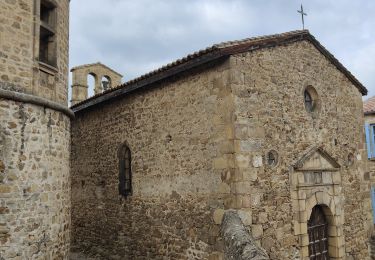
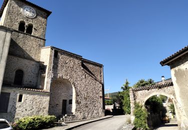
Trail Walking of 7.6 km to be discovered at Auvergne-Rhône-Alpes, Loire, Pélussin. This trail is proposed by FILLEULE.

Description

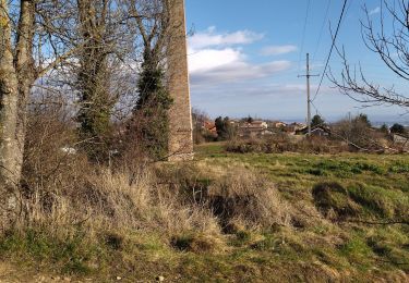
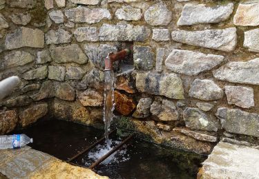
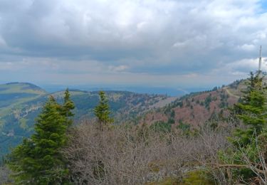
Montée le matin jusqu'au Priel puis sentier dans les sous bois jusqu'au lieu dit "la scie"

Elevation profile

Positioning

Country:
France
Region :
Auvergne-Rhône-Alpes
Department/Province :
Loire
Municipality :
Pélussin
Location:
Unknown
Start:(UTM)
630593 ; 5030789 (31T) N.

Comments

Please log in to post a review or rate the element
 

Trails nearby

Trail Mountain bike Roisey - Crêt de l'Oeillon Par Saint-Sabin - Photo
Mountain bike
simon.paume

Mountain bike

Difficult
(7)
Roisey, Auvergne-Rhône-Alpes, Loire, France
36 km | 51 km-effort
3h 15min
Yes
Trail Walking Doizieux - PIL-Crêt de l'Oeillon_Jasserie - Photo
Walking
MIKARANDO

Walking

Difficult
(1)
Doizieux, Auvergne-Rhône-Alpes, Loire, France
8.4 km | 12.3 km-effort
2h 48min
Yes
Trail Walking Pélussin - 42 pelussin - Photo
Walking
GUIDE
randodyssée

Walking

Easy
Pélussin, Auvergne-Rhône-Alpes, Loire, France
14.5 km | 22 km-effort
5h 13min
No
Trail Walking Pélussin - 42 pelussin organise - Photo
Walking
GUIDE
randodyssée

Walking

Easy
Pélussin, Auvergne-Rhône-Alpes, Loire, France
20 km | 33 km-effort
6h 18min
No
Trail Walking Chuyer - Autour du mont Ministre - Photo
Walking
pcostet

Walking

Easy
(2)
Chuyer, Auvergne-Rhône-Alpes, Loire, France
7.5 km | 11.2 km-effort
Unknown
Yes
Trail Walking Roisey - Le cret de l'oeillon - Photo
Walking
Vedett26

Walking

Difficult
(1)
Roisey, Auvergne-Rhône-Alpes, Loire, France
13.3 km | 22 km-effort
4h 59min
Yes
Trail Walking Véranne - sentier des crets du Mont Pilat  - Photo
Walking
GUIDE
stef789

Walking

Easy
Véranne, Auvergne-Rhône-Alpes, Loire, France
7.7 km | 10.9 km-effort
2h 37min
Yes
Trail Walking Pélussin - Randonnée du tacot à Pelussin  - Photo
Walking
dudu42

Walking

Difficult
Pélussin, Auvergne-Rhône-Alpes, Loire, France
17.5 km | 26 km-effort
3h 55min
No
Trail Walking Chuyer - 42-Chuyer-mont-Ministre-19km-685m-été - Photo
Walking
SyMA

Walking

Medium
Chuyer, Auvergne-Rhône-Alpes, Loire, France
19 km | 28 km-effort
5h 50min
Yes


Close
My subscriptions