![](/images/other/stat-length.png)
20210901 - Lambermont 6.5 Km
pierreh01
User GUIDE
![Length](/images/other/stat-length.png)
Length
6.6 km
![Max alt](https://static1.geolcdn.com/siteimages/upload/files/1508320355ic_sort_altitude_max_24dp.png)
Max alt
273 m
![Uphill gradient](https://static1.geolcdn.com/siteimages/upload/files/1508320355ic_sort_den_pos_24dp.png)
Uphill gradient
144 m
![Km-Effort](/images/other/stat-length.png)
Km-Effort
8.5 km
![Min alt](https://static1.geolcdn.com/siteimages/upload/files/1508320355ic_sort_altitude_min_24dp.png)
Min alt
195 m
![Downhill gradient](https://static1.geolcdn.com/siteimages/upload/files/1508320355ic_sort_den_neg_24dp.png)
Downhill gradient
144 m
![Boucle](https://static1.geolcdn.com/siteimages/upload/files/16400158638029165_repeat_loop_refresh_sync_direction_icon.png)
Boucle
Yes
Creation date :
2021-09-01 12:39:28.0
Updated on :
2021-09-01 17:37:19.717
![Walking](https://static1.geolcdn.com/sitytour/trail-icons/101.png)
1h55
Difficulty : Medium
![Scan this QR Code to open this trail in the SityTrail application](https://capi.geolives.com/qq0zvz2zws4bq2lad0pu/sitytour/trails/2920749/qr.png?size=200)
FREE GPS app for hiking
About
Trail Walking of 6.6 km to be discovered at Wallonia, Liège, Verviers. This trail is proposed by pierreh01.
Description
Mercredi 1 septembre 2021.
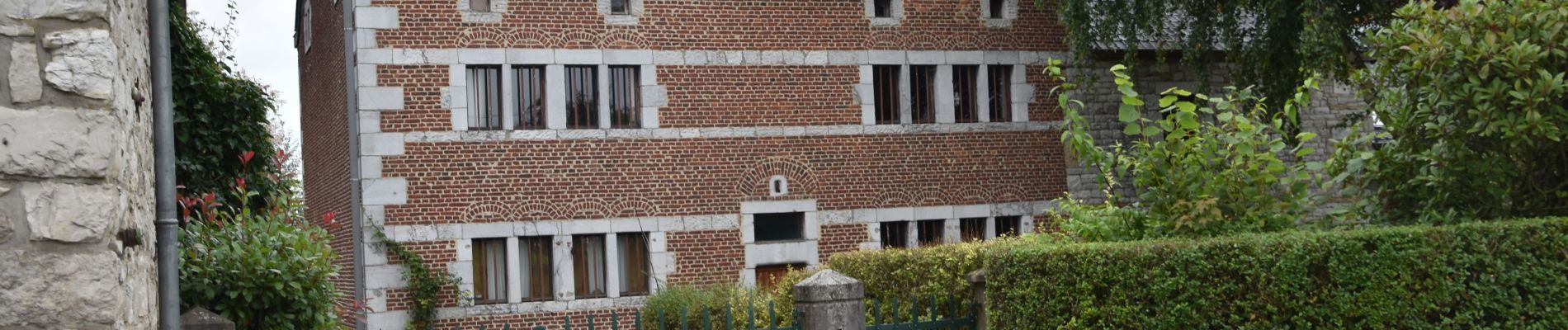
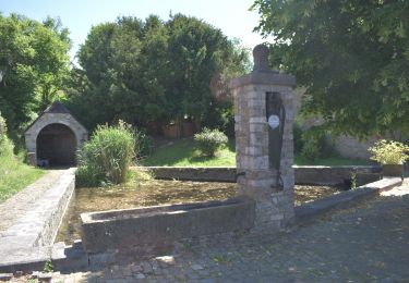
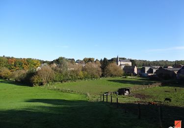
Balade en boucle, non balisée, au départ du cimetière de Lambermont.
Par chemins forestiers, campagnards, dans les champs et dans les bois, avec quand même un peu de macadam.
Par endroits, chemins boueux après les pluies conséquentes des jours passés.
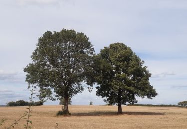
Positioning
Country:
Belgium
Region :
Wallonia
Department/Province :
Liège
Municipality :
Verviers
Location:
Unknown
Start:(Dec)
Start:(UTM)
700049 ; 5608172 (31U) N.
Comments
Trails nearby
![Trail Walking Pepinster - RB-Lg-23_Soiron_via-racc-2 - Photo](https://media.geolcdn.com/t/375/260/ext.jpg?maxdim=2&url=https%3A%2F%2Fservices.sitytrail.com%2FGeolivesWS%2FDownloadMedia.ashx%3FTrailID%3D400856%26Media%3D1646b7fd-8650-448d-bc3d-5efa9ed8c932.jpg)
![Walking Walking](https://static1.geolcdn.com/sitytour/trail-icons/101.png)
RB-Lg-23_Soiron_via-racc-2
Walking
(8)
Pepinster,
Wallonia,
Liège,
Belgium
![](/images/other/stat-length.png)
13.4 km | 17.5 km-effort
3h 58min
![](https://static1.geolcdn.com/siteimages/upload/files/16400158638029165_repeat_loop_refresh_sync_direction_icon.png)
Yes
![Trail Walking Pepinster - RB-Lg-23_Soiron - Photo](https://media.geolcdn.com/t/375/260/ext.jpg?maxdim=2&url=https%3A%2F%2Fservices.sitytrail.com%2FGeolivesWS%2FDownloadMedia.ashx%3FTrailID%3D400853%26Media%3D1646b7fd-8650-448d-bc3d-5efa9ed8c932.jpg)
![Walking Walking](https://static1.geolcdn.com/sitytour/trail-icons/101.png)
![Trail Walking Verviers - Grand vivier - Cossart - Photo](https://media.geolcdn.com/t/375/260/ext.jpg?maxdim=2&url=https%3A%2F%2Fstatic1.geolcdn.com%2Fsiteimages%2Fupload%2Ffiles%2F1553511878bg_sport_marche.png)
![Walking Walking](https://static1.geolcdn.com/sitytour/trail-icons/101.png)
Grand vivier - Cossart
Walking
Easy
(5)
Verviers,
Wallonia,
Liège,
Belgium
![](/images/other/stat-length.png)
4.7 km | 6.4 km-effort
1h 26min
![](https://static1.geolcdn.com/siteimages/upload/files/16400158638029165_repeat_loop_refresh_sync_direction_icon.png)
Yes
![Trail Walking Pepinster - 2022-05-13_11h44m22_Cirkwi-Soiron_6___Tribomont,_Wegnez - Photo](https://media.geolcdn.com/t/375/260/ec8c930a-9871-4566-956d-2a2016034199.jpg&format=jpg&maxdim=2)
![Walking Walking](https://static1.geolcdn.com/sitytour/trail-icons/101.png)
2022-05-13_11h44m22_Cirkwi-Soiron_6___Tribomont,_Wegnez
Walking
Easy
(1)
Pepinster,
Wallonia,
Liège,
Belgium
![](/images/other/stat-length.png)
9.5 km | 12.5 km-effort
2h 50min
![](https://static1.geolcdn.com/siteimages/upload/files/16400158638029165_repeat_loop_refresh_sync_direction_icon.png)
Yes
![Walking Walking](https://static1.geolcdn.com/sitytour/trail-icons/101.png)
20210214 - Bruyères 5 Km
Walking
Easy
(1)
Herve,
Wallonia,
Liège,
Belgium
![](/images/other/stat-length.png)
5.3 km | 6.6 km-effort
1h 41min
![](https://static1.geolcdn.com/siteimages/upload/files/16400158638029165_repeat_loop_refresh_sync_direction_icon.png)
Yes
![Trail Walking Pepinster - 20200601 - Soiron 12 Km - Photo](https://media.geolcdn.com/t/375/260/b3555895-e878-4d0e-a50f-8e043fb8b752.jpg&format=jpg&maxdim=2)
![Walking Walking](https://static1.geolcdn.com/sitytour/trail-icons/101.png)
20200601 - Soiron 12 Km
Walking
Difficult
(2)
Pepinster,
Wallonia,
Liège,
Belgium
![](/images/other/stat-length.png)
12.1 km | 17.6 km-effort
2h 35min
![](https://static1.geolcdn.com/siteimages/upload/files/16400158638029165_repeat_loop_refresh_sync_direction_icon.png)
Yes
![Trail Walking Pepinster - RB-Lg-23_Soiron_via-racc-1 - Photo](https://media.geolcdn.com/t/375/260/ext.jpg?maxdim=2&url=https%3A%2F%2Fservices.sitytrail.com%2FGeolivesWS%2FDownloadMedia.ashx%3FTrailID%3D400854%26Media%3D1646b7fd-8650-448d-bc3d-5efa9ed8c932.jpg)
![Walking Walking](https://static1.geolcdn.com/sitytour/trail-icons/101.png)
RB-Lg-23_Soiron_via-racc-1
Walking
(3)
Pepinster,
Wallonia,
Liège,
Belgium
![](/images/other/stat-length.png)
16.8 km | 21 km-effort
4h 49min
![](https://static1.geolcdn.com/siteimages/upload/files/16400158638029165_repeat_loop_refresh_sync_direction_icon.png)
Yes
![Trail Walking Herve - Grand-Rechain 🎅🎄 - Photo](https://media.geolcdn.com/t/375/260/4ac1b489-a981-486f-9575-913bd20e929a.jpg&format=jpg&maxdim=2)
![Walking Walking](https://static1.geolcdn.com/sitytour/trail-icons/101.png)
Grand-Rechain 🎅🎄
Walking
Easy
(1)
Herve,
Wallonia,
Liège,
Belgium
![](/images/other/stat-length.png)
7.4 km | 8.8 km-effort
2h 0min
![](https://static1.geolcdn.com/siteimages/upload/files/16400158638029165_repeat_loop_refresh_sync_direction_icon.png)
Yes
![Trail Walking Verviers - Stembert . les Roudoudous . Stembert - Photo](https://media.geolcdn.com/t/375/260/83013b57-22fc-4f55-b86f-1cd16e0258d4.jpg&format=jpg&maxdim=2)
![Walking Walking](https://static1.geolcdn.com/sitytour/trail-icons/101.png)
Stembert . les Roudoudous . Stembert
Walking
Easy
(2)
Verviers,
Wallonia,
Liège,
Belgium
![](/images/other/stat-length.png)
10.5 km | 13.5 km-effort
2h 48min
![](https://static1.geolcdn.com/siteimages/upload/files/16400158638029165_repeat_loop_refresh_sync_direction_icon.png)
Yes