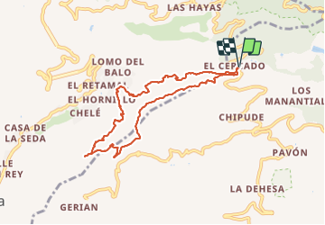
![](/images/other/stat-length.png)
![Trail Walking Vallehermoso - Canaries - La Gomera - Valle Gran Rey - jour 6 - Photo](https://media.geolcdn.com/t/1900/400/653810b0-6e97-4d9e-b714-527c7555ce9f.jpg&format=pjpeg&maxdim=2)
Canaries - La Gomera - Valle Gran Rey - jour 6
fhascoet
User
![Length](/images/other/stat-length.png)
![Max alt](https://static1.geolcdn.com/siteimages/upload/files/1508320355ic_sort_altitude_max_24dp.png)
![Uphill gradient](https://static1.geolcdn.com/siteimages/upload/files/1508320355ic_sort_den_pos_24dp.png)
![Km-Effort](/images/other/stat-length.png)
![Min alt](https://static1.geolcdn.com/siteimages/upload/files/1508320355ic_sort_altitude_min_24dp.png)
![Downhill gradient](https://static1.geolcdn.com/siteimages/upload/files/1508320355ic_sort_den_neg_24dp.png)
![Boucle](https://static1.geolcdn.com/siteimages/upload/files/16400158638029165_repeat_loop_refresh_sync_direction_icon.png)
![Walking](https://static1.geolcdn.com/sitytour/trail-icons/101.png)
7h55
Difficulty : Very difficult
![Scan this QR Code to open this trail in the SityTrail application](https://capi.geolives.com/qq0zvz2zws4bq2lad0pu/sitytour/trails/2915170/qr.png?size=200)
FREE GPS app for hiking
About
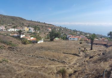
Trail Walking of 10.8 km to be discovered at Canary Islands, Santa Cruz de Tenerife, Vallehermoso. This trail is proposed by fhascoet.
Description
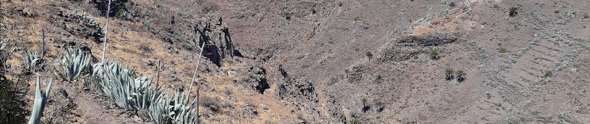
Randonnée assez longue et difficile.
La descente au fond de la vallée est très belle et bien marquée mais raide, assez difficile et par moment vertigineuse. Elle demande une bonne habitude de la randonnée.
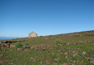
La remontée, un chemin large et empierré, est assez éprouvante sous le soleil.
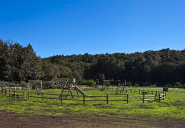
La durée tient compte des arrêts dont le repas sous un figuier.
Positioning
Comments
Trails nearby
![Trail On foot Vallehermoso - La Calera - Chipude - Photo](https://media.geolcdn.com/t/375/260/b7f8f67a-60bd-4561-90e0-83fd3a54fad3.jpeg&format=jpg&maxdim=2)
![On foot On foot](https://static1.geolcdn.com/sitytour/trail-icons/100.png)
On foot
![](/images/other/stat-length.png)
![](https://static1.geolcdn.com/siteimages/upload/files/16400158638029165_repeat_loop_refresh_sync_direction_icon.png)
![Trail On foot Agulo - PR LG 3 - Photo](https://media.geolcdn.com/t/375/260/afef9a1d-8886-4d58-be0c-78363cbd237a.jpeg&format=jpg&maxdim=2)
![On foot On foot](https://static1.geolcdn.com/sitytour/trail-icons/100.png)
On foot
![](/images/other/stat-length.png)
![](https://static1.geolcdn.com/siteimages/upload/files/16400158638029165_repeat_loop_refresh_sync_direction_icon.png)
![Trail On foot Vallehermoso - Laguna Grande II - Photo](https://media.geolcdn.com/t/375/260/fea34cc3-5ea7-416d-8acd-34e974e31bb6.jpeg&format=jpg&maxdim=2)
![On foot On foot](https://static1.geolcdn.com/sitytour/trail-icons/100.png)
On foot
![](/images/other/stat-length.png)
![](https://static1.geolcdn.com/siteimages/upload/files/16400158638029165_repeat_loop_refresh_sync_direction_icon.png)
![Trail On foot Vallehermoso - Ruta 14: Laguna Grande - Alto de Garajonay - Photo](https://media.geolcdn.com/t/375/260/fea34cc3-5ea7-416d-8acd-34e974e31bb6.jpeg&format=jpg&maxdim=2)
![On foot On foot](https://static1.geolcdn.com/sitytour/trail-icons/100.png)
On foot
![](/images/other/stat-length.png)
![](https://static1.geolcdn.com/siteimages/upload/files/16400158638029165_repeat_loop_refresh_sync_direction_icon.png)
![Trail On foot Alajeró - Ruta 16: Pajarito - Ajugal - Photo](https://media.geolcdn.com/t/375/260/de173e01-927b-4cca-bc9d-79cda4d5f77d.jpeg&format=jpg&maxdim=2)
![On foot On foot](https://static1.geolcdn.com/sitytour/trail-icons/100.png)
On foot
![](/images/other/stat-length.png)
![](https://static1.geolcdn.com/siteimages/upload/files/16400158638029165_repeat_loop_refresh_sync_direction_icon.png)
![Trail On foot Hermigua - Ruta 17: Pajarito - Alto de Garajonay - Pajarito - Photo](https://media.geolcdn.com/t/375/260/72d2f045-c0bf-444b-8c36-7a4692fcc430.jpeg&format=jpg&maxdim=2)
![On foot On foot](https://static1.geolcdn.com/sitytour/trail-icons/100.png)
On foot
![](/images/other/stat-length.png)
![](https://static1.geolcdn.com/siteimages/upload/files/16400158638029165_repeat_loop_refresh_sync_direction_icon.png)
![Trail On foot Valle Gran Rey - Cañada de Jorge - Photo](https://media.geolcdn.com/t/375/260/579162eb-caab-490a-aca6-b48da9d89d76.jpeg&format=jpg&maxdim=2)
![On foot On foot](https://static1.geolcdn.com/sitytour/trail-icons/100.png)
On foot
![](/images/other/stat-length.png)
![](https://static1.geolcdn.com/siteimages/upload/files/16400158638029165_repeat_loop_refresh_sync_direction_icon.png)
![Trail On foot Valle Gran Rey - Las Creces - Photo](https://media.geolcdn.com/t/375/260/36c7d64e-33cb-4c96-9d72-b38e2e1af37f.jpeg&format=jpg&maxdim=2)
![On foot On foot](https://static1.geolcdn.com/sitytour/trail-icons/100.png)
On foot
![](/images/other/stat-length.png)
![](https://static1.geolcdn.com/siteimages/upload/files/16400158638029165_repeat_loop_refresh_sync_direction_icon.png)
![Trail Walking Vallehermoso - Chipude - Alajero - Photo](https://media.geolcdn.com/t/375/260/21525875-aff7-48fd-a62a-07651ca6cdcd.jpg&format=jpg&maxdim=2)
![Walking Walking](https://static1.geolcdn.com/sitytour/trail-icons/101.png)
Walking
![](/images/other/stat-length.png)
![](https://static1.geolcdn.com/siteimages/upload/files/16400158638029165_repeat_loop_refresh_sync_direction_icon.png)