![](/images/other/stat-length.png)
#190823 - Promenade des Hougardiers***
Randos Ouvertes
User
![Length](/images/other/stat-length.png)
![Max alt](https://static1.geolcdn.com/siteimages/upload/files/1508320355ic_sort_altitude_max_24dp.png)
![Uphill gradient](https://static1.geolcdn.com/siteimages/upload/files/1508320355ic_sort_den_pos_24dp.png)
![Km-Effort](/images/other/stat-length.png)
![Min alt](https://static1.geolcdn.com/siteimages/upload/files/1508320355ic_sort_altitude_min_24dp.png)
![Downhill gradient](https://static1.geolcdn.com/siteimages/upload/files/1508320355ic_sort_den_neg_24dp.png)
![Boucle](https://static1.geolcdn.com/siteimages/upload/files/16400158638029165_repeat_loop_refresh_sync_direction_icon.png)
![Walking](https://static1.geolcdn.com/sitytour/trail-icons/101.png)
2h02
Difficulty : Medium
![Scan this QR Code to open this trail in the SityTrail application](https://capi.geolives.com/qq0zvz2zws4bq2lad0pu/sitytour/trails/2908181/qr.png?size=200)
FREE GPS app for hiking
About
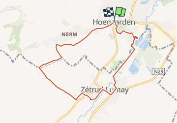
Trail Walking of 7.8 km to be discovered at Flanders, Flemish Brabant, Hoegaarden. This trail is proposed by Randos Ouvertes.
Description
Très belle marche au départ d'une belle ville du Brabant Flamand.
Parcours basé en partie sur Promenade des Hougardiers.
Suppression de deux parties sans grand intérêt.
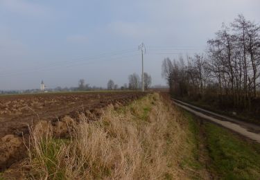
Assez bien de routes, mais très beua cadre et belles maisons à voir.
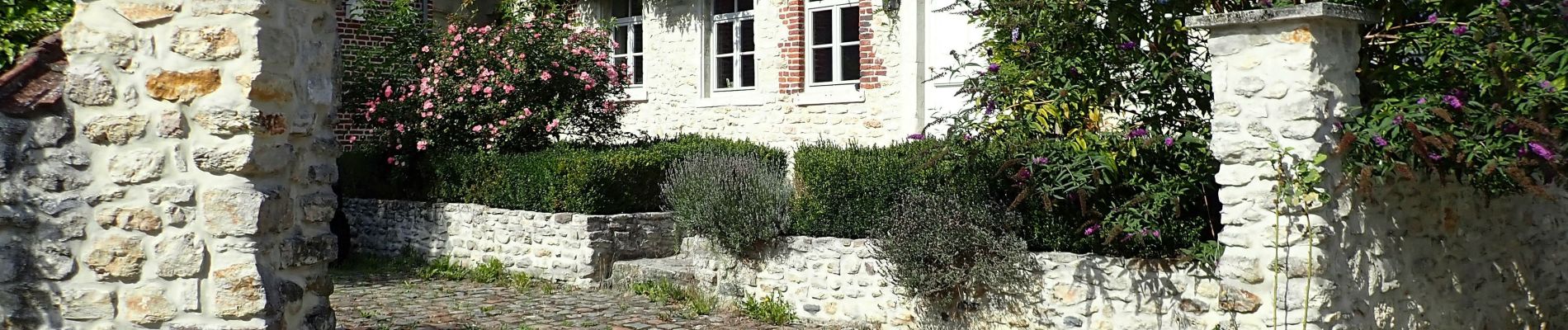
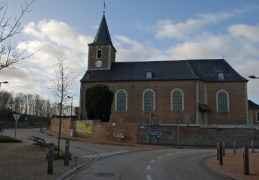
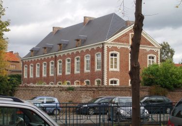
À Hoegaarden**** très belles construction historiques au centre ville.
Positioning
Comments
Trails nearby
![Trail Walking Hoegaarden - Meldert - Photo](https://media.geolcdn.com/t/375/260/31b1a0a0-1852-490a-917d-83e16fb1a5a8.jpg&format=jpg&maxdim=2)
![Walking Walking](https://static1.geolcdn.com/sitytour/trail-icons/101.png)
Walking
![](/images/other/stat-length.png)
![](https://static1.geolcdn.com/siteimages/upload/files/16400158638029165_repeat_loop_refresh_sync_direction_icon.png)
![Trail On foot Tienen - Orbeccawandeling Kort - Photo](https://media.geolcdn.com/t/375/260/e812d299-df6e-4ffd-bbb0-c17a49cbfa6d.jpeg&format=jpg&maxdim=2)
![On foot On foot](https://static1.geolcdn.com/sitytour/trail-icons/100.png)
On foot
![](/images/other/stat-length.png)
![](https://static1.geolcdn.com/siteimages/upload/files/16400158638029165_repeat_loop_refresh_sync_direction_icon.png)
![Trail On foot Tienen - Historische stadswandeling lange versie - Photo](https://media.geolcdn.com/t/375/260/880c2351-9a43-4116-b784-ff3c5f0a5c77.jpeg&format=jpg&maxdim=2)
![On foot On foot](https://static1.geolcdn.com/sitytour/trail-icons/100.png)
On foot
![](/images/other/stat-length.png)
![](https://static1.geolcdn.com/siteimages/upload/files/16400158638029165_repeat_loop_refresh_sync_direction_icon.png)
![Trail On foot Tienen - Historische stadswandeling korte versie - Photo](https://media.geolcdn.com/t/375/260/88b016db-5db9-4642-9498-4fbb5c5b2028.jpeg&format=jpg&maxdim=2)
![On foot On foot](https://static1.geolcdn.com/sitytour/trail-icons/100.png)
On foot
![](/images/other/stat-length.png)
![](https://static1.geolcdn.com/siteimages/upload/files/16400158638029165_repeat_loop_refresh_sync_direction_icon.png)
![Trail On foot Jodoigne - Promenade des Hougardiers - Photo](https://media.geolcdn.com/t/375/260/1071dc8c-34bb-425f-a7cf-e1b285bff63f.jpeg&format=jpg&maxdim=2)
![On foot On foot](https://static1.geolcdn.com/sitytour/trail-icons/100.png)
On foot
![](/images/other/stat-length.png)
![](https://static1.geolcdn.com/siteimages/upload/files/16400158638029165_repeat_loop_refresh_sync_direction_icon.png)
![Trail On foot Jodoigne - Promenade de Bon Secours - Photo](https://media.geolcdn.com/t/375/260/ec9ec11a-6d77-4c0b-aac1-93a6a5470637.jpeg&format=jpg&maxdim=2)
![On foot On foot](https://static1.geolcdn.com/sitytour/trail-icons/100.png)
On foot
![](/images/other/stat-length.png)
![](https://static1.geolcdn.com/siteimages/upload/files/16400158638029165_repeat_loop_refresh_sync_direction_icon.png)
![Trail On foot Beauvechain - Promenade de Sclûse - Photo](https://media.geolcdn.com/t/375/260/c1929032-f640-4516-9c4c-d087908ff1e2.jpeg&format=jpg&maxdim=2)
![On foot On foot](https://static1.geolcdn.com/sitytour/trail-icons/100.png)
On foot
![](/images/other/stat-length.png)
![](https://static1.geolcdn.com/siteimages/upload/files/16400158638029165_repeat_loop_refresh_sync_direction_icon.png)
![Trail On foot Hoegaarden - Mene- en Jordaanwandeling - Photo](https://media.geolcdn.com/t/375/260/758c5d97-4085-4265-85c9-f07729efccc1.jpeg&format=jpg&maxdim=2)
![On foot On foot](https://static1.geolcdn.com/sitytour/trail-icons/100.png)
On foot
![](/images/other/stat-length.png)
![](https://static1.geolcdn.com/siteimages/upload/files/16400158638029165_repeat_loop_refresh_sync_direction_icon.png)
![Trail On foot Hoegaarden - Dorps- en Kapellenwandeling - Photo](https://media.geolcdn.com/t/375/260/233912c1-8e5e-4a86-a9ad-b7484bc407f1.jpeg&format=jpg&maxdim=2)
![On foot On foot](https://static1.geolcdn.com/sitytour/trail-icons/100.png)
On foot
![](/images/other/stat-length.png)
![](https://static1.geolcdn.com/siteimages/upload/files/16400158638029165_repeat_loop_refresh_sync_direction_icon.png)