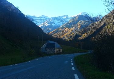
Trail Walking Gavarnie-Gèdre - Le Lac des Gloriettes - Photo
© OpenStreetMap contributors
Length
Length
14.5 km
Max alt
Max alt
1762 m
Uphill gradient
Uphill gradient
915 m
Km-Effort
Km-Effort  
27 km
Min alt
Min alt
1011 m
Downhill gradient
Downhill gradient
916 m
Boucle
Boucle
Yes
Creation date :
2021-08-21 19:19:05.443
Updated on :
2022-06-01 18:55:45.496

(0 Reviews)

Walking
Walking
6h04
Difficulty : Very difficult

Scan this QR Code to open this trail in the SityTrail application

FREE GPS app for hiking

Logo SityTrail SityTrail

IGN / Geographical institutes

Download SityTrail from the App Store Download SityTrail from Google Play

Logo SityTrail SityTrail World

The world is yours!

Download SityTrail from the App Store Download SityTrail from Google Play Download SityTrail on Huawei AppGallery

About

Trail Walking of 14.5 km to be discovered at Occitania, Hautespyrenees, Gavarnie-Gèdre. This trail is proposed by mitch1952.

Description

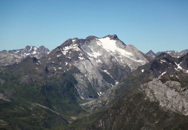
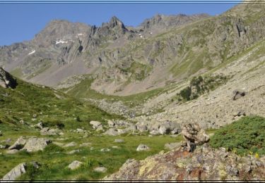
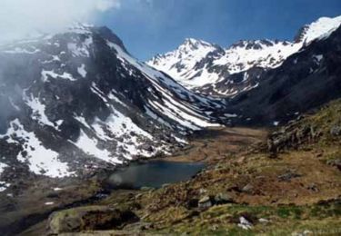
Utilisation des sentiers de Ramond et découverte depuis le pont de l' Espuguette sur le gave d' Estaubé pour faire la boucle autour du lac des Gloriettes . Superbe panorama dont le Mont Perdu, la Munia , la Géla , le Gerbats , le Pic des Aiguillous etc...
Randonnée réalisée avec Sabine
IBP trouve un dénivelée cumulé de 964 m
Indice IBP 101 Cotation E5 T3 R3

Elevation profile

Positioning

Country:
France
Region :
Occitania
Department/Province :
Hautespyrenees
Municipality :
Gavarnie-Gèdre
Location:
Gèdre
Start:(UTM)
256328 ; 4741425 (31T) N.

Trails nearby

Trail Walking Gavarnie-Gèdre - Le Pimené par la vallée d'Estaubé  - Gèbre - Photo
Walking
tracegps

Walking

Difficult
(1)
Gavarnie-Gèdre, Occitania, Hautespyrenees, France
19.8 km | 35 km-effort
9h 0min
Yes
Trail Walking Gavarnie-Gèdre - Lacot de l'Oule - Photo
Walking
tracegps

Walking

Difficult
(1)
Gavarnie-Gèdre, Occitania, Hautespyrenees, France
6.5 km | 15.7 km-effort
4h 30min
No
Trail Walking Gavarnie-Gèdre - Lacs de Cestrède et Antarrouyes - Photo
Walking
tracegps

Walking

Very difficult
(1)
Gavarnie-Gèdre, Occitania, Hautespyrenees, France
4.4 km | 10.7 km-effort
3h 0min
No
Trail Walking Gavarnie-Gèdre - PYRENNES  cirque d'Estaube   - Photo
Walking
ego

Walking

Medium
(1)
Gavarnie-Gèdre, Occitania, Hautespyrenees, France
6.1 km | 8.6 km-effort
1h 56min
No
Trail Walking Gavarnie-Gèdre - Gèdre - barrage des gloriettes - Photo
Walking
marcel.F

Walking

Easy
(1)
Gavarnie-Gèdre, Occitania, Hautespyrenees, France
6.2 km | 8.3 km-effort
1h 57min
Yes
Trail Walking Gavarnie-Gèdre - Pyrénées 2023 Jour 6 - Pic Pimené 2647 m - Cirque de Gavarnie - Photo
Walking
GUIDE
Michel1963

Walking

Very difficult
Gavarnie-Gèdre, Occitania, Hautespyrenees, France
22 km | 40 km-effort
8h 59min
No
Trail Walking Gavarnie-Gèdre - Les Gloriettes et Cascades .  - Photo
Walking
sereton

Walking

Medium
Gavarnie-Gèdre, Occitania, Hautespyrenees, France
12.3 km | 15.5 km-effort
3h 56min
Yes
Trail Walking Gavarnie-Gèdre - Cirque d’Estaubé - Photo
Walking
jaja64

Walking

Easy
Gavarnie-Gèdre, Occitania, Hautespyrenees, France
13.5 km | 18.2 km-effort
6h 5min
Yes
Trail On foot Gavarnie-Gèdre - Plateau de Saugué - Photo
On foot
GUIDE+

On foot

Easy
Gavarnie-Gèdre, Occitania, Hautespyrenees, France
3.1 km | 6.9 km-effort
1h 33min
No


Close
My subscriptions