![](/images/other/stat-length.png)
![Trail Road bike Saint-Alban-Leysse - le Revard en boucle - Photo](https://media.geolcdn.com/t/1900/400/735b8540-fead-4765-b67f-15a05e0fdd24.jpg&format=pjpeg&maxdim=2)
le Revard en boucle
nadd73
User GUIDE
![Length](/images/other/stat-length.png)
Length
66 km
![Max alt](https://static1.geolcdn.com/siteimages/upload/files/1508320355ic_sort_altitude_max_24dp.png)
Max alt
1534 m
![Uphill gradient](https://static1.geolcdn.com/siteimages/upload/files/1508320355ic_sort_den_pos_24dp.png)
Uphill gradient
1494 m
![Km-Effort](/images/other/stat-length.png)
Km-Effort
86 km
![Min alt](https://static1.geolcdn.com/siteimages/upload/files/1508320355ic_sort_altitude_min_24dp.png)
Min alt
230 m
![Downhill gradient](https://static1.geolcdn.com/siteimages/upload/files/1508320355ic_sort_den_neg_24dp.png)
Downhill gradient
1494 m
![Boucle](https://static1.geolcdn.com/siteimages/upload/files/16400158638029165_repeat_loop_refresh_sync_direction_icon.png)
Boucle
Yes
Creation date :
2021-08-18 06:27:00.819
Updated on :
2021-08-18 11:49:21.204
![Road bike](https://static1.geolcdn.com/sitytour/trail-icons/201.png)
3h45
Difficulty : Difficult
![Scan this QR Code to open this trail in the SityTrail application](https://capi.geolives.com/qq0zvz2zws4bq2lad0pu/sitytour/trails/2903032/qr.png?size=200)
FREE GPS app for hiking
About
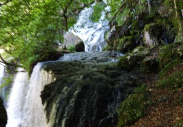
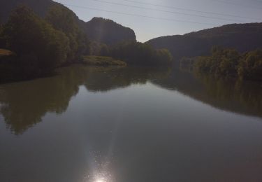
Trail Road bike of 66 km to be discovered at Auvergne-Rhône-Alpes, Savoy, Saint-Alban-Leysse. This trail is proposed by nadd73.
Description
Départ de St Alban leysse.
Montée régulière par contre la descente côté Aix n'est pas top, la route est très endommagée.
Positioning
Country:
France
Region :
Auvergne-Rhône-Alpes
Department/Province :
Savoy
Municipality :
Saint-Alban-Leysse
Location:
Unknown
Start:(Dec)
Start:(UTM)
731265 ; 5051172 (31T) N.
Comments
Trails nearby
![Trail Running Saint-Jean-d'Arvey - Tour du plateau de la Leysse - Photo](https://media.geolcdn.com/t/375/260/ext.jpg?maxdim=2&url=https%3A%2F%2Fservices.sitytrail.com%2FGeolivesWS%2FDownloadMedia.ashx%3FTrailID%3D127434%26Media%3D08a8806c-d534-407b-8c02-e91e2473a9c8.JPG)
![Running Running](https://static1.geolcdn.com/sitytour/trail-icons/103.png)
Tour du plateau de la Leysse
Running
Very easy
(1)
Saint-Jean-d'Arvey,
Auvergne-Rhône-Alpes,
Savoy,
France
![](/images/other/stat-length.png)
47 km | 82 km-effort
10h 0min
![](https://static1.geolcdn.com/siteimages/upload/files/16400158638029165_repeat_loop_refresh_sync_direction_icon.png)
Yes
![Trail Walking Challes-les-Eaux - Le Mont Saint-Michel 895 m, depuis Challes-les-Eaux - Photo](https://media.geolcdn.com/t/375/260/ext.jpg?maxdim=2&url=https%3A%2F%2Fservices.sitytrail.com%2FGeolivesWS%2FDownloadMedia.ashx%3FTrailID%3D191627%26Media%3D15268_1.jpg)
![Walking Walking](https://static1.geolcdn.com/sitytour/trail-icons/101.png)
Le Mont Saint-Michel 895 m, depuis Challes-les-Eaux
Walking
Difficult
(1)
Challes-les-Eaux,
Auvergne-Rhône-Alpes,
Savoy,
France
![](/images/other/stat-length.png)
7.6 km | 15 km-effort
4h 15min
![](https://static1.geolcdn.com/siteimages/upload/files/16400158638029165_repeat_loop_refresh_sync_direction_icon.png)
Yes
![Trail Mountain bike Bassens - Pragondra - Photo](https://media.geolcdn.com/t/375/260/ext.jpg?maxdim=2&url=https%3A%2F%2Fservices.sitytrail.com%2FGeolivesWS%2FDownloadMedia.ashx%3FTrailID%3D147927%26Media%3D20120818110710.jpg)
![Mountain bike Mountain bike](https://static1.geolcdn.com/sitytour/trail-icons/202.png)
Pragondra
Mountain bike
Very easy
(1)
Bassens,
Auvergne-Rhône-Alpes,
Savoy,
France
![](/images/other/stat-length.png)
24 km | 34 km-effort
2h 49min
![](https://static1.geolcdn.com/siteimages/upload/files/16400158638029165_repeat_loop_refresh_sync_direction_icon.png)
No
![Trail Cycle Saint-Jean-d'Arvey - st jean meythet via plainpalais et semnoz - Photo](https://media.geolcdn.com/t/375/260/ext.jpg?maxdim=2&url=https%3A%2F%2Fstatic1.geolcdn.com%2Fsiteimages%2Fupload%2Ffiles%2F1524743154velo.jpg)
![Cycle Cycle](https://static1.geolcdn.com/sitytour/trail-icons/200.png)
st jean meythet via plainpalais et semnoz
Cycle
Difficult
(1)
Saint-Jean-d'Arvey,
Auvergne-Rhône-Alpes,
Savoy,
France
![](/images/other/stat-length.png)
66 km | 92 km-effort
3h 16min
![](https://static1.geolcdn.com/siteimages/upload/files/16400158638029165_repeat_loop_refresh_sync_direction_icon.png)
No
![Trail Walking Saint-Alban-Leysse - 73- Le chemin des poussettes - Photo](https://media.geolcdn.com/t/375/260/ext.jpg?maxdim=2&url=https%3A%2F%2Fstatic1.geolcdn.com%2Fsiteimages%2Fupload%2Ffiles%2F1553511878bg_sport_marche.png)
![Walking Walking](https://static1.geolcdn.com/sitytour/trail-icons/101.png)
73- Le chemin des poussettes
Walking
Easy
(1)
Saint-Alban-Leysse,
Auvergne-Rhône-Alpes,
Savoy,
France
![](/images/other/stat-length.png)
4.9 km | 10.6 km-effort
2h 2min
![](https://static1.geolcdn.com/siteimages/upload/files/16400158638029165_repeat_loop_refresh_sync_direction_icon.png)
Yes
![Trail Mountain bike Saint-Alban-Leysse - 2012-03-24 - Malpassant+ St sat - Photo](https://media.geolcdn.com/t/375/260/ext.jpg?maxdim=2&url=https%3A%2F%2Fstatic1.geolcdn.com%2Fsiteimages%2Fupload%2Ffiles%2F1524743154velo.jpg)
![Mountain bike Mountain bike](https://static1.geolcdn.com/sitytour/trail-icons/202.png)
2012-03-24 - Malpassant+ St sat
Mountain bike
Medium
(1)
Saint-Alban-Leysse,
Auvergne-Rhône-Alpes,
Savoy,
France
![](/images/other/stat-length.png)
27 km | 44 km-effort
3h 2min
![](https://static1.geolcdn.com/siteimages/upload/files/16400158638029165_repeat_loop_refresh_sync_direction_icon.png)
Yes
![Trail Walking Curienne - Boucle de curienne - Photo](https://media.geolcdn.com/t/375/260/bf0e46c4-b1d7-4727-95a4-0b49e6273a30.jpg&format=jpg&maxdim=2)
![Walking Walking](https://static1.geolcdn.com/sitytour/trail-icons/101.png)
Boucle de curienne
Walking
Easy
Curienne,
Auvergne-Rhône-Alpes,
Savoy,
France
![](/images/other/stat-length.png)
6.2 km | 9.1 km-effort
2h 22min
![](https://static1.geolcdn.com/siteimages/upload/files/16400158638029165_repeat_loop_refresh_sync_direction_icon.png)
Yes
![Trail Walking Les Déserts - Nivolet - Photo](https://media.geolcdn.com/t/375/260/048cf6ab-404d-4bce-bd74-e2c4ccef4fd8.jpg&format=jpg&maxdim=2)
![Walking Walking](https://static1.geolcdn.com/sitytour/trail-icons/101.png)
Nivolet
Walking
Medium
Les Déserts,
Auvergne-Rhône-Alpes,
Savoy,
France
![](/images/other/stat-length.png)
8.5 km | 19 km-effort
5h 29min
![](https://static1.geolcdn.com/siteimages/upload/files/16400158638029165_repeat_loop_refresh_sync_direction_icon.png)
Yes
![Trail Hybrid bike Cognin - Chambéry jujurieux - Photo](https://media.geolcdn.com/t/375/260/718fb78c-ba3a-4f4f-9193-923a356e563d.jpg&format=jpg&maxdim=2)
![Hybrid bike Hybrid bike](https://static1.geolcdn.com/sitytour/trail-icons/203.png)
Chambéry jujurieux
Hybrid bike
Difficult
Cognin,
Auvergne-Rhône-Alpes,
Savoy,
France
![](/images/other/stat-length.png)
123 km | 143 km-effort
7h 30min
![](https://static1.geolcdn.com/siteimages/upload/files/16400158638029165_repeat_loop_refresh_sync_direction_icon.png)
No