


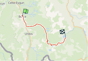

16.9 km | 30 km-effort

User


FREE GPS app for hiking
 SityTrail
IGN / Geographical institutes
SityTrail World
The world is yours!
Trail Walking of 21 km to be discovered at New Aquitaine, Pyrénées-Atlantiques, Borce. This trail is proposed by LEGUE.
Grosse journée de 21 Km
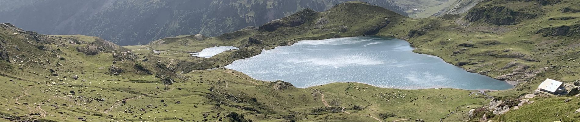
Départ à 6h30 de Borce, passage au chemin de la mâture, montée sévère jusqu’au col d’Ayous hors les nuages. Magnifique vue sur le lac Gentau , mais chaleur d’enfer …
Descente sur les bords du lac de Bious Artigues


Snowshoes

Walking

Walking

On foot
On foot
On foot
On foot

On foot
On foot