Trail Walking La Côte-d'Arbroz - Pic de Chalune - Photo
© OpenStreetMap contributors
Length
Length
7.6 km
Max alt
Max alt
2089 m
Uphill gradient
Uphill gradient
726 m
Km-Effort
Km-Effort  
17.2 km
Min alt
Min alt
1357 m
Downhill gradient
Downhill gradient
726 m
Boucle
Boucle
Yes
Creation date :
2021-08-13 11:52:32.0
Updated on :
2021-08-13 16:31:05.793

(0 Reviews)

Walking
Walking
3h31
Difficulty : Difficult

Scan this QR Code to open this trail in the SityTrail application

FREE GPS app for hiking

Logo SityTrail SityTrail

IGN / Geographical institutes

Download SityTrail from the App Store Download SityTrail from Google Play

Logo SityTrail SityTrail World

The world is yours!

Download SityTrail from the App Store Download SityTrail from Google Play Download SityTrail on Huawei AppGallery

About

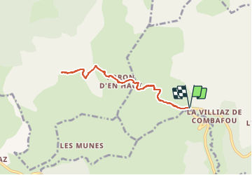
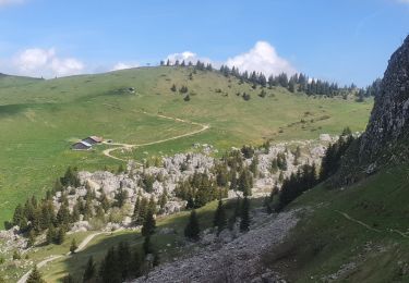
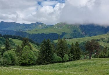
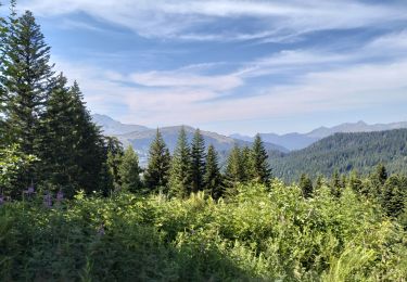
Trail Walking of 7.6 km to be discovered at Auvergne-Rhône-Alpes, Upper Savoy, La Côte-d'Arbroz. This trail is proposed by Bearn64230.

Elevation profile

Photos

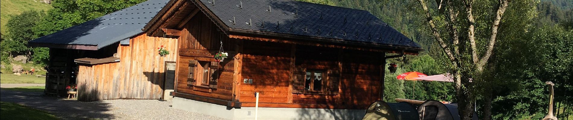
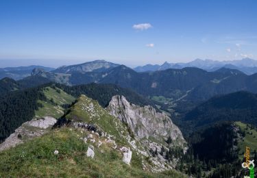
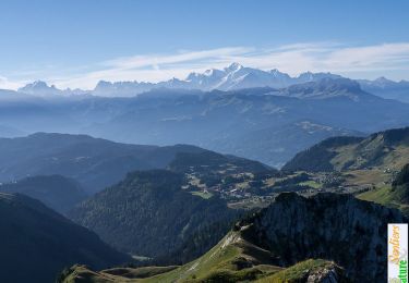
44 photos in total. Please click on a photo to see them all in the gallery.

Positioning

Country:
France
Region :
Auvergne-Rhône-Alpes
Department/Province :
Upper Savoy
Municipality :
La Côte-d'Arbroz
Location:
Unknown
Start:(UTM)
315750 ; 5116144 (32T) N.

Trails nearby

Trail Nordic walking Bellevaux - tour du roc - Photo
Nordic walking
PierreBellevaux

Nordic walking

Medium
(1)
Bellevaux, Auvergne-Rhône-Alpes, Upper Savoy, France
26 km | 53 km-effort
4h 7min
Yes
Trail Walking Bellevaux - La Haute Pointe 1968m, depuis le Plan des Rasses - Photo
Walking
tracegps

Walking

Medium
(1)
Bellevaux, Auvergne-Rhône-Alpes, Upper Savoy, France
9.8 km | 21 km-effort
5h 30min
Yes
Trail Walking Taninges - La Pointe de Marcelly 1999m - le Praz-de-Lys - Photo
Walking
tracegps

Walking

Medium
(2)
Taninges, Auvergne-Rhône-Alpes, Upper Savoy, France
8 km | 16.3 km-effort
4h 15min
Yes
Trail Walking Mieussy - La Pointe de Chavasse, 2012m - Photo
Walking
tracegps

Walking

Difficult
(1)
Mieussy, Auvergne-Rhône-Alpes, Upper Savoy, France
9.9 km | 18.2 km-effort
4h 45min
Yes
Trail Walking Mieussy - 14-05-2022 Sommand - Col du Cordon - Cascades du Saix  - Pertuiset  - Photo
Walking
GUIDE
Kargil

Walking

Difficult
Mieussy, Auvergne-Rhône-Alpes, Upper Savoy, France
14.9 km | 26 km-effort
4h 17min
Yes
Trail Walking Les Gets - morzine col du mont chery - Photo
Walking
labarone

Walking

Very difficult
Les Gets, Auvergne-Rhône-Alpes, Upper Savoy, France
16.6 km | 30 km-effort
6h 45min
Yes
Trail Touring skiing Taninges - pointe de Chalune  - Photo
Touring skiing
ajpbm

Touring skiing

Medium
Taninges, Auvergne-Rhône-Alpes, Upper Savoy, France
10.8 km | 21 km-effort
4h 40min
Yes
Trail Walking Taninges - Balade autour de Beauregard - Photo
Walking
000151.528cee2ba5ea499bb7720e62b4a3eb52.0056

Walking

Medium
Taninges, Auvergne-Rhône-Alpes, Upper Savoy, France
5.9 km | 10.5 km-effort
1h 39min
Yes
Trail Walking Verchaix - 74-Gets-chapelle-de Jacquicourt-4,8km-245m - Photo
Walking
SyMA

Walking

Very easy
Verchaix, Auvergne-Rhône-Alpes, Upper Savoy, France
4.8 km | 8.1 km-effort
2h 17min
Yes


Close
My subscriptions