8.7 km | 10.6 km-effort
Reco-pour
frederic.farge
User
Length
15.3 km
Max alt
316 m
Uphill gradient
280 m
Km-Effort
19 km
Min alt
224 m
Downhill gradient
267 m
Boucle
No
Creation date :
2021-08-13 10:46:24.0
Updated on :
2021-08-13 13:34:45.013
2h22
Difficulty : Unknown
FREE GPS app for hiking
About
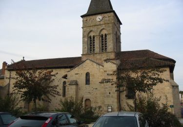
Trail Trail of 15.3 km to be discovered at New Aquitaine, Haute-Vienne, Saint-Auvent. This trail is proposed by frederic.farge.
Positioning
Country:
France
Region :
New Aquitaine
Department/Province :
Haute-Vienne
Municipality :
Saint-Auvent
Location:
Unknown
Start:(Dec)
Start:(UTM)
338931 ; 5074538 (31T) N.
Comments
Trails nearby
Sentier de l'aubépine
On foot
Easy
Saint-Laurent-sur-Gorre,
New Aquitaine,
Haute-Vienne,
France
2h 24min
Yes
Autour de St Laurent sur Gore
sport
Very easy
Saint-Laurent-sur-Gorre,
New Aquitaine,
Haute-Vienne,
France
7.9 km | 9.4 km-effort
Unknown
Yes
Sentier de l’aubépine St Laurent sur Gorre
Walking
Medium
(1)
Saint-Laurent-sur-Gorre,
New Aquitaine,
Haute-Vienne,
France
8.8 km | 10.8 km-effort
2h 27min
Yes
saint auvent vallée de la gore et forêt de Rochechouart
Walking
Medium
Saint-Auvent,
New Aquitaine,
Haute-Vienne,
France
9.3 km | 11.9 km-effort
2h 18min
Yes
En route pour le petit Lourdes en Limousin (cyclo 42 km)
Road bike
Very difficult
Saint-Laurent-sur-Gorre,
New Aquitaine,
Haute-Vienne,
France
42 km | 50 km-effort
2h 53min
Yes
St. Laurent sur Gorre - Cognac la Foret 2018-08-14
Electric bike
Easy
Saint-Laurent-sur-Gorre,
New Aquitaine,
Haute-Vienne,
France
33 km | 41 km-effort
2h 0min
Yes
7 Saint Laurent sur Gorre-Escoire-Les Gaunies-St Jacques de Compostelle
Mountain bike
Difficult
Saint-Laurent-sur-Gorre,
New Aquitaine,
Haute-Vienne,
France
114 km | 139 km-effort
8h 47min
No
Prospection RU -A-C-BOULOU
Via ferrata
Easy
Rochechouart,
New Aquitaine,
Haute-Vienne,
France
95 km | 110 km-effort
3h 18min
No
Saint Auvent circuit de découverte
Walking
Easy
Saint-Auvent,
New Aquitaine,
Haute-Vienne,
France
3.5 km | 4.7 km-effort
1h 1min
Yes