


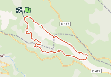

4.8 km | 7.2 km-effort


User


FREE GPS app for hiking
 SityTrail
IGN / Geographical institutes
SityTrail World
The world is yours!
Trail Walking of 10.6 km to be discovered at New Aquitaine, Pyrénées-Atlantiques, Béhorléguy. This trail is proposed by benat40.
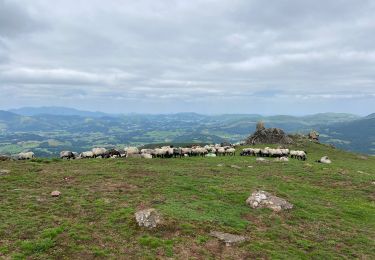
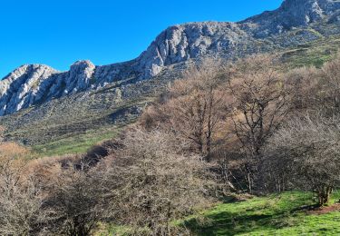
Randonnée rendue difficile par mauvais temps et un sentier qui s'est perdu au fil du temps notamment au départ et surtout à l'arrivée.
Eviter le départ à cet endroit

sport

Walking
Walking

Walking

Walking

Walking
Walking
Walking
Walking