![](/images/other/stat-length.png)
![Trail Cycle Mostuéjouls - Le mont Aigoual par le col de Perjuret - Photo](https://media.geolcdn.com/t/1900/400/ext.pjpeg?maxdim=2&url=https%3A%2F%2Fstatic1.geolcdn.com%2Fsiteimages%2Fupload%2Ffiles%2F1524743154velo.jpg)
Le mont Aigoual par le col de Perjuret
ARVIEU
User
![Length](/images/other/stat-length.png)
Length
78 km
![Max alt](https://static1.geolcdn.com/siteimages/upload/files/1508320355ic_sort_altitude_max_24dp.png)
Max alt
1560 m
![Uphill gradient](https://static1.geolcdn.com/siteimages/upload/files/1508320355ic_sort_den_pos_24dp.png)
Uphill gradient
3418 m
![Km-Effort](/images/other/stat-length.png)
Km-Effort
123 km
![Min alt](https://static1.geolcdn.com/siteimages/upload/files/1508320355ic_sort_altitude_min_24dp.png)
Min alt
388 m
![Downhill gradient](https://static1.geolcdn.com/siteimages/upload/files/1508320355ic_sort_den_neg_24dp.png)
Downhill gradient
3108 m
![Boucle](https://static1.geolcdn.com/siteimages/upload/files/16400158638029165_repeat_loop_refresh_sync_direction_icon.png)
Boucle
No
Creation date :
2021-08-02 15:15:06.044
Updated on :
2021-08-02 15:17:48.315
![Cycle](https://static1.geolcdn.com/sitytour/trail-icons/200.png)
4h00
Difficulty : Difficult
![Scan this QR Code to open this trail in the SityTrail application](https://capi.geolives.com/qq0zvz2zws4bq2lad0pu/sitytour/trails/2883003/qr.png?size=200)
FREE GPS app for hiking
About
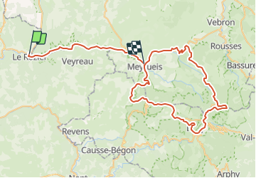
Trail Cycle of 78 km to be discovered at Occitania, Aveyron, Mostuéjouls. This trail is proposed by ARVIEU.
Description
Départ et arrivée depuis Le Rozier.
Circuit empruntant les gorges de la Jonte et passage au col du Perjuret randu célèbre par la chute mortelle du cycliste professionnel Roger Rivière.
Positioning
Country:
France
Region :
Occitania
Department/Province :
Aveyron
Municipality :
Mostuéjouls
Location:
Unknown
Start:(Dec)
Start:(UTM)
516598 ; 4893510 (31T) N.
Comments
Trails nearby
![Trail Walking Le Rozier - 12 vase de Sèvres Chine ch. brunet - Photo](https://media.geolcdn.com/t/375/260/42bd83b0-7fd2-4ea6-86ca-ddc89ff015aa.jpg&format=jpg&maxdim=2)
![Walking Walking](https://static1.geolcdn.com/sitytour/trail-icons/101.png)
12 vase de Sèvres Chine ch. brunet
Walking
Medium
(1)
Le Rozier,
Occitania,
Lozère,
France
![](/images/other/stat-length.png)
10.1 km | 18.8 km-effort
5h 40min
![](https://static1.geolcdn.com/siteimages/upload/files/16400158638029165_repeat_loop_refresh_sync_direction_icon.png)
Yes
![Trail Walking Mostuéjouls - Cirque de Saint Marcellin - Mostuéjouls - Liaucous - Photo](https://media.geolcdn.com/t/375/260/ext.jpg?maxdim=2&url=https%3A%2F%2Fservices.sitytrail.com%2FGeolivesWS%2FDownloadMedia.ashx%3FTrailID%3D173134%26Media%3D14690_6.jpg)
![Walking Walking](https://static1.geolcdn.com/sitytour/trail-icons/101.png)
Cirque de Saint Marcellin - Mostuéjouls - Liaucous
Walking
Medium
(1)
Mostuéjouls,
Occitania,
Aveyron,
France
![](/images/other/stat-length.png)
15.4 km | 24 km-effort
5h 0min
![](https://static1.geolcdn.com/siteimages/upload/files/16400158638029165_repeat_loop_refresh_sync_direction_icon.png)
Yes
![Trail Walking Le Rozier - Causse et gorges au pays des vautours - Photo](https://media.geolcdn.com/t/375/260/cab4842f-73f8-42f5-b236-9c9a4da22964.jpg&format=jpg&maxdim=2)
![Walking Walking](https://static1.geolcdn.com/sitytour/trail-icons/101.png)
Causse et gorges au pays des vautours
Walking
Difficult
Le Rozier,
Occitania,
Lozère,
France
![](/images/other/stat-length.png)
27 km | 40 km-effort
7h 48min
![](https://static1.geolcdn.com/siteimages/upload/files/16400158638029165_repeat_loop_refresh_sync_direction_icon.png)
No
![Trail Walking Saint-Pierre-des-Tripiers - Cassagnes crête vallée Jonte et Tarn 12,2 km - Photo](https://media.geolcdn.com/t/375/260/9473c7ff-c94b-41a9-84a9-d12f53c1c0cb.jpg&format=jpg&maxdim=2)
![Walking Walking](https://static1.geolcdn.com/sitytour/trail-icons/101.png)
Cassagnes crête vallée Jonte et Tarn 12,2 km
Walking
Medium
Saint-Pierre-des-Tripiers,
Occitania,
Lozère,
France
![](/images/other/stat-length.png)
12.6 km | 20 km-effort
5h 38min
![](https://static1.geolcdn.com/siteimages/upload/files/16400158638029165_repeat_loop_refresh_sync_direction_icon.png)
No
![Trail Walking Rivière-sur-Tarn - Grands Causses - Peyrelade - Chateau-vignes-forêt - 2016 09 09 - Photo](https://media.geolcdn.com/t/375/260/ext.jpg?maxdim=2&url=https%3A%2F%2Fservices.sitytrail.com%2FGeolivesWS%2FDownloadMedia.ashx%3FTrailID%3D629408%26Media%3Dfix__20160909102534.jpg)
![Walking Walking](https://static1.geolcdn.com/sitytour/trail-icons/101.png)
Grands Causses - Peyrelade - Chateau-vignes-forêt - 2016 09 09
Walking
Medium
Rivière-sur-Tarn,
Occitania,
Aveyron,
France
![](/images/other/stat-length.png)
9.9 km | 15.2 km-effort
3h 30min
![](https://static1.geolcdn.com/siteimages/upload/files/16400158638029165_repeat_loop_refresh_sync_direction_icon.png)
Yes
![Trail Walking Saint-Pierre-des-Tripiers - Grands Causses - Cassagnes - Corniches du Causse Méjean - 2016 09 08 - Photo](https://media.geolcdn.com/t/375/260/ext.jpg?maxdim=2&url=https%3A%2F%2Fservices.sitytrail.com%2FGeolivesWS%2FDownloadMedia.ashx%3FTrailID%3D629401%26Media%3Dfix__20160908104835.jpg)
![Walking Walking](https://static1.geolcdn.com/sitytour/trail-icons/101.png)
Grands Causses - Cassagnes - Corniches du Causse Méjean - 2016 09 08
Walking
Medium
Saint-Pierre-des-Tripiers,
Occitania,
Lozère,
France
![](/images/other/stat-length.png)
8.4 km | 14.2 km-effort
3h 10min
![](https://static1.geolcdn.com/siteimages/upload/files/16400158638029165_repeat_loop_refresh_sync_direction_icon.png)
Yes
![Trail Walking Peyreleau - Grands Causses - Peyreleau - Corniches du Causse Noir- 2016 09 06 - Photo](https://media.geolcdn.com/t/375/260/ext.jpg?maxdim=2&url=https%3A%2F%2Fservices.sitytrail.com%2FGeolivesWS%2FDownloadMedia.ashx%3FTrailID%3D629392%26Media%3Dfix__20160906104401.jpg)
![Walking Walking](https://static1.geolcdn.com/sitytour/trail-icons/101.png)
Grands Causses - Peyreleau - Corniches du Causse Noir- 2016 09 06
Walking
Difficult
Peyreleau,
Occitania,
Aveyron,
France
![](/images/other/stat-length.png)
12.5 km | 21 km-effort
6h 40min
![](https://static1.geolcdn.com/siteimages/upload/files/16400158638029165_repeat_loop_refresh_sync_direction_icon.png)
Yes
![Trail Walking Mostuéjouls - Grands Causses - Liaucous - St-Marcellin - 2016 07 04 - 680m 14,3km - Photo](https://media.geolcdn.com/t/375/260/ext.jpg?maxdim=2&url=https%3A%2F%2Fservices.sitytrail.com%2FGeolivesWS%2FDownloadMedia.ashx%3FTrailID%3D595296%26Media%3Dfix__20160704145129.jpg)
![Walking Walking](https://static1.geolcdn.com/sitytour/trail-icons/101.png)
Grands Causses - Liaucous - St-Marcellin - 2016 07 04 - 680m 14,3km
Walking
Medium
Mostuéjouls,
Occitania,
Aveyron,
France
![](/images/other/stat-length.png)
14.3 km | 21 km-effort
4h 50min
![](https://static1.geolcdn.com/siteimages/upload/files/16400158638029165_repeat_loop_refresh_sync_direction_icon.png)
Yes
![Trail Walking Veyreau - J3 St Jean des Balmes Ermitage St Michel - Photo](https://media.geolcdn.com/t/375/260/ext.jpg?maxdim=2&url=https%3A%2F%2Fstatic1.geolcdn.com%2Fsiteimages%2Fupload%2Ffiles%2F1553511878bg_sport_marche.png)
![Walking Walking](https://static1.geolcdn.com/sitytour/trail-icons/101.png)
J3 St Jean des Balmes Ermitage St Michel
Walking
Easy
(2)
Veyreau,
Occitania,
Aveyron,
France
![](/images/other/stat-length.png)
9.6 km | 13.9 km-effort
3h 18min
![](https://static1.geolcdn.com/siteimages/upload/files/16400158638029165_repeat_loop_refresh_sync_direction_icon.png)
Yes