Trail Walking Vinadio - giro di lagi (les lacs de Lausfer) - Photo

giro di lagi (les lacs de Lausfer)

 stef789
stef789

User GUIDE

© OpenStreetMap contributors
Length
Length
9.1 km
Max alt
Max alt
2472 m
Uphill gradient
Uphill gradient
515 m
Km-Effort
Km-Effort  
15.9 km
Min alt
Min alt
2067 m
Downhill gradient
Downhill gradient
515 m
Boucle
Boucle
Yes
Creation date :
2021-08-01 10:32:13.623
Updated on :
2021-08-01 17:24:37.551

(0 Reviews)

Walking
Walking
4h26
Difficulty : Medium

Scan this QR Code to open this trail in the SityTrail application

FREE GPS app for hiking

Logo SityTrail SityTrail

IGN / Geographical institutes

Download SityTrail from the App Store Download SityTrail from Google Play

Logo SityTrail SityTrail World

The world is yours!

Download SityTrail from the App Store Download SityTrail from Google Play Download SityTrail on Huawei AppGallery

About

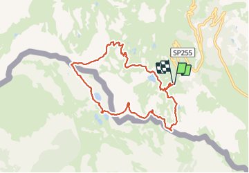
Trail Walking of 9.1 km to be discovered at Piemont, Cuneo, Vinadio. This trail is proposed by stef789.

Elevation profile

Photos

Positioning

Country:
Italy
Region :
Piemont
Department/Province :
Cuneo
Municipality :
Vinadio
Location:
Unknown
Start:(UTM)
348751 ; 4898834 (32T) N.

Trails nearby

Trail Walking Isola - Châtaigneraie ISOLA - Photo
Walking
jpnice06

Walking

Very easy
(1)
Isola, Provence-Alpes-Côte d'Azur, Maritime Alps, France
4.4 km | 7.1 km-effort
2h 9min
Yes
Trail Other activity Isola - Isola 2000 baisse Druos refuge Quesa - Photo
Other activity
patsure

Other activity

Very easy
(1)
Isola, Provence-Alpes-Côte d'Azur, Maritime Alps, France
21 km | 35 km-effort
8h 5min
Yes
Trail On foot Isola - Tête Mercière - Photo
On foot
GUIDE+

On foot

Easy
Isola, Provence-Alpes-Côte d'Azur, Maritime Alps, France
8.1 km | 14.8 km-effort
3h 21min
No
Trail On foot Vinadio - Tour du Lausfer - Photo
On foot
GUIDE+

On foot

Easy
Vinadio, Piemont, Cuneo, Italy
9.5 km | 16.7 km-effort
3h 47min
Yes
Trail On foot Vinadio - (SI E13) Sant'Anna di Vinadio - Vinadio Frazione Strepeis - Photo
On foot
GUIDE+

On foot

Easy
Vinadio, Piemont, Cuneo, Italy
9.1 km | 16.1 km-effort
3h 40min
No
Trail Walking Isola - cime de la lombarde - Photo
Walking
osa

Walking

Very difficult
(1)
Isola, Provence-Alpes-Côte d'Azur, Maritime Alps, France
16.7 km | 31 km-effort
9h 25min
Yes
Trail Walking Vinadio - Cime de la Lombarde 2800m 26.8.24 - Photo
Walking
GUIDE
fredetpascale

Walking

Very difficult
Vinadio, Piemont, Cuneo, Italy
3.4 km | 9.1 km-effort
2h 30min
Yes
Trail Walking Vinadio - Tour du Lausfer 25.8.24 - Photo
Walking
GUIDE
fredetpascale

Walking

Medium
Vinadio, Piemont, Cuneo, Italy
9 km | 16.2 km-effort
3h 30min
Yes
Trail sport Isola - Baisse druos  - Photo
sport
GUIDE
jouans

sport

Very easy
Isola, Provence-Alpes-Côte d'Azur, Maritime Alps, France
9.3 km | 16.3 km-effort
Unknown
Yes


Close
My subscriptions