Trail Walking Allos - Les cabanes du talon - Photo
© OpenStreetMap contributors
Length
Length
14.8 km
Max alt
Max alt
1950 m
Uphill gradient
Uphill gradient
497 m
Km-Effort
Km-Effort  
21 km
Min alt
Min alt
1664 m
Downhill gradient
Downhill gradient
496 m
Boucle
Boucle
Yes
Creation date :
2021-07-27 08:04:51.721
Updated on :
2021-07-27 14:15:02.579

(0 Reviews)

Walking
Walking
3h49
Difficulty : Medium

Scan this QR Code to open this trail in the SityTrail application

FREE GPS app for hiking

Logo SityTrail SityTrail

IGN / Geographical institutes

Download SityTrail from the App Store Download SityTrail from Google Play

Logo SityTrail SityTrail World

The world is yours!

Download SityTrail from the App Store Download SityTrail from Google Play Download SityTrail on Huawei AppGallery

About

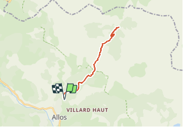
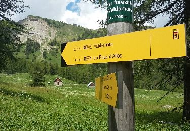
Trail Walking of 14.8 km to be discovered at Provence-Alpes-Côte d'Azur, Alpes-de-Haute-Provence, Allos. This trail is proposed by FrancisM..

Description

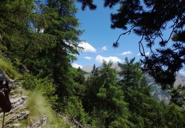
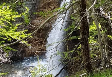
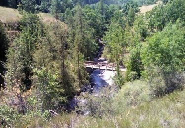
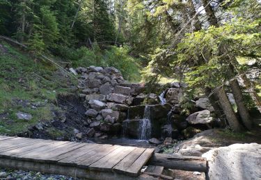
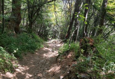
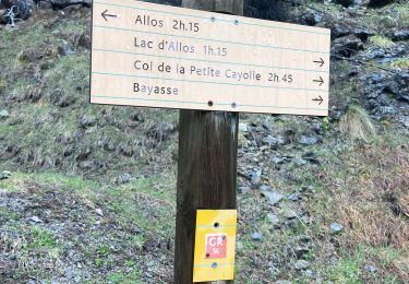
Départ de la barrière de la piste de la Vacheresse à Super Allos (dernière partie de route difficile). Première partie sur route forestière sans intérêt particulier puis parcours sur sentier  beaucoup plus plaisant notamment le long du torrent. Cascade du Pich visible uniquement de loin et peu d'eau à cette période.
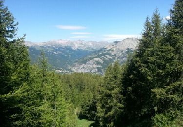
Montée jusqu'au cabanes du Talon agréable. Petit abri possible et source. Retour par le même sentier.

Elevation profile

Positioning

Country:
France
Region :
Provence-Alpes-Côte d'Azur
Department/Province :
Alpes-de-Haute-Provence
Municipality :
Allos
Location:
Unknown
Start:(UTM)
310983 ; 4902309 (32T) N.

Trails nearby

Trail Walking Allos - Allos:rando à partir de la Haute Colette - Photo
Walking
halgrain

Walking

Medium
Allos, Provence-Alpes-Côte d'Azur, Alpes-de-Haute-Provence, France
4 km | 7.7 km-effort
3h 48min
Yes
Trail Walking Allos - lac d allos - Photo
Walking
Mariephil

Walking

Very easy
Allos, Provence-Alpes-Côte d'Azur, Alpes-de-Haute-Provence, France
12.3 km | 19.8 km-effort
4h 49min
Yes
Trail 4x4 Allos - Piste de Bouchier - Photo
4x4
pascal06300

4x4

Very easy
Allos, Provence-Alpes-Côte d'Azur, Alpes-de-Haute-Provence, France
3.6 km | 5.8 km-effort
Unknown
No
Trail Walking Allos - MF de Valdemars - Photo
Walking
LtZIP

Walking

Medium
Allos, Provence-Alpes-Côte d'Azur, Alpes-de-Haute-Provence, France
14 km | 21 km-effort
4h 24min
Yes
Trail Walking Allos - Allos -Le Brec - Allos - Photo
Walking
jacobn

Walking

Very easy
Allos, Provence-Alpes-Côte d'Azur, Alpes-de-Haute-Provence, France
4.7 km | 6.6 km-effort
1h 25min
No
Trail Walking Allos - Rochecline - Photo
Walking
c100106

Walking

Difficult
Allos, Provence-Alpes-Côte d'Azur, Alpes-de-Haute-Provence, France
12.2 km | 26 km-effort
3h 21min
Yes
Trail Walking Allos - lac d'Allos. depuis la fontaine de Valplane - Photo
Walking
samifly51

Walking

Very difficult
Allos, Provence-Alpes-Côte d'Azur, Alpes-de-Haute-Provence, France
16.1 km | 26 km-effort
6h 10min
Yes
Trail Walking Allos - Lac des grenouilles  - Photo
Walking
samifly51

Walking

Medium
Allos, Provence-Alpes-Côte d'Azur, Alpes-de-Haute-Provence, France
6.2 km | 10.2 km-effort
2h 46min
No
Trail Walking Allos - Lac d’allos  - Photo
Walking
GioA10

Walking

Very difficult
Allos, Provence-Alpes-Côte d'Azur, Alpes-de-Haute-Provence, France
6.7 km | 12.7 km-effort
3h 50min
No


Close
My subscriptions