


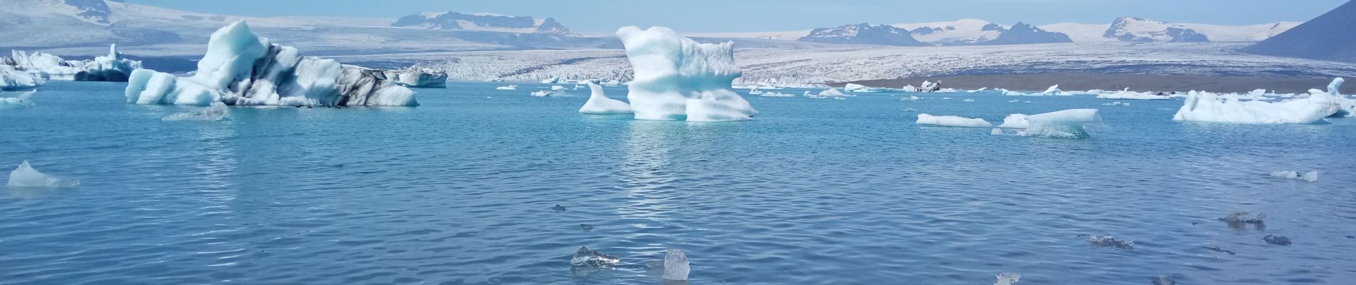
Jokulsarlon

jcclerc
User
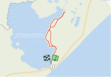

Length
15.5 km
Boucle
Yes
Creation date :
2021-07-20 10:47:58.418
Updated on :
2021-07-20 17:03:31.002
6h14
Difficulty : Medium

FREE GPS app for hiking
 SityTrail
IGN / Geographical institutes
SityTrail World
The world is yours!
About
Trail Walking of 15.5 km to be discovered at Unknown, Sveitarfélagið Hornafjörður. This trail is proposed by jcclerc.
Description
randonnée sur la rive est du lac glaciaire.
Photos


Positioning
Country:
Iceland
Region :
Unknown
Department/Province :
Sveitarfélagið Hornafjörður
Municipality :
Unknown
Location:
Unknown
Start:(Dec)
Start:(UTM)
442342 ; 7102895 (28W) N.
Comments
Trails nearby