![](/images/other/stat-length.png)
![Trail Walking Les Sables-d'Olonne - Sables-d'Olonne forêt domaniale 11 km - Photo](https://media.geolcdn.com/t/1900/400/ext.pjpeg?maxdim=2&url=https%3A%2F%2Fstatic1.geolcdn.com%2Fsiteimages%2Fupload%2Ffiles%2F1553511878bg_sport_marche.png)
Sables-d'Olonne forêt domaniale 11 km
YV24
User
![Length](/images/other/stat-length.png)
Length
10.8 km
![Max alt](https://static1.geolcdn.com/siteimages/upload/files/1508320355ic_sort_altitude_max_24dp.png)
Max alt
21 m
![Uphill gradient](https://static1.geolcdn.com/siteimages/upload/files/1508320355ic_sort_den_pos_24dp.png)
Uphill gradient
83 m
![Km-Effort](/images/other/stat-length.png)
Km-Effort
11.9 km
![Min alt](https://static1.geolcdn.com/siteimages/upload/files/1508320355ic_sort_altitude_min_24dp.png)
Min alt
4 m
![Downhill gradient](https://static1.geolcdn.com/siteimages/upload/files/1508320355ic_sort_den_neg_24dp.png)
Downhill gradient
83 m
![Boucle](https://static1.geolcdn.com/siteimages/upload/files/16400158638029165_repeat_loop_refresh_sync_direction_icon.png)
Boucle
Yes
Creation date :
2021-07-19 07:27:40.544
Updated on :
2021-07-24 16:09:54.612
![Walking](https://static1.geolcdn.com/sitytour/trail-icons/101.png)
2h43
Difficulty : Difficult
![Scan this QR Code to open this trail in the SityTrail application](https://capi.geolives.com/qq0zvz2zws4bq2lad0pu/sitytour/trails/2866512/qr.png?size=200)
FREE GPS app for hiking
About
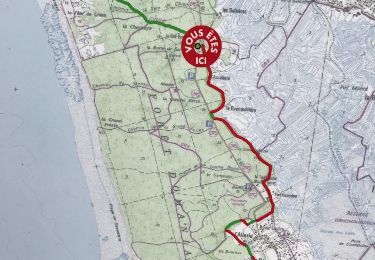
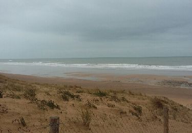
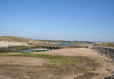
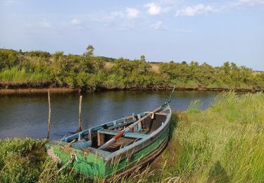
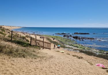
Trail Walking of 10.8 km to be discovered at Pays de la Loire, Vendée, Les Sables-d'Olonne. This trail is proposed by YV24.
Description
Au départ du parking aménagé à la Tantouille,
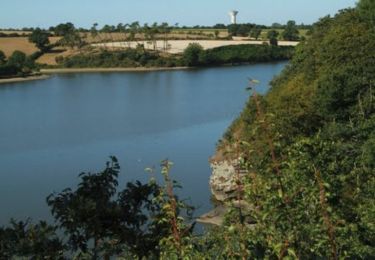
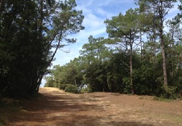
Boucle en forêt, sans difficulté, partcable en tout temps.
Tables de pique nique au parking.
Attention, ce tracé qui empreinte plusieurs portions de boucles balisées. Suivre le tacé.
Positioning
Country:
France
Region :
Pays de la Loire
Department/Province :
Vendée
Municipality :
Les Sables-d'Olonne
Location:
Olonne-sur-Mer
Start:(Dec)
Start:(UTM)
591000 ; 5156959 (30T) N.
Comments
Trails nearby
![Trail Mountain bike L'Île-d'Olonne - Les marais de l'île d'Olonne - Le Jaunay - Photo](https://media.geolcdn.com/t/375/260/ext.jpg?maxdim=2&url=https%3A%2F%2Fservices.sitytrail.com%2FGeolivesWS%2FDownloadMedia.ashx%3FTrailID%3D129690%26Media%3D13226_2.jpg)
![Mountain bike Mountain bike](https://static1.geolcdn.com/sitytour/trail-icons/202.png)
Les marais de l'île d'Olonne - Le Jaunay
Mountain bike
Difficult
(2)
L'Île-d'Olonne,
Pays de la Loire,
Vendée,
France
![](/images/other/stat-length.png)
54 km | 63 km-effort
3h 30min
![](https://static1.geolcdn.com/siteimages/upload/files/16400158638029165_repeat_loop_refresh_sync_direction_icon.png)
Yes
![Trail Walking L'Île-d'Olonne - Sentier la fleur de sel - Photo](https://media.geolcdn.com/t/375/260/1ccf5a45-c40a-4459-b03e-737e931f1f29.jpg&format=jpg&maxdim=2)
![Walking Walking](https://static1.geolcdn.com/sitytour/trail-icons/101.png)
Sentier la fleur de sel
Walking
Very easy
L'Île-d'Olonne,
Pays de la Loire,
Vendée,
France
![](/images/other/stat-length.png)
5 km | 5.3 km-effort
1h 4min
![](https://static1.geolcdn.com/siteimages/upload/files/16400158638029165_repeat_loop_refresh_sync_direction_icon.png)
Yes
![Trail Cycle Les Sables-d'Olonne - 85 OLONNE-BREM-BRETIGNOLLES - Photo](https://media.geolcdn.com/t/375/260/ext.jpg?maxdim=2&url=https%3A%2F%2Fservices.sitytrail.com%2FGeolivesWS%2FDownloadMedia.ashx%3FTrailID%3D1129147%26Media%3Dfix__20190331155219.jpg)
![Cycle Cycle](https://static1.geolcdn.com/sitytour/trail-icons/200.png)
85 OLONNE-BREM-BRETIGNOLLES
Cycle
Easy
Les Sables-d'Olonne,
Pays de la Loire,
Vendée,
France
![](/images/other/stat-length.png)
33 km | 35 km-effort
2h 5min
![](https://static1.geolcdn.com/siteimages/upload/files/16400158638029165_repeat_loop_refresh_sync_direction_icon.png)
Yes
![Trail Other activity Les Sables-d'Olonne - rando Dudu 05-01-2019 - Photo](https://media.geolcdn.com/t/375/260/ext.jpg?maxdim=2&url=https%3A%2F%2Fservices.sitytrail.com%2FGeolivesWS%2FDownloadMedia.ashx%3FTrailID%3D1092695%26Media%3D20190105170235.jpg)
![Other activity Other activity](https://static1.geolcdn.com/sitytour/trail-icons/900.png)
rando Dudu 05-01-2019
Other activity
Very easy
Les Sables-d'Olonne,
Pays de la Loire,
Vendée,
France
![](/images/other/stat-length.png)
10.5 km | 11.5 km-effort
2h 19min
![](https://static1.geolcdn.com/siteimages/upload/files/16400158638029165_repeat_loop_refresh_sync_direction_icon.png)
Yes
![Trail Other activity Les Sables-d'Olonne - vert olonne - Photo](https://media.geolcdn.com/t/375/260/ext.jpg?maxdim=2&url=https%3A%2F%2Fservices.sitytrail.com%2FGeolivesWS%2FDownloadMedia.ashx%3FTrailID%3D684620%26Media%3Dfix__20170115104246.jpg)
![Other activity Other activity](https://static1.geolcdn.com/sitytour/trail-icons/900.png)
vert olonne
Other activity
Very easy
Les Sables-d'Olonne,
Pays de la Loire,
Vendée,
France
![](/images/other/stat-length.png)
18.7 km | 21 km-effort
2h 5min
![](https://static1.geolcdn.com/siteimages/upload/files/16400158638029165_repeat_loop_refresh_sync_direction_icon.png)
Yes
![Trail Walking Les Sables-d'Olonne - Forêt et Marais au Pays des Olonnes - Photo](https://media.geolcdn.com/t/375/260/ext.jpg?maxdim=2&url=https%3A%2F%2Fservices.sitytrail.com%2FGeolivesWS%2FDownloadMedia.ashx%3FTrailID%3D191330%26Media%3D14886_5.jpg)
![Walking Walking](https://static1.geolcdn.com/sitytour/trail-icons/101.png)
Forêt et Marais au Pays des Olonnes
Walking
Medium
Les Sables-d'Olonne,
Pays de la Loire,
Vendée,
France
![](/images/other/stat-length.png)
15.3 km | 16.7 km-effort
3h 30min
![](https://static1.geolcdn.com/siteimages/upload/files/16400158638029165_repeat_loop_refresh_sync_direction_icon.png)
Yes
![Trail Walking Les Sables-d'Olonne - sentier des Gravelots - Olonne sur Mer - Photo](https://media.geolcdn.com/t/375/260/ext.jpg?maxdim=2&url=https%3A%2F%2Fservices.sitytrail.com%2FGeolivesWS%2FDownloadMedia.ashx%3FTrailID%3D139948%26Media%3D20120719121703.jpg)
![Walking Walking](https://static1.geolcdn.com/sitytour/trail-icons/101.png)
sentier des Gravelots - Olonne sur Mer
Walking
Easy
Les Sables-d'Olonne,
Pays de la Loire,
Vendée,
France
![](/images/other/stat-length.png)
3.9 km | 4.2 km-effort
1h 19min
![](https://static1.geolcdn.com/siteimages/upload/files/16400158638029165_repeat_loop_refresh_sync_direction_icon.png)
No
![Trail Walking Les Sables-d'Olonne - Marais d'Olonne - Photo](https://media.geolcdn.com/t/375/260/5a074176-f5de-4cd7-b919-7ed7d7805997.jpg&format=jpg&maxdim=2)
![Walking Walking](https://static1.geolcdn.com/sitytour/trail-icons/101.png)
Marais d'Olonne
Walking
Medium
Les Sables-d'Olonne,
Pays de la Loire,
Vendée,
France
![](/images/other/stat-length.png)
14.5 km | 15.2 km-effort
4h 56min
![](https://static1.geolcdn.com/siteimages/upload/files/16400158638029165_repeat_loop_refresh_sync_direction_icon.png)
Yes
![Trail Walking Les Sables-d'Olonne - Vendée_Sables-d'Olonne_Plage_de_Sauveterre - Photo](https://media.geolcdn.com/t/375/260/c681cc1a-daed-4477-9ef7-8159f743e858.jpg&format=jpg&maxdim=2)
![Walking Walking](https://static1.geolcdn.com/sitytour/trail-icons/101.png)
Vendée_Sables-d'Olonne_Plage_de_Sauveterre
Walking
Very easy
Les Sables-d'Olonne,
Pays de la Loire,
Vendée,
France
![](/images/other/stat-length.png)
4.6 km | 5.2 km-effort
1h 32min
![](https://static1.geolcdn.com/siteimages/upload/files/16400158638029165_repeat_loop_refresh_sync_direction_icon.png)
Yes