17 km | 24 km-effort
MAJOREL
User
Length
14.1 km
Max alt
629 m
Uphill gradient
406 m
Km-Effort
19.5 km
Min alt
424 m
Downhill gradient
407 m
Boucle
Yes
Creation date :
2021-07-17 10:08:15.224
Updated on :
2021-07-17 10:08:15.224
FREE GPS app for hiking
About
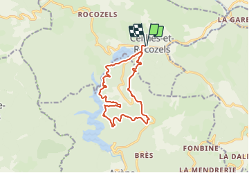
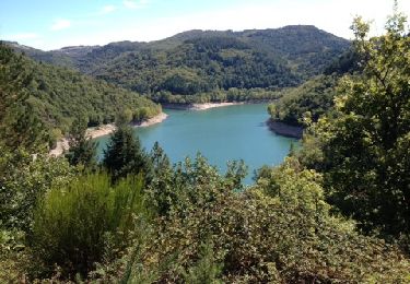
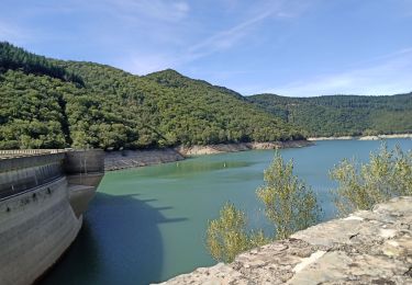
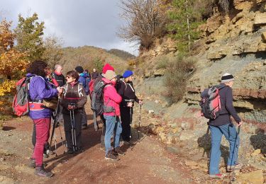
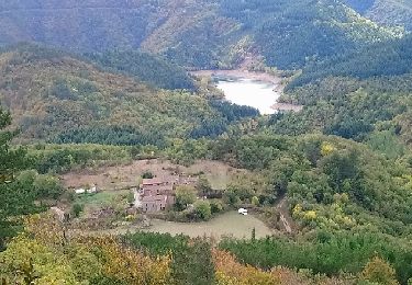
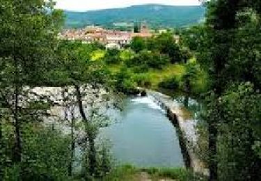
Trail of 14.1 km to be discovered at Occitania, Hérault, Ceilhes-et-Rocozels. This trail is proposed by MAJOREL.
Positioning
Country:
France
Region :
Occitania
Department/Province :
Hérault
Municipality :
Ceilhes-et-Rocozels
Location:
Unknown
Start:(Dec)
Start:(UTM)
508992 ; 4850006 (31T) N.
Comments
Trails nearby
Foret Domaniale des monts d'Orb
Walking
Easy
(1)
Ceilhes-et-Rocozels,
Occitania,
Hérault,
France
5h 13min
Yes
ceilhes
Walking
Very easy
(1)
Ceilhes-et-Rocozels,
Occitania,
Hérault,
France
9.6 km | 13.5 km-effort
3h 26min
Yes
Arsel 3-10-17 a partir de ce îles du col vert à montredon
Walking
Very easy
Ceilhes-et-Rocozels,
Occitania,
Hérault,
France
22 km | 31 km-effort
6h 5min
No
Avene et ses Foréts
Walking
Very easy
(1)
Avène,
Occitania,
Hérault,
France
17.6 km | 25 km-effort
4h 6min
Yes
Ceilhes
Walking
Very difficult
Ceilhes-et-Rocozels,
Occitania,
Hérault,
France
13.7 km | 19.6 km-effort
4h 39min
Yes
Le Ruisseau de Jure
Walking
Medium
Ceilhes-et-Rocozels,
Occitania,
Hérault,
France
9.2 km | 13.8 km-effort
4h 0min
Yes
Le Réservoir d'Avène
Walking
Medium
Ceilhes-et-Rocozels,
Occitania,
Hérault,
France
11 km | 16.1 km-effort
4h 0min
Yes
avene ceilhes
Mountain bike
Difficult
Ceilhes-et-Rocozels,
Occitania,
Hérault,
France
30 km | 40 km-effort
2h 44min
Yes