![](/images/other/stat-length.png)
![Trail Walking Bénonces - Cascade de Luiset /Rocher de Cuny - Photo](https://media.geolcdn.com/t/1900/400/512cabb3-ac23-4daf-9f38-7ed7dd095ac7.jpg&format=pjpeg&maxdim=2)
Cascade de Luiset /Rocher de Cuny
GuyCharvier
User
![Length](/images/other/stat-length.png)
Length
17 km
![Max alt](https://static1.geolcdn.com/siteimages/upload/files/1508320355ic_sort_altitude_max_24dp.png)
Max alt
797 m
![Uphill gradient](https://static1.geolcdn.com/siteimages/upload/files/1508320355ic_sort_den_pos_24dp.png)
Uphill gradient
649 m
![Km-Effort](/images/other/stat-length.png)
Km-Effort
26 km
![Min alt](https://static1.geolcdn.com/siteimages/upload/files/1508320355ic_sort_altitude_min_24dp.png)
Min alt
440 m
![Downhill gradient](https://static1.geolcdn.com/siteimages/upload/files/1508320355ic_sort_den_neg_24dp.png)
Downhill gradient
628 m
![Boucle](https://static1.geolcdn.com/siteimages/upload/files/16400158638029165_repeat_loop_refresh_sync_direction_icon.png)
Boucle
Yes
Creation date :
2021-07-11 07:24:24.019
Updated on :
2021-07-11 14:17:10.137
![Walking](https://static1.geolcdn.com/sitytour/trail-icons/101.png)
4h36
Difficulty : Medium
![Scan this QR Code to open this trail in the SityTrail application](https://capi.geolives.com/qq0zvz2zws4bq2lad0pu/sitytour/trails/2857330/qr.png?size=200)
FREE GPS app for hiking
About
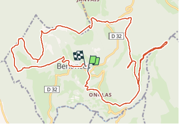
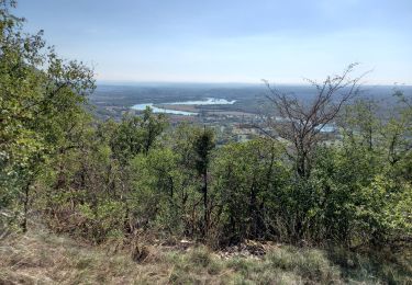
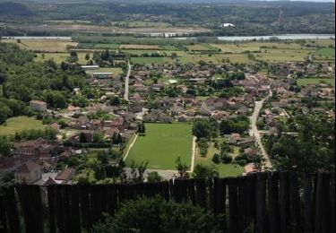
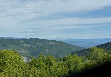
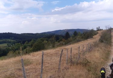
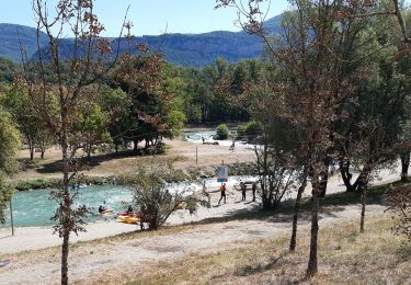
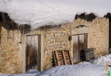
Trail Walking of 17 km to be discovered at Auvergne-Rhône-Alpes, Ain, Bénonces. This trail is proposed by GuyCharvier.
Description
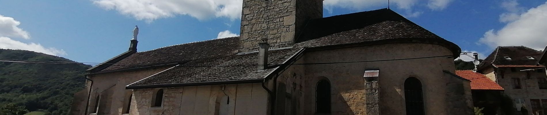
Départ église de Bénonces dans l'Ain, belle rando à faire après forte pluie pour la Cascade.
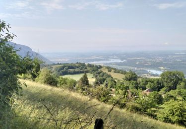
Pays très reposant, très calme, idéal pour se ressourcer.
Positioning
Country:
France
Region :
Auvergne-Rhône-Alpes
Department/Province :
Ain
Municipality :
Bénonces
Location:
Unknown
Start:(Dec)
Start:(UTM)
692537 ; 5077771 (31T) N.
Comments
Trails nearby
![Trail Walking Seillonnaz - seillonnaz, cascade de Brive, lompnaz - Photo](https://media.geolcdn.com/t/375/260/53d4a498-08d5-4202-b900-e163f49fdbc9.jpg&format=jpg&maxdim=2)
![Walking Walking](https://static1.geolcdn.com/sitytour/trail-icons/101.png)
seillonnaz, cascade de Brive, lompnaz
Walking
Medium
Seillonnaz,
Auvergne-Rhône-Alpes,
Ain,
France
![](/images/other/stat-length.png)
13.2 km | 19.4 km-effort
3h 39min
![](https://static1.geolcdn.com/siteimages/upload/files/16400158638029165_repeat_loop_refresh_sync_direction_icon.png)
Yes
![Trail Walking Souclin - 01-soudon-cleyzieu-20km825m - Photo](https://media.geolcdn.com/t/375/260/0346293c-b114-4c04-91d5-976f9c67f4c8.jpg&format=jpg&maxdim=2)
![Walking Walking](https://static1.geolcdn.com/sitytour/trail-icons/101.png)
01-soudon-cleyzieu-20km825m
Walking
Difficult
Souclin,
Auvergne-Rhône-Alpes,
Ain,
France
![](/images/other/stat-length.png)
20 km | 31 km-effort
7h 2min
![](https://static1.geolcdn.com/siteimages/upload/files/16400158638029165_repeat_loop_refresh_sync_direction_icon.png)
Yes
![Trail Walking Villebois - les balcons de souclin hameau de buis - Photo](https://media.geolcdn.com/t/375/260/3b5f007f-b409-4554-ba2e-def6bfe006e4.jpg&format=jpg&maxdim=2)
![Walking Walking](https://static1.geolcdn.com/sitytour/trail-icons/101.png)
les balcons de souclin hameau de buis
Walking
Medium
(1)
Villebois,
Auvergne-Rhône-Alpes,
Ain,
France
![](/images/other/stat-length.png)
16.1 km | 24 km-effort
5h 3min
![](https://static1.geolcdn.com/siteimages/upload/files/16400158638029165_repeat_loop_refresh_sync_direction_icon.png)
Yes
![Trail Walking Ordonnaz - innimond - Photo](https://media.geolcdn.com/t/375/260/ext.jpg?maxdim=2&url=https%3A%2F%2Fstatic1.geolcdn.com%2Fsiteimages%2Fupload%2Ffiles%2F1553511878bg_sport_marche.png)
![Walking Walking](https://static1.geolcdn.com/sitytour/trail-icons/101.png)
innimond
Walking
Very easy
(1)
Ordonnaz,
Auvergne-Rhône-Alpes,
Ain,
France
![](/images/other/stat-length.png)
17.6 km | 25 km-effort
5h 18min
![](https://static1.geolcdn.com/siteimages/upload/files/16400158638029165_repeat_loop_refresh_sync_direction_icon.png)
Yes
![Trail Walking Serrières-de-Briord - voir la vierge - Photo](https://media.geolcdn.com/t/375/260/ext.jpg?maxdim=2&url=https%3A%2F%2Fservices.sitytrail.com%2FGeolivesWS%2FDownloadMedia.ashx%3FTrailID%3D200063%26Media%3D20130623154145.jpg)
![Walking Walking](https://static1.geolcdn.com/sitytour/trail-icons/101.png)
voir la vierge
Walking
Easy
Serrières-de-Briord,
Auvergne-Rhône-Alpes,
Ain,
France
![](/images/other/stat-length.png)
5.6 km | 9.3 km-effort
1h 48min
![](https://static1.geolcdn.com/siteimages/upload/files/16400158638029165_repeat_loop_refresh_sync_direction_icon.png)
Yes
![Trail Mountain bike Serrières-de-Briord - Serrieres de Briord - Calvaire de Portes - Photo](https://media.geolcdn.com/t/375/260/ext.jpg?maxdim=2&url=https%3A%2F%2Fservices.sitytrail.com%2FGeolivesWS%2FDownloadMedia.ashx%3FTrailID%3D107044%26Media%3D11853_6.jpg)
![Mountain bike Mountain bike](https://static1.geolcdn.com/sitytour/trail-icons/202.png)
Serrieres de Briord - Calvaire de Portes
Mountain bike
Very difficult
Serrières-de-Briord,
Auvergne-Rhône-Alpes,
Ain,
France
![](/images/other/stat-length.png)
64 km | 91 km-effort
6h 30min
![](https://static1.geolcdn.com/siteimages/upload/files/16400158638029165_repeat_loop_refresh_sync_direction_icon.png)
Yes
![Trail Horseback riding Bénonces - col de portes - Photo](https://media.geolcdn.com/t/375/260/54810e80-f5d5-4cbb-9935-a749da2f45af.jpg&format=jpg&maxdim=2)
![Horseback riding Horseback riding](https://static1.geolcdn.com/sitytour/trail-icons/301.png)
col de portes
Horseback riding
Medium
Bénonces,
Auvergne-Rhône-Alpes,
Ain,
France
![](/images/other/stat-length.png)
39 km | 61 km-effort
4h 11min
![](https://static1.geolcdn.com/siteimages/upload/files/16400158638029165_repeat_loop_refresh_sync_direction_icon.png)
No
![Trail Electric bike Montalieu-Vercieu - Le Tour de la Vallée Bleue en VAE - Photo](https://media.geolcdn.com/t/375/260/9253f46c-1312-4f3d-b4d2-f49e4324aa30.jpg&format=jpg&maxdim=2)
![Electric bike Electric bike](https://static1.geolcdn.com/sitytour/trail-icons/205.png)
Le Tour de la Vallée Bleue en VAE
Electric bike
Medium
Montalieu-Vercieu,
Auvergne-Rhône-Alpes,
Isère,
France
![](/images/other/stat-length.png)
24 km | 26 km-effort
Unknown
![](https://static1.geolcdn.com/siteimages/upload/files/16400158638029165_repeat_loop_refresh_sync_direction_icon.png)
Yes
![Trail Snowshoes Villebois - Le Crêt de Pont 1059m, depuis Bouis - Photo](https://media.geolcdn.com/t/375/260/ext.jpg?maxdim=2&url=https%3A%2F%2Fservices.sitytrail.com%2FGeolivesWS%2FDownloadMedia.ashx%3FTrailID%3D317286%26Media%3D16473_1.jpg)
![Snowshoes Snowshoes](https://static1.geolcdn.com/sitytour/trail-icons/504.png)
Le Crêt de Pont 1059m, depuis Bouis
Snowshoes
Easy
Villebois,
Auvergne-Rhône-Alpes,
Ain,
France
![](/images/other/stat-length.png)
14.1 km | 24 km-effort
5h 30min
![](https://static1.geolcdn.com/siteimages/upload/files/16400158638029165_repeat_loop_refresh_sync_direction_icon.png)
Yes