


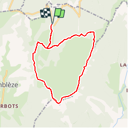


14.9 km | 22 km-effort


User


FREE GPS app for hiking
 SityTrail
IGN / Geographical institutes
SityTrail World
The world is yours!
Trail Walking of 15.3 km to be discovered at Auvergne-Rhône-Alpes, Drôme, Omblèze. This trail is proposed by bob2023.
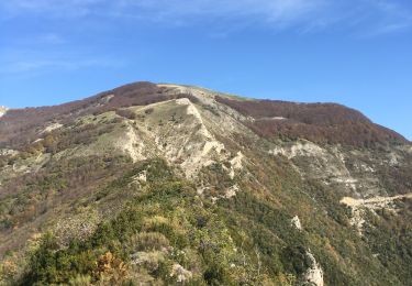
Magnifique plateau a faire au printemps pour les milliers de fleurs. Aucune difficulté.
Continuer la route après le col de la bataille, et se garer au mémorial (refuge Gardiol).
La 1ere partie, jusqu'a la ferme d'ambel peut être faite par des personnes agées


Walking

Walking

Walking

Walking

Walking

Walking

Mountain bike
Walking
Walking