Trail Mountain bike Ponthoile - ST-VALERY ... par la très belle chapelle de Hamelet.  - Photo

ST-VALERY ... par la très belle chapelle de Hamelet.

© OpenStreetMap contributors
Length
Length
18.9 km
Max alt
Max alt
8 m
Uphill gradient
Uphill gradient
53 m
Km-Effort
Km-Effort  
19.6 km
Min alt
Min alt
0 m
Downhill gradient
Downhill gradient
53 m
Boucle
Boucle
Yes
Creation date :
2021-07-09 12:33:17.655
Updated on :
2021-07-17 06:33:59.27

(0 Reviews)

Mountain bike
Mountain bike
1h49
Difficulty : Very easy

Scan this QR Code to open this trail in the SityTrail application

FREE GPS app for hiking

Logo SityTrail SityTrail

IGN / Geographical institutes

Download SityTrail from the App Store Download SityTrail from Google Play

Logo SityTrail SityTrail World

The world is yours!

Download SityTrail from the App Store Download SityTrail from Google Play Download SityTrail on Huawei AppGallery

About

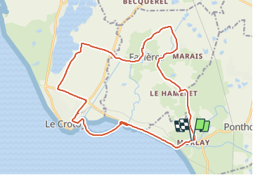
Trail Mountain bike of 18.9 km to be discovered at Hauts-de-France, Somme, Ponthoile. This trail is proposed by GerardBouche.

Description

Au départ de Morlay par la chapelle du Hamelet (XVI ème siècle) le village de Favières (Le Marais, le Moulin à eau) et le hameau de Mayoc.
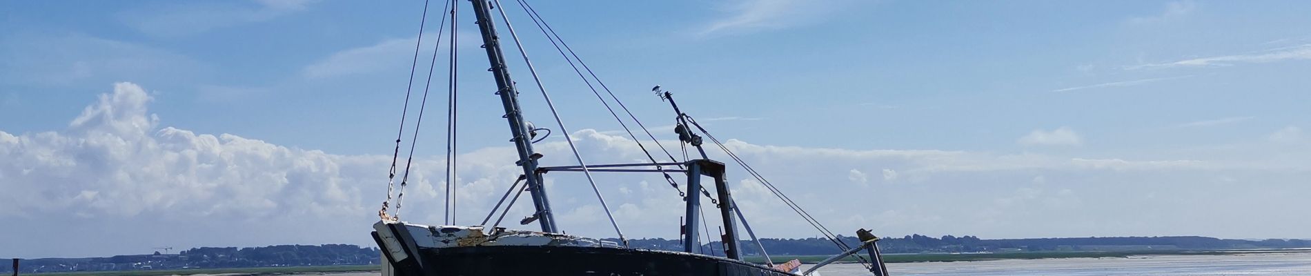
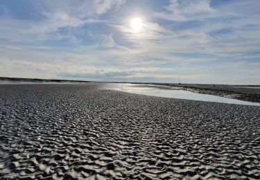
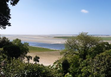
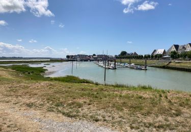
Rejoindre la cité des Crotellois (Le Crotoy) , et poursuivre par sa promenade " Manessier " ( /-2 km) avec son point de vue sur le port, sa baie et ses prés salés.


Elevation profile

Photos

Positioning

Country:
France
Region :
Hauts-de-France
Department/Province :
Somme
Municipality :
Ponthoile
Location:
Unknown
Start:(UTM)
406284 ; 5562958 (31U) N.

Trails nearby

Trail Walking Saint-Valery-sur-Somme - Balade à Saint-Valéry-sur-Somme - Photo
Walking
GUIDE
Desrumaux

Walking

Easy
(4)
Saint-Valery-sur-Somme, Hauts-de-France, Somme, France
10.4 km | 12.2 km-effort
2h 41min
Yes
Trail Walking Saint-Valery-sur-Somme - Balade à Saint-Valery sur Somme - Photo
Walking
tracegps

Walking

Medium
(3)
Saint-Valery-sur-Somme, Hauts-de-France, Somme, France
7.1 km | 8.6 km-effort
2h 19min
Yes
Trail Walking Favières - Circuit de Morlay - Photo
Walking
tracegps

Walking

Difficult
(1)
Favières, Hauts-de-France, Somme, France
12.4 km | 12.8 km-effort
4h 0min
Yes
Trail Walking Saint-Valery-sur-Somme - Traversée Baie de Somme 11/08/2021 - Photo
Walking
GUIDE
R@ph

Walking

Medium
Saint-Valery-sur-Somme, Hauts-de-France, Somme, France
8.5 km | 8.8 km-effort
2h 0min
No
Trail Mountain bike Saint-Valery-sur-Somme - Gravelot Baie de sommes - Photo
Mountain bike
Jeanlouisbray

Mountain bike

Easy
(1)
Saint-Valery-sur-Somme, Hauts-de-France, Somme, France
44 km | 47 km-effort
4h 56min
Yes
Trail Cycle Le Crotoy - Crotoy - Marquenterre - Photo
Cycle
jacques.moulin@hotmail.com

Cycle

Medium
(1)
Le Crotoy, Hauts-de-France, Somme, France
18.3 km | 19.2 km-effort
1h 8min
Yes
Trail Walking Le Crotoy - traversée baie somme et train - Photo
Walking
lefrancm

Walking

Very easy
(1)
Le Crotoy, Hauts-de-France, Somme, France
24 km | 25 km-effort
6h 58min
No
Trail Walking Saint-Valery-sur-Somme - Baie de Somme - Photo
Walking
Greg813

Walking

Difficult
Saint-Valery-sur-Somme, Hauts-de-France, Somme, France
25 km | 27 km-effort
5h 26min
Yes
Trail Walking Le Crotoy - Port du crotoy - port de St Valéry sur somme par GR - Photo
Walking
ash

Walking

Very easy
(1)
Le Crotoy, Hauts-de-France, Somme, France
12.3 km | 12.7 km-effort
2h 40min
No


Close
My subscriptions