![](/images/other/stat-length.png)
![Trail Walking Tende - 2021-07-02 Sortie CAF - Mercantour J3 - Photo](https://media.geolcdn.com/t/1900/400/ext.pjpeg?maxdim=2&url=https%3A%2F%2Fstatic1.geolcdn.com%2Fsiteimages%2Fupload%2Ffiles%2F1553511878bg_sport_marche.png)
2021-07-02 Sortie CAF - Mercantour J3
eric.mignot
User
![Length](/images/other/stat-length.png)
Length
7.9 km
![Max alt](https://static1.geolcdn.com/siteimages/upload/files/1508320355ic_sort_altitude_max_24dp.png)
Max alt
2889 m
![Uphill gradient](https://static1.geolcdn.com/siteimages/upload/files/1508320355ic_sort_den_pos_24dp.png)
Uphill gradient
692 m
![Km-Effort](/images/other/stat-length.png)
Km-Effort
17.2 km
![Min alt](https://static1.geolcdn.com/siteimages/upload/files/1508320355ic_sort_altitude_min_24dp.png)
Min alt
2215 m
![Downhill gradient](https://static1.geolcdn.com/siteimages/upload/files/1508320355ic_sort_den_neg_24dp.png)
Downhill gradient
690 m
![Boucle](https://static1.geolcdn.com/siteimages/upload/files/16400158638029165_repeat_loop_refresh_sync_direction_icon.png)
Boucle
No
Creation date :
2021-07-02 05:36:50.82
Updated on :
2021-07-08 16:39:27.687
![Walking](https://static1.geolcdn.com/sitytour/trail-icons/101.png)
6h00
Difficulty : Difficult
![Scan this QR Code to open this trail in the SityTrail application](https://capi.geolives.com/qq0zvz2zws4bq2lad0pu/sitytour/trails/2852420/qr.png?size=200)
FREE GPS app for hiking
About
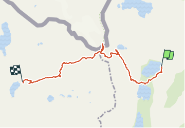
Trail Walking of 7.9 km to be discovered at Provence-Alpes-Côte d'Azur, Maritime Alps, Tende. This trail is proposed by eric.mignot.
Description
du refuge de Valmasque (2233m) au refuge de Nice (2232m)
via le Pas de la Fous (2828m)
Ascension de la Cime Viglino (2910m) depuis le Pas de la Fous
Positioning
Country:
France
Region :
Provence-Alpes-Côte d'Azur
Department/Province :
Maritime Alps
Municipality :
Tende
Location:
Unknown
Start:(Dec)
Start:(UTM)
375699 ; 4885052 (32T) N.
Comments
Trails nearby
![Trail Walking Tende - 83 fontanalba lac des mesches - Photo](https://media.geolcdn.com/t/375/260/b97ea35d-6453-4d46-a2d9-b51ae651ac2f.jpg&format=jpg&maxdim=2)
![Walking Walking](https://static1.geolcdn.com/sitytour/trail-icons/101.png)
83 fontanalba lac des mesches
Walking
Medium
Tende,
Provence-Alpes-Côte d'Azur,
Maritime Alps,
France
![](/images/other/stat-length.png)
11.6 km | 19.6 km-effort
5h 19min
![](https://static1.geolcdn.com/siteimages/upload/files/16400158638029165_repeat_loop_refresh_sync_direction_icon.png)
No
![Trail On foot Tende - Circuit de Fontanalbe - Photo](https://media.geolcdn.com/t/375/260/fbada9bc-eac2-4c15-a16e-af4bb85123b6.jpeg&format=jpg&maxdim=2)
![On foot On foot](https://static1.geolcdn.com/sitytour/trail-icons/100.png)
Circuit de Fontanalbe
On foot
Medium
Tende,
Provence-Alpes-Côte d'Azur,
Maritime Alps,
France
![](/images/other/stat-length.png)
14.6 km | 24 km-effort
5h 28min
![](https://static1.geolcdn.com/siteimages/upload/files/16400158638029165_repeat_loop_refresh_sync_direction_icon.png)
Yes
![Trail On foot Belvédère - Les Merveilles par la Gordolasque - Photo](https://media.geolcdn.com/t/375/260/530d04a7-b615-4962-acf5-9f79fcad8eda.jpeg&format=jpg&maxdim=2)
![On foot On foot](https://static1.geolcdn.com/sitytour/trail-icons/100.png)
Les Merveilles par la Gordolasque
On foot
Medium
Belvédère,
Provence-Alpes-Côte d'Azur,
Maritime Alps,
France
![](/images/other/stat-length.png)
13 km | 29 km-effort
6h 35min
![](https://static1.geolcdn.com/siteimages/upload/files/16400158638029165_repeat_loop_refresh_sync_direction_icon.png)
Yes
![Walking Walking](https://static1.geolcdn.com/sitytour/trail-icons/101.png)
SityTrail - Refuge de Nice et Les Lacs
Walking
Very difficult
Belvédère,
Provence-Alpes-Côte d'Azur,
Maritime Alps,
France
![](/images/other/stat-length.png)
13 km | 25 km-effort
5h 4min
![](https://static1.geolcdn.com/siteimages/upload/files/16400158638029165_repeat_loop_refresh_sync_direction_icon.png)
Yes
![Trail Walking Belvédère - Refuge de Nice le Lac Autier - Photo](https://media.geolcdn.com/t/375/260/90f5472c-c83a-4f85-b43b-3f70801c497f.jpg&format=jpg&maxdim=2)
![Walking Walking](https://static1.geolcdn.com/sitytour/trail-icons/101.png)
Refuge de Nice le Lac Autier
Walking
Very difficult
Belvédère,
Provence-Alpes-Côte d'Azur,
Maritime Alps,
France
![](/images/other/stat-length.png)
8.4 km | 16.4 km-effort
5h 1min
![](https://static1.geolcdn.com/siteimages/upload/files/16400158638029165_repeat_loop_refresh_sync_direction_icon.png)
No
![Trail Walking Belvédère - Pont du Countet refuge de Nice et Lacs du Mont Clapier - Photo](https://media.geolcdn.com/t/375/260/e630815b-37c0-4f3c-a885-04147e40707a.jpg&format=jpg&maxdim=2)
![Walking Walking](https://static1.geolcdn.com/sitytour/trail-icons/101.png)
Pont du Countet refuge de Nice et Lacs du Mont Clapier
Walking
Difficult
Belvédère,
Provence-Alpes-Côte d'Azur,
Maritime Alps,
France
![](/images/other/stat-length.png)
8.1 km | 18.1 km-effort
4h 1min
![](https://static1.geolcdn.com/siteimages/upload/files/16400158638029165_repeat_loop_refresh_sync_direction_icon.png)
No
![Trail Walking Tende - Casterino - Fontanalba - 2016 06 20 - Photo](https://media.geolcdn.com/t/375/260/ext.jpg?maxdim=2&url=https%3A%2F%2Fservices.sitytrail.com%2FGeolivesWS%2FDownloadMedia.ashx%3FTrailID%3D597810%26Media%3Dfix__20160620152052.jpg)
![Walking Walking](https://static1.geolcdn.com/sitytour/trail-icons/101.png)
Casterino - Fontanalba - 2016 06 20
Walking
Difficult
Tende,
Provence-Alpes-Côte d'Azur,
Maritime Alps,
France
![](/images/other/stat-length.png)
16.8 km | 27 km-effort
6h 35min
![](https://static1.geolcdn.com/siteimages/upload/files/16400158638029165_repeat_loop_refresh_sync_direction_icon.png)
Yes
![Trail Walking Tende - Casterino - Refuge de Valmasque - les 3 lacs - 2016 06 28 - 860m 17.7km - Photo](https://media.geolcdn.com/t/375/260/ext.jpg?maxdim=2&url=https%3A%2F%2Fservices.sitytrail.com%2FGeolivesWS%2FDownloadMedia.ashx%3FTrailID%3D597803%26Media%3Dfix__20160628122144.jpg)
![Walking Walking](https://static1.geolcdn.com/sitytour/trail-icons/101.png)
Casterino - Refuge de Valmasque - les 3 lacs - 2016 06 28 - 860m 17.7km
Walking
Difficult
Tende,
Provence-Alpes-Côte d'Azur,
Maritime Alps,
France
![](/images/other/stat-length.png)
17.7 km | 28 km-effort
6h 0min
![](https://static1.geolcdn.com/siteimages/upload/files/16400158638029165_repeat_loop_refresh_sync_direction_icon.png)
Yes
![Trail Walking Tende - Valmasque- Bego-Pas de L'Autier-Countet - Photo](https://media.geolcdn.com/t/375/260/ext.jpg?maxdim=2&url=https%3A%2F%2Fstatic1.geolcdn.com%2Fsiteimages%2Fupload%2Ffiles%2F1553511878bg_sport_marche.png)
![Walking Walking](https://static1.geolcdn.com/sitytour/trail-icons/101.png)
Valmasque- Bego-Pas de L'Autier-Countet
Walking
Difficult
(1)
Tende,
Provence-Alpes-Côte d'Azur,
Maritime Alps,
France
![](/images/other/stat-length.png)
16.9 km | 30 km-effort
5h 57min
![](https://static1.geolcdn.com/siteimages/upload/files/16400158638029165_repeat_loop_refresh_sync_direction_icon.png)
No