Trail Walking Châtillon-en-Diois - Les Cabanes de Châtillon (Glandasse) - Photo

Les Cabanes de Châtillon (Glandasse)

© OpenStreetMap contributors
Length
Length
13.5 km
Max alt
Max alt
1789 m
Uphill gradient
Uphill gradient
1205 m
Km-Effort
Km-Effort  
30 km
Min alt
Min alt
579 m
Downhill gradient
Downhill gradient
1206 m
Boucle
Boucle
Yes
Creation date :
2021-06-26 16:28:06.779
Updated on :
2021-06-29 07:17:31.477

(0 Reviews)

Walking
Walking
5h00
Difficulty : Very difficult

Scan this QR Code to open this trail in the SityTrail application

FREE GPS app for hiking

Logo SityTrail SityTrail

IGN / Geographical institutes

Download SityTrail from the App Store Download SityTrail from Google Play

Logo SityTrail SityTrail World

The world is yours!

Download SityTrail from the App Store Download SityTrail from Google Play Download SityTrail on Huawei AppGallery

About

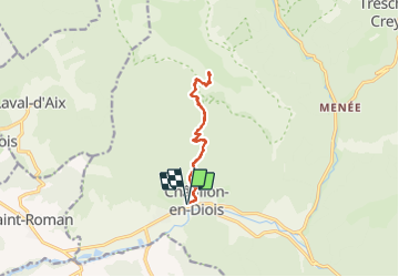
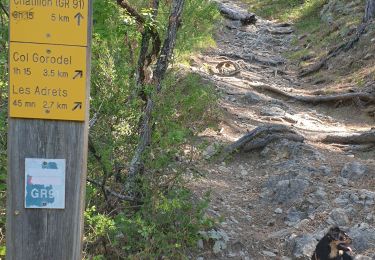
Trail Walking of 13.5 km to be discovered at Auvergne-Rhône-Alpes, Drôme, Châtillon-en-Diois. This trail is proposed by Philindy26.

Description

Départ du village de Chatillon en Diois...
Géolocalisation (Google Maps) : https://goo.gl/maps/bzCqc1VZtEu9Rgk27

Monter par le GR91, la Côte Queyras pour arriver aux Cabanes de Chatillon.

Retour par le même chemin…

Elevation profile

Photos

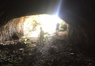
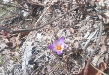
35 photos in total. Please click on a photo to see them all in the gallery.

Positioning

Country:
France
Region :
Auvergne-Rhône-Alpes
Department/Province :
Drôme
Municipality :
Châtillon-en-Diois
Location:
Châtillon-en-Diois
Start:(UTM)
696699 ; 4951991 (31T) N.

Trails nearby

Trail Walking Châtillon-en-Diois - chatillon en Diois, GR91 - Photo
Walking
francislassauce

Walking

Difficult
(1)
Châtillon-en-Diois, Auvergne-Rhône-Alpes, Drôme, France
7.8 km | 14.3 km-effort
3h 14min
Yes
Trail Walking Châtillon-en-Diois - Pas des CLots - Photo
Walking
OscarMa

Walking

Difficult
(1)
Châtillon-en-Diois, Auvergne-Rhône-Alpes, Drôme, France
16.1 km | 34 km-effort
7h 15min
Yes
Trail Walking Châtillon-en-Diois - glandasse par chatillon - Photo
Walking
pphilippe

Walking

Medium
(1)
Châtillon-en-Diois, Auvergne-Rhône-Alpes, Drôme, France
15.4 km | 32 km-effort
4h 45min
Yes
Trail Walking Châtillon-en-Diois - 26 grotte pellebit en traversee zel - Photo
Walking
GUIDE
randodyssée

Walking

Medium
Châtillon-en-Diois, Auvergne-Rhône-Alpes, Drôme, France
14.1 km | 27 km-effort
7h 39min
No
Trail sport Châtillon-en-Diois - Châtillon en Diois col de Caux  - Photo
sport
alinetpierre

sport

Very easy
Châtillon-en-Diois, Auvergne-Rhône-Alpes, Drôme, France
12 km | 19.9 km-effort
Unknown
Yes
Trail Walking Châtillon-en-Diois - Pellebit - Photo
Walking
ajd26

Walking

Very difficult
Châtillon-en-Diois, Auvergne-Rhône-Alpes, Drôme, France
14.2 km | 27 km-effort
6h 13min
Yes
Trail Walking Châtillon-en-Diois - Cabane de Chatillon  - Photo
Walking
Atchoum26

Walking

Medium
Châtillon-en-Diois, Auvergne-Rhône-Alpes, Drôme, France
17.6 km | 37 km-effort
6h 4min
No
Trail Walking Châtillon-en-Diois - chatillon en Diois. les oursieres  - Photo
Walking
francislassauce

Walking

Difficult
Châtillon-en-Diois, Auvergne-Rhône-Alpes, Drôme, France
8.6 km | 15.1 km-effort
4h 42min
Yes
Trail Walking Châtillon-en-Diois - Chatillon en Diois la cabane - Photo
Walking
Atchoum26

Walking

Medium
Châtillon-en-Diois, Auvergne-Rhône-Alpes, Drôme, France
17 km | 33 km-effort
7h 9min
Yes


Close
My subscriptions