![](/images/other/stat-length.png)
![Trail Walking Embrun - Rando Mont-Guillaume Lac de l'Hivernet - Photo](https://media.geolcdn.com/t/1900/400/7ee566fb-b970-4065-aae0-448d7da9b1ae.jpg&format=pjpeg&maxdim=2)
Rando Mont-Guillaume Lac de l'Hivernet
Fab-Oz
User
![Length](/images/other/stat-length.png)
![Max alt](https://static1.geolcdn.com/siteimages/upload/files/1508320355ic_sort_altitude_max_24dp.png)
![Uphill gradient](https://static1.geolcdn.com/siteimages/upload/files/1508320355ic_sort_den_pos_24dp.png)
![Km-Effort](/images/other/stat-length.png)
![Min alt](https://static1.geolcdn.com/siteimages/upload/files/1508320355ic_sort_altitude_min_24dp.png)
![Downhill gradient](https://static1.geolcdn.com/siteimages/upload/files/1508320355ic_sort_den_neg_24dp.png)
![Boucle](https://static1.geolcdn.com/siteimages/upload/files/16400158638029165_repeat_loop_refresh_sync_direction_icon.png)
![Walking](https://static1.geolcdn.com/sitytour/trail-icons/101.png)
5h35
Difficulty : Very difficult
![Scan this QR Code to open this trail in the SityTrail application](https://capi.geolives.com/qq0zvz2zws4bq2lad0pu/sitytour/trails/2829124/qr.png?size=200)
FREE GPS app for hiking
About
Trail Walking of 15 km to be discovered at Provence-Alpes-Côte d'Azur, Hautes-Alpes, Embrun. This trail is proposed by Fab-Oz.
Description
Au départ du parking avant les Fontaniers
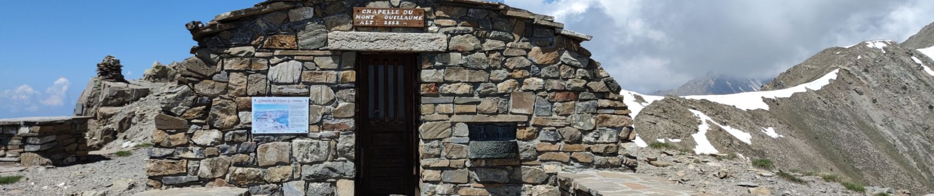
Montée jusqu'au Mont Guillaume par la forêt de Clos Jarry, les Séyères. Suivre la crête jusqu'au col de Trempa-Latz;
Attention, on part hors des sentiers balisés pour rejoindre le col de Chante-Perdrix, puis le lac de l'Hivernet, avec beaucoup de névés (mi-juin), et la descente très fun dans la neige jusqu'au lac !
Après, on suit le sentier en descente jusqu'au parking en passant par l'Aiguille.
Positioning
Comments
Trails nearby
![Trail Walking Embrun - Lac de l'Hivernet - Photo](https://media.geolcdn.com/t/375/260/ext.jpg?maxdim=2&url=https%3A%2F%2Fservices.sitytrail.com%2FGeolivesWS%2FDownloadMedia.ashx%3FTrailID%3D1027861%26Media%3Dfix__20180818122123.jpg)
![Walking Walking](https://static1.geolcdn.com/sitytour/trail-icons/101.png)
Walking
![](/images/other/stat-length.png)
![](https://static1.geolcdn.com/siteimages/upload/files/16400158638029165_repeat_loop_refresh_sync_direction_icon.png)
![Trail Walking Embrun - Mont Guillaume-Col de Chanté Perdrix-Lac de l'Hivernet(07-09-16) - Photo](https://media.geolcdn.com/t/375/260/ext.jpg?maxdim=2&url=https%3A%2F%2Fservices.sitytrail.com%2FGeolivesWS%2FDownloadMedia.ashx%3FTrailID%3D594349%26Media%3Dfix__20160707110131.jpg)
![Walking Walking](https://static1.geolcdn.com/sitytour/trail-icons/101.png)
Walking
![](/images/other/stat-length.png)
![](https://static1.geolcdn.com/siteimages/upload/files/16400158638029165_repeat_loop_refresh_sync_direction_icon.png)
![Trail Walking Châteauroux-les-Alpes - boucle cascade de la pisse - Photo](https://media.geolcdn.com/t/375/260/ext.jpg?maxdim=2&url=https%3A%2F%2Fservices.sitytrail.com%2FGeolivesWS%2FDownloadMedia.ashx%3FTrailID%3D455276%26Media%3Dfix__20150806173304.jpg)
![Walking Walking](https://static1.geolcdn.com/sitytour/trail-icons/101.png)
Walking
![](/images/other/stat-length.png)
![](https://static1.geolcdn.com/siteimages/upload/files/16400158638029165_repeat_loop_refresh_sync_direction_icon.png)
![Trail Walking Puy-Saint-Eusèbe - canal de reyssas jusqu'aux Touisses / retour par le GR Serre-Ponçon via ravin de la pisse - Photo](https://media.geolcdn.com/t/375/260/207bcfa3-5f2f-4889-95d2-ad39c84c3a40.jpg&format=jpg&maxdim=2)
![Walking Walking](https://static1.geolcdn.com/sitytour/trail-icons/101.png)
Walking
![](/images/other/stat-length.png)
![](https://static1.geolcdn.com/siteimages/upload/files/16400158638029165_repeat_loop_refresh_sync_direction_icon.png)
![Trail Walking Embrun - Mont Guillaume - Col de Trempa-Latz - 2671 - 10/09/23 - Photo](https://media.geolcdn.com/t/375/260/a1ad9c13-09fc-4e7a-a956-c96541f21c7a.jpg&format=jpg&maxdim=2)
![Walking Walking](https://static1.geolcdn.com/sitytour/trail-icons/101.png)
Walking
![](/images/other/stat-length.png)
![](https://static1.geolcdn.com/siteimages/upload/files/16400158638029165_repeat_loop_refresh_sync_direction_icon.png)
![Trail Walking Embrun - Mont Guillaume - Photo](https://media.geolcdn.com/t/375/260/8a5a6651-8a6c-4528-b5ff-78962c8c835d.jpg&format=jpg&maxdim=2)
![Walking Walking](https://static1.geolcdn.com/sitytour/trail-icons/101.png)
Walking
![](/images/other/stat-length.png)
![](https://static1.geolcdn.com/siteimages/upload/files/16400158638029165_repeat_loop_refresh_sync_direction_icon.png)
![Trail Walking Embrun - Mt Guillaume - Lac de l'Hivernet - Photo](https://media.geolcdn.com/t/375/260/cbed6be4-74aa-4976-902e-a579816616cf.jpg&format=jpg&maxdim=2)
![Walking Walking](https://static1.geolcdn.com/sitytour/trail-icons/101.png)
Walking
![](/images/other/stat-length.png)
![](https://static1.geolcdn.com/siteimages/upload/files/16400158638029165_repeat_loop_refresh_sync_direction_icon.png)
![Trail Walking Embrun - lac de l hivernet - Photo](https://media.geolcdn.com/t/375/260/544b0507-fa9b-4776-945d-9f01d5a68a38.jpg&format=jpg&maxdim=2)
![Walking Walking](https://static1.geolcdn.com/sitytour/trail-icons/101.png)
Walking
![](/images/other/stat-length.png)
![](https://static1.geolcdn.com/siteimages/upload/files/16400158638029165_repeat_loop_refresh_sync_direction_icon.png)
![Trail Walking Embrun - Embrun - 3.4km 90m 1h00 - 2018 06 26 - privé - Photo](https://media.geolcdn.com/t/375/260/ext.jpg?maxdim=2&url=https%3A%2F%2Fservices.sitytrail.com%2FGeolivesWS%2FDownloadMedia.ashx%3FTrailID%3D999315%26Media%3Dfix__20180626102346.jpg)
![Walking Walking](https://static1.geolcdn.com/sitytour/trail-icons/101.png)
Walking
![](/images/other/stat-length.png)
![](https://static1.geolcdn.com/siteimages/upload/files/16400158638029165_repeat_loop_refresh_sync_direction_icon.png)