


009 Craigellachie Stonehaven

gpstracks
User
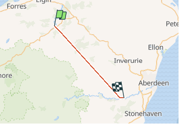

Length
68 km

Max alt
498 m

Uphill gradient
2432 m
Km-Effort
100 km

Min alt
47 m

Downhill gradient
2481 m
Boucle
No
Creation date :
2014-12-10 00:00:00.0
Updated on :
2014-12-10 00:00:00.0
--
Difficulty : Unknown

FREE GPS app for hiking
 SityTrail
IGN / Geographical institutes
SityTrail World
The world is yours!
About
Trail Motor of 68 km to be discovered at Scotland, Moray. This trail is proposed by gpstracks.
Description
More information on GPStracks.nl : http://www.gpstracks.nl
Positioning
Country:
United Kingdom
Region :
Scotland
Department/Province :
Moray
Municipality :
Unknown
Location:
Unknown
Start:(Dec)
Start:(UTM)
488611 ; 6371872 (30V) N.
Comments
Trails nearby