Trail Road bike Dienne - Arapiroune  - Photo
© OpenStreetMap contributors
Length
Length
75 km
Max alt
Max alt
1333 m
Uphill gradient
Uphill gradient
1541 m
Km-Effort
Km-Effort  
95 km
Min alt
Min alt
812 m
Downhill gradient
Downhill gradient
1539 m
Boucle
Boucle
Yes
Creation date :
2021-06-12 06:20:21.068
Updated on :
2021-06-13 12:39:37.012

(0 Reviews)

Road bike
Road bike
4h29
Difficulty : Difficult

Scan this QR Code to open this trail in the SityTrail application

FREE GPS app for hiking

Logo SityTrail SityTrail

IGN / Geographical institutes

Download SityTrail from the App Store Download SityTrail from Google Play

Logo SityTrail SityTrail World

The world is yours!

Download SityTrail from the App Store Download SityTrail from Google Play Download SityTrail on Huawei AppGallery

About

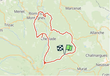
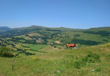
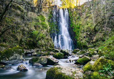
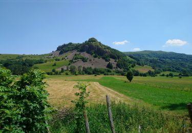
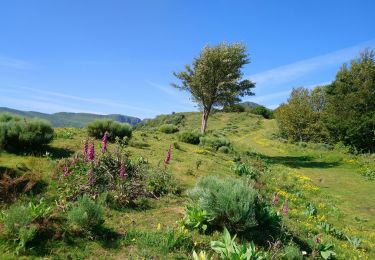
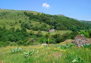
Trail Road bike of 75 km to be discovered at Auvergne-Rhône-Alpes, Cantal, Dienne. This trail is proposed by Jean-Marie Bousquet.

Description

Dienne-Riom-Marchastel-la font sainte-Cheylade-col de Serre -Dienne

Elevation profile

Positioning

Country:
France
Region :
Auvergne-Rhône-Alpes
Department/Province :
Cantal
Municipality :
Dienne
Location:
Unknown
Start:(UTM)
483490 ; 5000536 (31T) N.

Trails nearby

Trail Walking Dienne - Cantal - le Chaumeil - Dienne et Rocher de Laqueille - 9km 265m 2h50 - 2019 07 05 - Photo
Walking
GUIDE
Orcal37

Walking

Very easy
(1)
Dienne, Auvergne-Rhône-Alpes, Cantal, France
9 km | 12.6 km-effort
2h 50min
Yes
Trail Walking Lavigerie - Le Puy de Peyre Arse depuis la Gravière - Photo
Walking
tracegps

Walking

Difficult
(2)
Lavigerie, Auvergne-Rhône-Alpes, Cantal, France
11.2 km | 21 km-effort
4h 0min
Yes
Trail Walking Laveissière - Le lac Glory de Laveissière - Photo
Walking
tracegps

Walking

Medium
(2)
Laveissière, Auvergne-Rhône-Alpes, Cantal, France
11.1 km | 16.8 km-effort
4h 0min
Yes
Trail On foot Lavigerie - La Vallée de l'Impradine - Photo
On foot
GUIDE+

On foot

Easy
Lavigerie, Auvergne-Rhône-Alpes, Cantal, France
5.5 km | 7.6 km-effort
1h 44min
Yes
Trail On foot Dienne - Sentier des Quirous - Photo
On foot
GUIDE+

On foot

Easy
Dienne, Auvergne-Rhône-Alpes, Cantal, France
12.2 km | 18.3 km-effort
4h 9min
No
Trail Walking Dienne - Cantal - Dienne - Drils et Laqueille - 7.2km 205m 2h50 - 2019 07 05 - Photo
Walking
GUIDE
Orcal37

Walking

Very easy
Dienne, Auvergne-Rhône-Alpes, Cantal, France
7.2 km | 9.9 km-effort
2h 50min
Yes
Trail Walking Lavigerie - Cantal - La Gravière - Les Fours de Peyre-Arse - 18.9km 760m 8h05 (30mn) - 2019 07 04 - Photo
Walking
GUIDE
Orcal37

Walking

Difficult
Lavigerie, Auvergne-Rhône-Alpes, Cantal, France
18.9 km | 29 km-effort
8h 5min
Yes
Trail Walking Lavigerie - Cantal - La Gravière - La Vallée de l'Impradine - 6km 170m 2h20 - 2019 07 03 - Photo
Walking
GUIDE
Orcal37

Walking

Very easy
Lavigerie, Auvergne-Rhône-Alpes, Cantal, France
6 km | 8.3 km-effort
2h 20min
Yes
Trail Walking Laveissière - Cantal - Cheyrouze (Laveissière) - Puy de Seycheuse - 14.8km 600m 5h35 - 2019 06 30 - Photo
Walking
GUIDE
Orcal37

Walking

Medium
Laveissière, Auvergne-Rhône-Alpes, Cantal, France
14.8 km | 23 km-effort
5h 35min
Yes


Close
My subscriptions