![](/images/other/stat-length.png)
![Trail Walking Allemond - Les Chalanches - Allemont - Photo](https://media.geolcdn.com/t/1900/400/544271fc-ea3c-4bf1-b1da-fbe1b1456b85.jpg&format=pjpeg&maxdim=2)
Les Chalanches - Allemont
patjobou
User
![Length](/images/other/stat-length.png)
![Max alt](https://static1.geolcdn.com/siteimages/upload/files/1508320355ic_sort_altitude_max_24dp.png)
![Uphill gradient](https://static1.geolcdn.com/siteimages/upload/files/1508320355ic_sort_den_pos_24dp.png)
![Km-Effort](/images/other/stat-length.png)
![Min alt](https://static1.geolcdn.com/siteimages/upload/files/1508320355ic_sort_altitude_min_24dp.png)
![Downhill gradient](https://static1.geolcdn.com/siteimages/upload/files/1508320355ic_sort_den_neg_24dp.png)
![Boucle](https://static1.geolcdn.com/siteimages/upload/files/16400158638029165_repeat_loop_refresh_sync_direction_icon.png)
![Walking](https://static1.geolcdn.com/sitytour/trail-icons/101.png)
5h25
Difficulty : Medium
![Scan this QR Code to open this trail in the SityTrail application](https://capi.geolives.com/qq0zvz2zws4bq2lad0pu/sitytour/trails/2821836/qr.png?size=200)
FREE GPS app for hiking
About
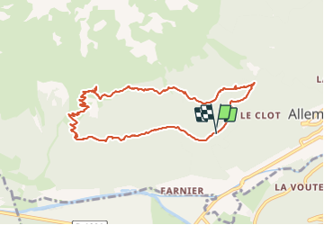
Trail Walking of 10.1 km to be discovered at Auvergne-Rhône-Alpes, Isère, Allemond. This trail is proposed by patjobou.
Description
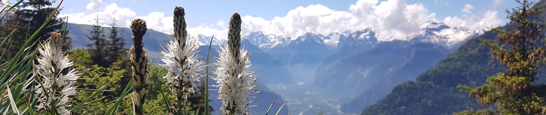
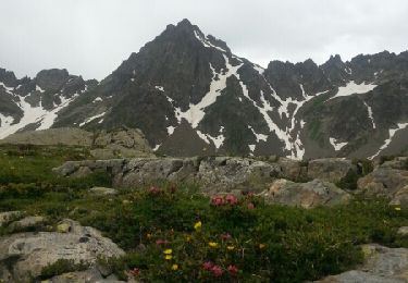
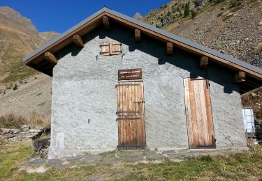
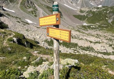
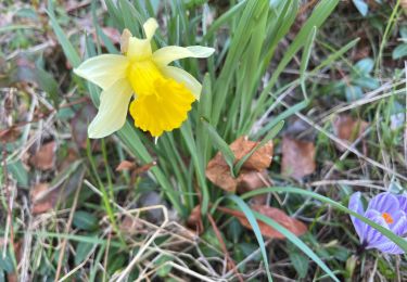
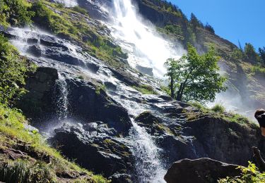
Une belle boucle avec des paysages variés. Montée dans une belle foret de feuillus puis parmi les asphodèles en fleurs! Repas à la cabane des Chalanches, avec de très belles vue sur la vallée de La Romanche, l'Oisans, et les Grandes Rousses. Un petit détour au dessus de la cabane permet de trouver l'entrée d'une ancienne mine. Belle descente en balcon, avec quelques traversées de ravins qui engagent à la prudence. Le sentier est toujours bien tracé.
Positioning
Comments
Trails nearby
![Trail Walking Allemond - Lac de Belledonne - Photo](https://media.geolcdn.com/t/375/260/ext.jpg?maxdim=2&url=https%3A%2F%2Fservices.sitytrail.com%2FGeolivesWS%2FDownloadMedia.ashx%3FTrailID%3D325958%26Media%3Dfix__20140719114309.jpg)
![Walking Walking](https://static1.geolcdn.com/sitytour/trail-icons/101.png)
Walking
![](/images/other/stat-length.png)
![](https://static1.geolcdn.com/siteimages/upload/files/16400158638029165_repeat_loop_refresh_sync_direction_icon.png)
![Trail Walking Allemond - allemond-les chalanches - Photo](https://media.geolcdn.com/t/375/260/ext.jpg?maxdim=2&url=https%3A%2F%2Fservices.sitytrail.com%2FGeolivesWS%2FDownloadMedia.ashx%3FTrailID%3D359050%26Media%3Dfix__20141101111257.jpg)
![Walking Walking](https://static1.geolcdn.com/sitytour/trail-icons/101.png)
Walking
![](/images/other/stat-length.png)
![](https://static1.geolcdn.com/siteimages/upload/files/16400158638029165_repeat_loop_refresh_sync_direction_icon.png)
![Trail Touring skiing Huez - Pic de la Pyramide. - Photo](https://media.geolcdn.com/t/375/260/d8f02114-cc43-41f4-8fcf-228e99c4af6c.jpg&format=jpg&maxdim=2)
![Touring skiing Touring skiing](https://static1.geolcdn.com/sitytour/trail-icons/503.png)
Touring skiing
![](/images/other/stat-length.png)
![](https://static1.geolcdn.com/siteimages/upload/files/16400158638029165_repeat_loop_refresh_sync_direction_icon.png)
![Trail Touring skiing Huez - Pic blanc par le tunnel - Photo](https://media.geolcdn.com/t/375/260/79c86d8d-1a1a-42e0-965d-518affa465c7.jpg&format=jpg&maxdim=2)
![Touring skiing Touring skiing](https://static1.geolcdn.com/sitytour/trail-icons/503.png)
Touring skiing
![](/images/other/stat-length.png)
![](https://static1.geolcdn.com/siteimages/upload/files/16400158638029165_repeat_loop_refresh_sync_direction_icon.png)
![Trail Touring skiing Allemond - col PT 2459m près de la gde Lance d'Allemond - Photo](https://media.geolcdn.com/t/375/260/9c8ab575-4333-48a0-9046-13f36910fc12.jpg&format=jpg&maxdim=2)
![Touring skiing Touring skiing](https://static1.geolcdn.com/sitytour/trail-icons/503.png)
Touring skiing
![](/images/other/stat-length.png)
![](https://static1.geolcdn.com/siteimages/upload/files/16400158638029165_repeat_loop_refresh_sync_direction_icon.png)
![Trail sport Vaujany - Randonnée - Photo](https://media.geolcdn.com/t/375/260/031a3bee-458a-4b9a-b2e3-d9cf5829f63e.jpg&format=jpg&maxdim=2)
sport
![](/images/other/stat-length.png)
![](https://static1.geolcdn.com/siteimages/upload/files/16400158638029165_repeat_loop_refresh_sync_direction_icon.png)
![Trail Walking Allemond - Lac de Belledonne trace réelle - Photo](https://media.geolcdn.com/t/375/260/3c006e55-5416-422b-8475-727a88b53584.jpg&format=jpg&maxdim=2)
![Walking Walking](https://static1.geolcdn.com/sitytour/trail-icons/101.png)
Walking
![](/images/other/stat-length.png)
![](https://static1.geolcdn.com/siteimages/upload/files/16400158638029165_repeat_loop_refresh_sync_direction_icon.png)
![Trail sport Allemond - Allemond et les hameaux - Photo](https://media.geolcdn.com/t/375/260/9ef2955e-597c-4a93-b262-e89ce8d66961.jpg&format=jpg&maxdim=2)
sport
![](/images/other/stat-length.png)
![](https://static1.geolcdn.com/siteimages/upload/files/16400158638029165_repeat_loop_refresh_sync_direction_icon.png)
![Trail Walking Oz - Oz en Oisans Cascade de La Fare - Photo](https://media.geolcdn.com/t/375/260/cedc7fb5-b126-433c-84a3-6190c51b3527.jpg&format=jpg&maxdim=2)
![Walking Walking](https://static1.geolcdn.com/sitytour/trail-icons/101.png)
Walking
![](/images/other/stat-length.png)
![](https://static1.geolcdn.com/siteimages/upload/files/16400158638029165_repeat_loop_refresh_sync_direction_icon.png)