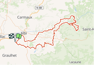
![](/images/other/stat-length.png)
![Trail Moto cross Aussac - Balade Brousse-le-Chateau, Vallée du Tarn - Photo](https://media.geolcdn.com/t/1900/400/3e518d80-9450-4e22-b5db-f3f89e0600b0.jpg&format=pjpeg&maxdim=2)
Balade Brousse-le-Chateau, Vallée du Tarn
jpipacific
User
![Length](/images/other/stat-length.png)
![Max alt](https://static1.geolcdn.com/siteimages/upload/files/1508320355ic_sort_altitude_max_24dp.png)
![Uphill gradient](https://static1.geolcdn.com/siteimages/upload/files/1508320355ic_sort_den_pos_24dp.png)
![Km-Effort](/images/other/stat-length.png)
![Min alt](https://static1.geolcdn.com/siteimages/upload/files/1508320355ic_sort_altitude_min_24dp.png)
![Downhill gradient](https://static1.geolcdn.com/siteimages/upload/files/1508320355ic_sort_den_neg_24dp.png)
![Boucle](https://static1.geolcdn.com/siteimages/upload/files/16400158638029165_repeat_loop_refresh_sync_direction_icon.png)
![Moto cross](https://static1.geolcdn.com/sitytour/trail-icons/406.png)
4h50
Difficulty : Medium
![Scan this QR Code to open this trail in the SityTrail application](https://capi.geolives.com/qq0zvz2zws4bq2lad0pu/sitytour/trails/2821552/qr.png?size=200)
FREE GPS app for hiking
About
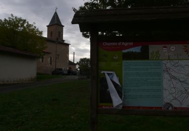
Trail Moto cross of 221 km to be discovered at Occitania, Tarn, Aussac. This trail is proposed by jpipacific.
Description
Fait avec Africa Twin CRF 1000 DCT en duo
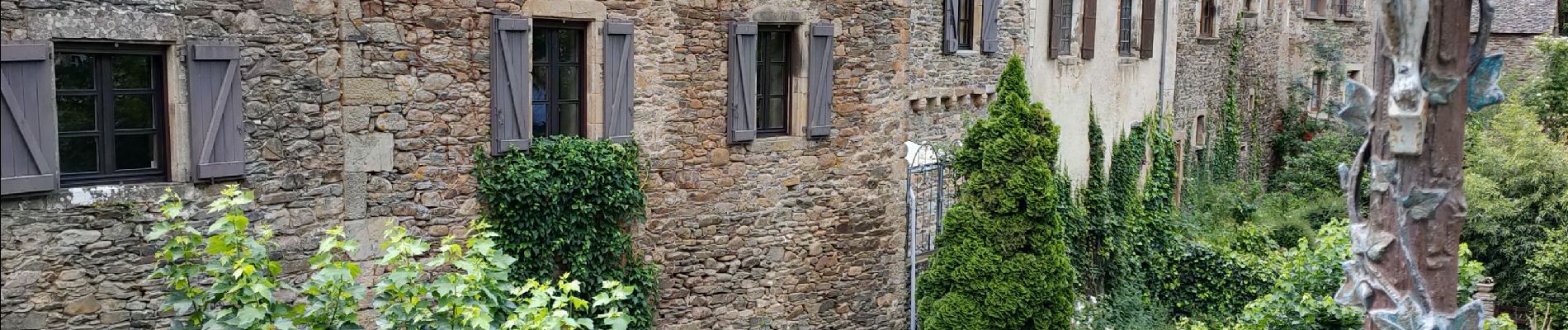
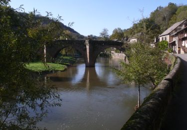
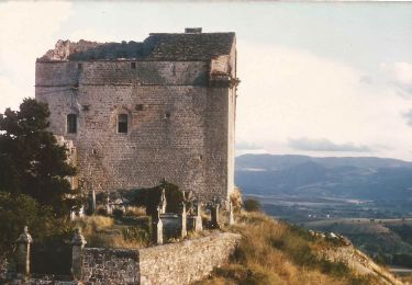
Magnifique balade. les points de vues se succèdent, les paysages sont splendides.
La route est parfois extrêmement étroite avec un revêtement spartiate. C'est bien d'avoir une moto Trail.
Très bon restaurant à Brousse le château (Hotel Le Relays du chasteau) Prix très raisonnable.
Positioning
Comments
Trails nearby
![Moto cross Moto cross](https://static1.geolcdn.com/sitytour/trail-icons/406.png)
Moto cross
![](/images/other/stat-length.png)
![](https://static1.geolcdn.com/siteimages/upload/files/16400158638029165_repeat_loop_refresh_sync_direction_icon.png)
![Walking Walking](https://static1.geolcdn.com/sitytour/trail-icons/101.png)
Walking
![](/images/other/stat-length.png)
![](https://static1.geolcdn.com/siteimages/upload/files/16400158638029165_repeat_loop_refresh_sync_direction_icon.png)
![Trail Moto cross Fénols - La route des seigneurs et chateaux Aveyronnais - Photo](https://media.geolcdn.com/t/375/260/cc55bc8b-c631-4d92-a303-1c1fc25e23b1.jpg&format=jpg&maxdim=2)
![Moto cross Moto cross](https://static1.geolcdn.com/sitytour/trail-icons/406.png)
Moto cross
![](/images/other/stat-length.png)
![](https://static1.geolcdn.com/siteimages/upload/files/16400158638029165_repeat_loop_refresh_sync_direction_icon.png)
![Trail Nordic walking Florentin - Sentier des colombes Florentin - Photo](https://media.geolcdn.com/t/375/260/bae8b8d3-bb4b-475b-a413-6e83538ce8b1.jpg&format=jpg&maxdim=2)
![Nordic walking Nordic walking](https://static1.geolcdn.com/sitytour/trail-icons/102.png)
Nordic walking
![](/images/other/stat-length.png)
![](https://static1.geolcdn.com/siteimages/upload/files/16400158638029165_repeat_loop_refresh_sync_direction_icon.png)
![Trail Walking Orban - SityTrail - 3061378 - orban-chemin-des-cretes - Photo](https://media.geolcdn.com/t/375/260/26a0c344-fd25-47d2-a26d-446f19e423e5.jpg&format=jpg&maxdim=2)
![Walking Walking](https://static1.geolcdn.com/sitytour/trail-icons/101.png)
Walking
![](/images/other/stat-length.png)
![](https://static1.geolcdn.com/siteimages/upload/files/16400158638029165_repeat_loop_refresh_sync_direction_icon.png)
![Trail 4x4 Fénols - Vabre Anglés Parc du haut Languedoc - Photo](https://media.geolcdn.com/t/375/260/efe61901-ab29-4794-b72e-2a76a5d8cb95.jpeg&format=jpg&maxdim=2)
![4x4 4x4](https://static1.geolcdn.com/sitytour/trail-icons/403.png)
4x4
![](/images/other/stat-length.png)
![](https://static1.geolcdn.com/siteimages/upload/files/16400158638029165_repeat_loop_refresh_sync_direction_icon.png)
![Trail Mountain bike Rouffiac - Circuit du Puech de Mourens - Rouffiac - Photo](https://media.geolcdn.com/t/375/260/ext.jpg?maxdim=2&url=https%3A%2F%2Fservices.sitytrail.com%2FGeolivesWS%2FDownloadMedia.ashx%3FTrailID%3D104295%26Media%3D7522_3.jpg)
![Mountain bike Mountain bike](https://static1.geolcdn.com/sitytour/trail-icons/202.png)
Mountain bike
![](/images/other/stat-length.png)
![](https://static1.geolcdn.com/siteimages/upload/files/16400158638029165_repeat_loop_refresh_sync_direction_icon.png)
![Trail Walking Rouffiac - Circuit du Puech de Mourens - Rouffiac - Photo](https://media.geolcdn.com/t/375/260/ext.jpg?maxdim=2&url=https%3A%2F%2Fservices.sitytrail.com%2FGeolivesWS%2FDownloadMedia.ashx%3FTrailID%3D104294%26Media%3D7522_3.jpg)
![Walking Walking](https://static1.geolcdn.com/sitytour/trail-icons/101.png)
Walking
![](/images/other/stat-length.png)
![](https://static1.geolcdn.com/siteimages/upload/files/16400158638029165_repeat_loop_refresh_sync_direction_icon.png)
![Walking Walking](https://static1.geolcdn.com/sitytour/trail-icons/101.png)
Walking
![](/images/other/stat-length.png)
![](https://static1.geolcdn.com/siteimages/upload/files/16400158638029165_repeat_loop_refresh_sync_direction_icon.png)