![](/images/other/stat-length.png)
![Trail Walking Beaulieu-sur-Dordogne - SityTrail - Balade en Bellocois et Xaintrie - Photo](https://media.geolcdn.com/t/1900/400/ext.pjpeg?maxdim=2&url=https%3A%2F%2Fstatic1.geolcdn.com%2Fsiteimages%2Fupload%2Ffiles%2F1553511878bg_sport_marche.png)
SityTrail - Balade en Bellocois et Xaintrie
Gpoujade
User
![Length](/images/other/stat-length.png)
![Max alt](https://static1.geolcdn.com/siteimages/upload/files/1508320355ic_sort_altitude_max_24dp.png)
![Uphill gradient](https://static1.geolcdn.com/siteimages/upload/files/1508320355ic_sort_den_pos_24dp.png)
![Km-Effort](/images/other/stat-length.png)
![Min alt](https://static1.geolcdn.com/siteimages/upload/files/1508320355ic_sort_altitude_min_24dp.png)
![Downhill gradient](https://static1.geolcdn.com/siteimages/upload/files/1508320355ic_sort_den_neg_24dp.png)
![Boucle](https://static1.geolcdn.com/siteimages/upload/files/16400158638029165_repeat_loop_refresh_sync_direction_icon.png)
![Walking](https://static1.geolcdn.com/sitytour/trail-icons/101.png)
8h37
Difficulty : Very difficult
![Mountain bike](https://static1.geolcdn.com/sitytour/trail-icons/202.png)
2h37
Difficulty : Difficult
![Scan this QR Code to open this trail in the SityTrail application](https://capi.geolives.com/qq0zvz2zws4bq2lad0pu/sitytour/trails/2820408/qr.png?size=200)
FREE GPS app for hiking
About
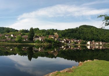
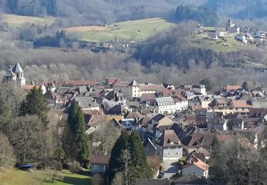
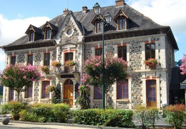
Trail Walking of 28 km to be discovered at New Aquitaine, Corrèze, Beaulieu-sur-Dordogne. This trail is proposed by Gpoujade.
Description
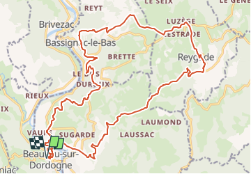
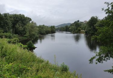
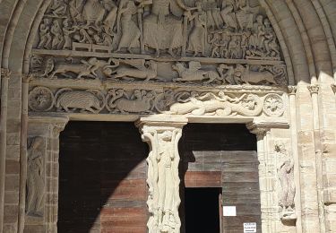
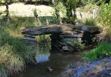
Randonnée au départ de la place du Champ de Mars à Beaulieu sur Dordogne. Après avoir traversé la Dordogne sur la passerelle des Aubarèdes, suivre le GRP des Gabariers en direction du château du Doux. La montée est régulière et ombragée.Une petite descente en direction du château de Chauvac avant de remonter sur le plateau. De très jolies vues sur la Dordogne jalonnent cette partie. Une fois arrivé à Luzèges, quitter le GRP et prendre la direction de Reygade. Avant le village, prendre à gauche et quitter la route pour prendre un chemin qui descend au ruisseau d'Orgues (balisé jaune). Suivre ensuite le GR 480 jusqu'à Beaulieu. Possibilité de rallonger cette balade de 10 km ( 400m de dénivellé positif) : ne pas quitter le GRP à Luzèges. rejoindre le GRP de Xaintrie noire et prendre à droite direction Billoux. Poursuivre sur ce GRP jusqu’à rejoindre la trace.
Bonne balade!
Positioning
Comments
Trails nearby
![Walking Walking](https://static1.geolcdn.com/sitytour/trail-icons/101.png)
Walking
![](/images/other/stat-length.png)
![](https://static1.geolcdn.com/siteimages/upload/files/16400158638029165_repeat_loop_refresh_sync_direction_icon.png)
![Trail Mountain bike Beaulieu-sur-Dordogne - Balade en Bellocois et Xaintrie_backup - Photo](https://media.geolcdn.com/t/375/260/ext.jpg?maxdim=2&url=https%3A%2F%2Fservices.sitytrail.com%2FGeolivesWS%2FDownloadMedia.ashx%3FTrailID%3D943147%26Media%3Dfix__20151129124333.jpg)
![Mountain bike Mountain bike](https://static1.geolcdn.com/sitytour/trail-icons/202.png)
Mountain bike
![](/images/other/stat-length.png)
![](https://static1.geolcdn.com/siteimages/upload/files/16400158638029165_repeat_loop_refresh_sync_direction_icon.png)
![Trail Walking Beaulieu-sur-Dordogne - boucle Beaulieu sur dordogne - Photo](https://media.geolcdn.com/t/375/260/44a622b3-0ad9-41fd-abdb-acf5845c9394.jpg&format=jpg&maxdim=2)
![Walking Walking](https://static1.geolcdn.com/sitytour/trail-icons/101.png)
Walking
![](/images/other/stat-length.png)
![](https://static1.geolcdn.com/siteimages/upload/files/16400158638029165_repeat_loop_refresh_sync_direction_icon.png)
![Trail Walking Beaulieu-sur-Dordogne - beaulieu sur dordogne - Photo](https://media.geolcdn.com/t/375/260/abdf22ae-db7c-4362-a1f0-4c72c7f87ff3.jpg&format=jpg&maxdim=2)
![Walking Walking](https://static1.geolcdn.com/sitytour/trail-icons/101.png)
Walking
![](/images/other/stat-length.png)
![](https://static1.geolcdn.com/siteimages/upload/files/16400158638029165_repeat_loop_refresh_sync_direction_icon.png)
![Trail Cycle Altillac - Altillac-Beaulieu-Lafage - Photo](https://media.geolcdn.com/t/375/260/ext.jpg?maxdim=2&url=https%3A%2F%2Fservices.sitytrail.com%2FGeolivesWS%2FDownloadMedia.ashx%3FTrailID%3D699081%26Media%3De4d5fc8f-4fe6-45f6-b2fd-905cbc14470e.jpg)
![Cycle Cycle](https://static1.geolcdn.com/sitytour/trail-icons/200.png)
Cycle
![](/images/other/stat-length.png)
![](https://static1.geolcdn.com/siteimages/upload/files/16400158638029165_repeat_loop_refresh_sync_direction_icon.png)
![Trail Mountain bike Beaulieu-sur-Dordogne - Balade en Bellocois et Xaintrie - Photo](https://media.geolcdn.com/t/375/260/ext.jpg?maxdim=2&url=https%3A%2F%2Fservices.sitytrail.com%2FGeolivesWS%2FDownloadMedia.ashx%3FTrailID%3D498375%26Media%3Dfix__20151129124333.jpg)
![Mountain bike Mountain bike](https://static1.geolcdn.com/sitytour/trail-icons/202.png)
Mountain bike
![](/images/other/stat-length.png)
![](https://static1.geolcdn.com/siteimages/upload/files/16400158638029165_repeat_loop_refresh_sync_direction_icon.png)
![Trail Walking Altillac - Beaulieu mardi - Photo](https://media.geolcdn.com/t/375/260/e615ba55-67ab-4317-820b-8f3ca07e5ec1.jpg&format=jpg&maxdim=2)
![Walking Walking](https://static1.geolcdn.com/sitytour/trail-icons/101.png)
Walking
![](/images/other/stat-length.png)
![](https://static1.geolcdn.com/siteimages/upload/files/16400158638029165_repeat_loop_refresh_sync_direction_icon.png)
![Trail Walking Beaulieu-sur-Dordogne - de Beaulieu à Camps St Mathurin - Photo](https://media.geolcdn.com/t/375/260/4dd7a4de-56cb-469c-aed4-02aa163c07c3.jpg&format=jpg&maxdim=2)
![Walking Walking](https://static1.geolcdn.com/sitytour/trail-icons/101.png)
Walking
![](/images/other/stat-length.png)
![](https://static1.geolcdn.com/siteimages/upload/files/16400158638029165_repeat_loop_refresh_sync_direction_icon.png)
![Trail Walking Altillac - Circuit autour d'Altillac - Photo](https://media.geolcdn.com/t/375/260/ext.jpg?maxdim=2&url=https%3A%2F%2Fservices.sitytrail.com%2FGeolivesWS%2FDownloadMedia.ashx%3FTrailID%3D103555%26Media%3D5808_1.jpg)
![Walking Walking](https://static1.geolcdn.com/sitytour/trail-icons/101.png)
Walking
![](/images/other/stat-length.png)
![](https://static1.geolcdn.com/siteimages/upload/files/16400158638029165_repeat_loop_refresh_sync_direction_icon.png)