


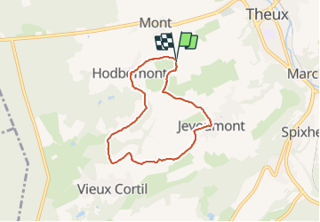

12.7 km | 16.8 km-effort


User


FREE GPS app for hiking
 SityTrail
IGN / Geographical institutes
SityTrail World
The world is yours!
Trail Walking of 5.7 km to be discovered at Wallonia, Liège, Theux. This trail is proposed by FouargePatrick.
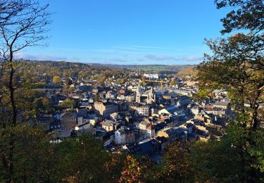
Ce petit village charmant se situe entre Jevoumont et Mont. On y accède via Mont par une route qui s’éclate en un éventail de chemins de campagne. Isolées bout de sa route sans issue, le village surprend par son calme et son authenticité.


Walking

Walking


Walking

Walking

Walking

On foot

Walking
Walking