


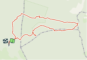

12.6 km | 16.7 km-effort

User


FREE GPS app for hiking
 SityTrail
IGN / Geographical institutes
SityTrail World
The world is yours!
Trail On foot of 13.3 km to be discovered at Provence-Alpes-Côte d'Azur, Var, Signes. This trail is proposed by GILOU440.
un corde pour un ressaut pas dur.sentier pas balisé mais cairné sur le sentier des bidoufles. Sinon bien balisé ailleur.
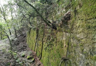
beaucoup de passages rocheux. 5h30 marche effectives sans se presser.


Walking

Walking
Walking

Walking

Walking

Walking

Running

Other activity
Walking