


23 km | 30 km-effort


User


FREE GPS app for hiking
 SityTrail
IGN / Geographical institutes
SityTrail World
The world is yours!
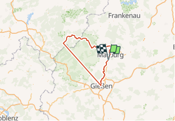
Trail Cycle of 146 km to be discovered at Hesse, Landkreis Marburg-Biedenkopf, Marburg. This trail is proposed by gpstracks.
More information on GPStracks.nl : http://www.gpstracks.nl
On foot
On foot
On foot
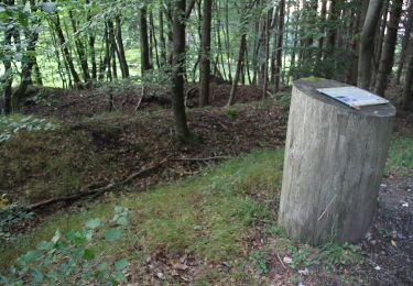
On foot
On foot
![Trail On foot Marburg - [C3] - Wanderweg des Verkehrs- und Verschönerungsvereins Marburg - Elisabethkirche - Michelbach - Photo](https://media.geolcdn.com/t/375/260/69c5ecc9-ddc2-4725-b05a-abdff16925e5.jpeg&format=jpg&maxdim=2)
On foot
![Trail On foot Marburg - [C1] - Rundwanderweg des Verkehrs- und Verschönerungsvereins Marburg - Photo](https://media.geolcdn.com/t/375/260/3873cad0-d181-4c5b-83e4-c6ed703e58f1.jpeg&format=jpg&maxdim=2)
On foot
![Trail On foot Marburg - [C2] Rundwanderweg Elisabethkirche Dammühle - Photo](https://media.geolcdn.com/t/375/260/d862ce6a-ca96-4f59-9c5d-a597e44ddacb.jpeg&format=jpg&maxdim=2)
On foot
![Trail On foot Marburg - [B5] - Rundwanderweg des Verkehrs- und Verschönerungsvereins Marburg - Photo](https://media.geolcdn.com/t/375/260/4c4944b9-e819-40cf-a68a-df255c985b2f.jpeg&format=jpg&maxdim=2)
On foot