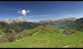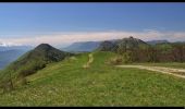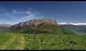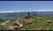

Mont Pelat

flip38
User

Length
15.5 km

Max alt
1535 m

Uphill gradient
918 m

Km-Effort
28 km

Min alt
788 m

Downhill gradient
916 m
Boucle
Yes
Creation date :
2021-05-28 07:47:36.824
Updated on :
2021-10-31 10:07:52.022
4h51
Difficulty : Medium

FREE GPS app for hiking
About
Trail Walking of 15.5 km to be discovered at Auvergne-Rhône-Alpes, Savoy, Sainte-Reine. This trail is proposed by flip38.
Description
Belle randonnée panoramique vers ce sommet des Bauges.
Montée assez raide vers les chalets de la Cha.
D'autres informations sur mon site : http://surlessommets.blog.free.fr/
Positioning
Country:
France
Region :
Auvergne-Rhône-Alpes
Department/Province :
Savoy
Municipality :
Sainte-Reine
Location:
Unknown
Start:(Dec)
Start:(UTM)
276758 ; 5053100 (32T) N.
Comments
Trails nearby
La Dent d'Arclusaz, 2041m


Walking
Difficult
(2)
Saint-Pierre-d'Albigny,
Auvergne-Rhône-Alpes,
Savoy,
France

13.9 km | 29 km-effort
7h 30min
Yes
La Pointe de la Galoppaz 1680m, depuis le Col du Lindar


Walking
Easy
(1)
Aillon-le-Jeune,
Auvergne-Rhône-Alpes,
Savoy,
France

7.4 km | 14.9 km-effort
3h 45min
No

Bauges le Colombier et des crêtes


Walking
Medium
(1)
Aillon-le-Jeune,
Auvergne-Rhône-Alpes,
Savoy,
France

14.2 km | 28 km-effort
5h 35min
Yes
Rochers de Barde


Walking
Medium
Aillon-le-Jeune,
Auvergne-Rhône-Alpes,
Savoy,
France

11.7 km | 24 km-effort
6h 25min
Yes

Colombier par rocher de la Bade et Cochette, retour par la Fulie


Walking
Very easy
(2)
Aillon-le-Jeune,
Auvergne-Rhône-Alpes,
Savoy,
France

17.7 km | 35 km-effort
6h 4min
Yes
Petit circuit découverte aillon le jeune


Walking
Very easy
Aillon-le-Jeune,
Auvergne-Rhône-Alpes,
Savoy,
France

5.9 km | 8.9 km-effort
1h 59min
Yes
pointe des Arlicots


Touring skiing
Medium
École,
Auvergne-Rhône-Alpes,
Savoy,
France

9.2 km | 23 km-effort
4h 56min
No

73 Pecloz Armene Mont d'Armenaz Rochers de l'Arpette


Walking
Very difficult
(1)
École,
Auvergne-Rhône-Alpes,
Savoy,
France

13.3 km | 33 km-effort
7h 29min
Yes
BAUGES: MONT COLOMBIER


Walking
Difficult
Aillon-le-Jeune,
Auvergne-Rhône-Alpes,
Savoy,
France

10.8 km | 23 km-effort
4h 19min
Yes


 SityTrail


