Trail Walking Adstock - Theford - Photo
© OpenStreetMap contributors
Length
Length
46 km
Max alt
Max alt
446 m
Uphill gradient
Uphill gradient
443 m
Km-Effort
Km-Effort  
52 km
Min alt
Min alt
278 m
Downhill gradient
Downhill gradient
490 m
Boucle
Boucle
No
Creation date :
2021-05-27 14:53:52.0
Updated on :
2021-05-27 16:49:19.24

(0 Reviews)

Walking
Walking
1h46
Difficulty : Very difficult

Scan this QR Code to open this trail in the SityTrail application

FREE GPS app for hiking

Logo SityTrail SityTrail

IGN / Geographical institutes

Download SityTrail from the App Store Download SityTrail from Google Play

Logo SityTrail SityTrail World

The world is yours!

Download SityTrail from the App Store Download SityTrail from Google Play Download SityTrail on Huawei AppGallery

About

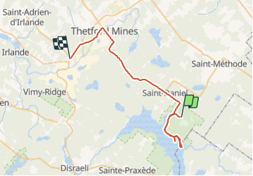
Trail Walking of 46 km to be discovered at Quebec, Les Appalaches, Adstock. This trail is proposed by issa marwan.

Description

Parc national

Elevation profile

Positioning

Country:
Canada
Region :
Quebec
Department/Province :
Les Appalaches
Municipality :
Adstock
Location:
Unknown
Start:(UTM)
333464 ; 5093442 (19T) N.

Trails nearby

Trail Walking Stornoway - Wikiloc - parc de Frontenac - Photo
Walking
GUIDE
Alizée.pee

Walking

Medium
Stornoway, Quebec, Le Granit, Canada
5.5 km | 6.2 km-effort
1h 22min
Yes
Trail Canoe - kayak Disraeli (ville) - Lac Aylmer - Photo
Canoe - kayak
DaVinci

Canoe - kayak

Medium
Disraeli (ville), Quebec, Les Appalaches, Canada
64 km | 64 km-effort
10h 35min
Yes
Trail Canoe - kayak Sainte-Praxède - Lac Saint François - Photo
Canoe - kayak
DaVinci

Canoe - kayak

Medium
Sainte-Praxède, Quebec, Les Appalaches, Canada
81 km | 85 km-effort
13h 30min
Yes


Close
My subscriptions