


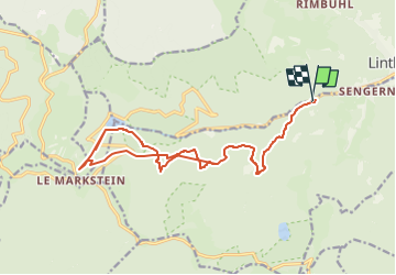

12.7 km | 20 km-effort


User


FREE GPS app for hiking
 SityTrail
IGN / Geographical institutes
SityTrail World
The world is yours!
Trail Walking of 18.8 km to be discovered at Grand Est, Haut-Rhin, Lautenbachzell. This trail is proposed by noni.
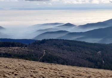
monument brun, Markstein.
peut etre un dessert... mais pas des myrtilles c'est pas la saison.

Walking

Walking

Walking

Walking

Walking

On foot
Walking
On foot
Walking
guide au top