![](/images/other/stat-length.png)
![Trail Walking Tain-l'Hermitage - 26 - la chapelle de l'Ermitage - Photo](https://media.geolcdn.com/t/1900/400/ext.pjpeg?maxdim=2&url=https%3A%2F%2Fstatic1.geolcdn.com%2Fsiteimages%2Fupload%2Ffiles%2F1553511878bg_sport_marche.png)
26 - la chapelle de l'Ermitage
guilmanu
User
![Length](/images/other/stat-length.png)
Length
5 km
![Max alt](https://static1.geolcdn.com/siteimages/upload/files/1508320355ic_sort_altitude_max_24dp.png)
Max alt
278 m
![Uphill gradient](https://static1.geolcdn.com/siteimages/upload/files/1508320355ic_sort_den_pos_24dp.png)
Uphill gradient
164 m
![Km-Effort](/images/other/stat-length.png)
Km-Effort
7.2 km
![Min alt](https://static1.geolcdn.com/siteimages/upload/files/1508320355ic_sort_altitude_min_24dp.png)
Min alt
120 m
![Downhill gradient](https://static1.geolcdn.com/siteimages/upload/files/1508320355ic_sort_den_neg_24dp.png)
Downhill gradient
167 m
![Boucle](https://static1.geolcdn.com/siteimages/upload/files/16400158638029165_repeat_loop_refresh_sync_direction_icon.png)
Boucle
Yes
Creation date :
2021-05-23 09:11:14.781
Updated on :
2021-05-23 17:03:52.918
![Walking](https://static1.geolcdn.com/sitytour/trail-icons/101.png)
1h37
Difficulty : Easy
![Scan this QR Code to open this trail in the SityTrail application](https://capi.geolives.com/qq0zvz2zws4bq2lad0pu/sitytour/trails/2798692/qr.png?size=200)
FREE GPS app for hiking
About
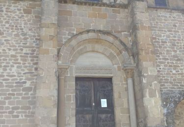
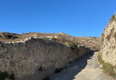
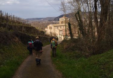
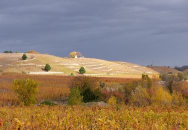
Trail Walking of 5 km to be discovered at Auvergne-Rhône-Alpes, Drôme, Tain-l'Hermitage. This trail is proposed by guilmanu.
Description
Quelques infos en plus ici : https://rando-ardeche-hermitage.fr/pedestre/de-lermite-a-lhermitage/
Et surtout il y a beaucoup d'autres rando...
Positioning
Country:
France
Region :
Auvergne-Rhône-Alpes
Department/Province :
Drôme
Municipality :
Tain-l'Hermitage
Location:
Unknown
Start:(Dec)
Start:(UTM)
644954 ; 4992253 (31T) N.
Comments
Trails nearby
![Trail Walking Chantemerle-les-Blés - 26 Chantemerle les bles - Photo](https://media.geolcdn.com/t/375/260/e7f73b94-acd8-4992-a63c-480111d0367d.jpg&format=jpg&maxdim=2)
![Walking Walking](https://static1.geolcdn.com/sitytour/trail-icons/101.png)
26 Chantemerle les bles
Walking
Easy
Chantemerle-les-Blés,
Auvergne-Rhône-Alpes,
Drôme,
France
![](/images/other/stat-length.png)
11.8 km | 15 km-effort
2h 23min
![](https://static1.geolcdn.com/siteimages/upload/files/16400158638029165_repeat_loop_refresh_sync_direction_icon.png)
Yes
![Trail Mountain bike Tournon-sur-Rhône - Rando des tours 2009 - Photo](https://media.geolcdn.com/t/375/260/ext.jpg?maxdim=2&url=https%3A%2F%2Fstatic1.geolcdn.com%2Fsiteimages%2Fupload%2Ffiles%2F1524743154velo.jpg)
![Mountain bike Mountain bike](https://static1.geolcdn.com/sitytour/trail-icons/202.png)
Rando des tours 2009
Mountain bike
Difficult
(1)
Tournon-sur-Rhône,
Auvergne-Rhône-Alpes,
Ardèche,
France
![](/images/other/stat-length.png)
40 km | 53 km-effort
3h 23min
![](https://static1.geolcdn.com/siteimages/upload/files/16400158638029165_repeat_loop_refresh_sync_direction_icon.png)
Yes
![Trail sport Tain-l'Hermitage - Pierre Aiguille Tain l’Hermitage - Photo](https://media.geolcdn.com/t/375/260/780993e3-c646-4f58-8907-44523fcf21a1.jpg&format=jpg&maxdim=2)
Pierre Aiguille Tain l’Hermitage
sport
Very easy
Tain-l'Hermitage,
Auvergne-Rhône-Alpes,
Drôme,
France
![](/images/other/stat-length.png)
5.2 km | 8.3 km-effort
Unknown
![](https://static1.geolcdn.com/siteimages/upload/files/16400158638029165_repeat_loop_refresh_sync_direction_icon.png)
Yes
![Trail Walking Tain-l'Hermitage - Tain l’Hermitage Croze - Photo](https://media.geolcdn.com/t/375/260/efb46ab6-23ad-4c99-945e-829a690cf3f7.jpg&format=jpg&maxdim=2)
![Walking Walking](https://static1.geolcdn.com/sitytour/trail-icons/101.png)
Tain l’Hermitage Croze
Walking
Medium
Tain-l'Hermitage,
Auvergne-Rhône-Alpes,
Drôme,
France
![](/images/other/stat-length.png)
7.8 km | 12 km-effort
2h 5min
![](https://static1.geolcdn.com/siteimages/upload/files/16400158638029165_repeat_loop_refresh_sync_direction_icon.png)
Yes
![Trail Mountain bike Tournon-sur-Rhône - Tournon-Meyras par la route-retour Tournon 21km 520m - Photo](https://media.geolcdn.com/t/375/260/ext.jpg?maxdim=2&url=https%3A%2F%2Fstatic1.geolcdn.com%2Fsiteimages%2Fupload%2Ffiles%2F1524743154velo.jpg)
![Mountain bike Mountain bike](https://static1.geolcdn.com/sitytour/trail-icons/202.png)
Tournon-Meyras par la route-retour Tournon 21km 520m
Mountain bike
Medium
(1)
Tournon-sur-Rhône,
Auvergne-Rhône-Alpes,
Ardèche,
France
![](/images/other/stat-length.png)
21 km | 28 km-effort
1h 54min
![](https://static1.geolcdn.com/siteimages/upload/files/16400158638029165_repeat_loop_refresh_sync_direction_icon.png)
Yes
![Trail Walking Vion - 07 vion zel 09.03.23 - Photo](https://media.geolcdn.com/t/375/260/cd44fdae-96be-40b3-b81f-ced3acdd5198.jpg&format=jpg&maxdim=2)
![Walking Walking](https://static1.geolcdn.com/sitytour/trail-icons/101.png)
07 vion zel 09.03.23
Walking
Easy
Vion,
Auvergne-Rhône-Alpes,
Ardèche,
France
![](/images/other/stat-length.png)
16.1 km | 24 km-effort
5h 52min
![](https://static1.geolcdn.com/siteimages/upload/files/16400158638029165_repeat_loop_refresh_sync_direction_icon.png)
Yes
![Trail Walking Tain-l'Hermitage - Gare Tain /Gite Bonnefontaine Plats par Mauves - Photo](https://media.geolcdn.com/t/375/260/e869d95d-b57f-427e-ab66-384935494bbb.jpg&format=jpg&maxdim=2)
![Walking Walking](https://static1.geolcdn.com/sitytour/trail-icons/101.png)
Gare Tain /Gite Bonnefontaine Plats par Mauves
Walking
Easy
Tain-l'Hermitage,
Auvergne-Rhône-Alpes,
Drôme,
France
![](/images/other/stat-length.png)
17.8 km | 24 km-effort
5h 23min
![](https://static1.geolcdn.com/siteimages/upload/files/16400158638029165_repeat_loop_refresh_sync_direction_icon.png)
No
![Trail Walking Tain-l'Hermitage - 2022-06-24_19h25m14_Tain L'Hermitage 14km.gpx.xml - Photo](https://media.geolcdn.com/t/375/260/a8d032cb-4e82-42c3-ba56-fd0d971879e7.jpg&format=jpg&maxdim=2)
![Walking Walking](https://static1.geolcdn.com/sitytour/trail-icons/101.png)
2022-06-24_19h25m14_Tain L'Hermitage 14km.gpx.xml
Walking
Medium
Tain-l'Hermitage,
Auvergne-Rhône-Alpes,
Drôme,
France
![](/images/other/stat-length.png)
14.1 km | 21 km-effort
4h 44min
![](https://static1.geolcdn.com/siteimages/upload/files/16400158638029165_repeat_loop_refresh_sync_direction_icon.png)
Yes
![Trail Walking Tain-l'Hermitage - Tain 14km - Photo](https://media.geolcdn.com/t/375/260/5eac1dd7-f084-4ef4-9659-9609ce6b6adf.jpg&format=jpg&maxdim=2)
![Walking Walking](https://static1.geolcdn.com/sitytour/trail-icons/101.png)
Tain 14km
Walking
Very difficult
Tain-l'Hermitage,
Auvergne-Rhône-Alpes,
Drôme,
France
![](/images/other/stat-length.png)
14 km | 21 km-effort
4h 44min
![](https://static1.geolcdn.com/siteimages/upload/files/16400158638029165_repeat_loop_refresh_sync_direction_icon.png)
Yes