![](/images/other/stat-length.png)
Source De La Sals à Sougraigne
PI11
User
![Length](/images/other/stat-length.png)
![Max alt](https://static1.geolcdn.com/siteimages/upload/files/1508320355ic_sort_altitude_max_24dp.png)
![Uphill gradient](https://static1.geolcdn.com/siteimages/upload/files/1508320355ic_sort_den_pos_24dp.png)
![Km-Effort](/images/other/stat-length.png)
![Min alt](https://static1.geolcdn.com/siteimages/upload/files/1508320355ic_sort_altitude_min_24dp.png)
![Downhill gradient](https://static1.geolcdn.com/siteimages/upload/files/1508320355ic_sort_den_neg_24dp.png)
![Boucle](https://static1.geolcdn.com/siteimages/upload/files/16400158638029165_repeat_loop_refresh_sync_direction_icon.png)
![Walking](https://static1.geolcdn.com/sitytour/trail-icons/101.png)
5h29
Difficulty : Easy
![Scan this QR Code to open this trail in the SityTrail application](https://capi.geolives.com/qq0zvz2zws4bq2lad0pu/sitytour/trails/2798567/qr.png?size=200)
FREE GPS app for hiking
About
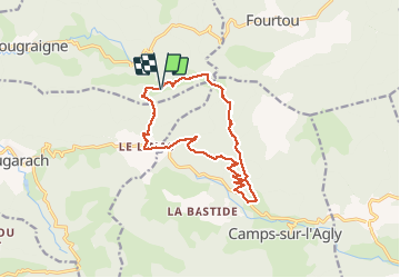
Trail Walking of 14.6 km to be discovered at Occitania, Aude, Sougraigne. This trail is proposed by PI11.
Description
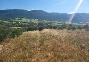
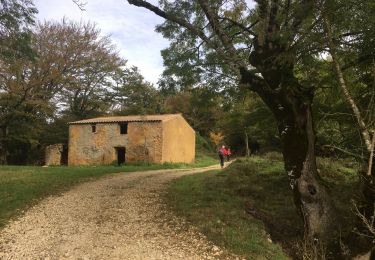
À Sougraigne, sur le Domaine de l’Eau Salée, jaillit la Sals, une source salée possédant jusqu’à 60gr de sel/litre et qui, de tout temps, a attiré de nombreux acteurs : verriers, mineurs de jais, charbonniers, bûcherons, bergers, colporteurs et contrebandiers du sel.
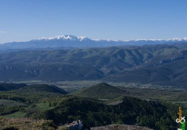
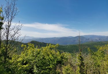
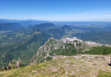
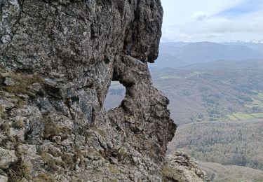
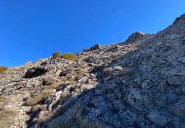
Cette randonnée se termine à la source et passe dans de nombreux sous-bois frais idéal en plein été. Attention quand même, il y a aussi des passages à découvert qui permettent d'avoir de beaux points de vue sur le pic de Bugarach.
Positioning
Comments
Trails nearby
![Trail Walking Bugarach - Le Pech de Bugarach - Photo](https://media.geolcdn.com/t/375/260/ext.jpg?maxdim=2&url=https%3A%2F%2Fservices.sitytrail.com%2FGeolivesWS%2FDownloadMedia.ashx%3FTrailID%3D103373%26Media%3D5434_4.jpg)
![Walking Walking](https://static1.geolcdn.com/sitytour/trail-icons/101.png)
Walking
![](/images/other/stat-length.png)
![](https://static1.geolcdn.com/siteimages/upload/files/16400158638029165_repeat_loop_refresh_sync_direction_icon.png)
![Trail Walking Bugarach - Le Pech de Bugarach 1230 m, depuis le Col du Linas - Photo](https://media.geolcdn.com/t/375/260/ext.jpg?maxdim=2&url=https%3A%2F%2Fservices.sitytrail.com%2FGeolivesWS%2FDownloadMedia.ashx%3FTrailID%3D191665%26Media%3D15324_1.jpg)
![Walking Walking](https://static1.geolcdn.com/sitytour/trail-icons/101.png)
Walking
![](/images/other/stat-length.png)
![](https://static1.geolcdn.com/siteimages/upload/files/16400158638029165_repeat_loop_refresh_sync_direction_icon.png)
![Trail Walking Bugarach - Bugarach par la fenêtre - Photo](https://media.geolcdn.com/t/375/260/f61c8120-4edd-4c37-b8d1-8f8539bc9df7.jpg&format=jpg&maxdim=2)
![Walking Walking](https://static1.geolcdn.com/sitytour/trail-icons/101.png)
Walking
![](/images/other/stat-length.png)
![](https://static1.geolcdn.com/siteimages/upload/files/16400158638029165_repeat_loop_refresh_sync_direction_icon.png)
![Trail Walking Bugarach - pic du Bugarach - Photo](https://media.geolcdn.com/t/375/260/0be0b540-d788-4840-b942-68a2805d5a8a.jpg&format=jpg&maxdim=2)
![Walking Walking](https://static1.geolcdn.com/sitytour/trail-icons/101.png)
Walking
![](/images/other/stat-length.png)
![](https://static1.geolcdn.com/siteimages/upload/files/16400158638029165_repeat_loop_refresh_sync_direction_icon.png)
![Trail Walking Bugarach - le Pech de Bugarach - Lac de La vène - Photo](https://media.geolcdn.com/t/375/260/d1455a7d-4be7-4620-998d-a60e0cfc8767.jpg&format=jpg&maxdim=2)
![Walking Walking](https://static1.geolcdn.com/sitytour/trail-icons/101.png)
Walking
![](/images/other/stat-length.png)
![](https://static1.geolcdn.com/siteimages/upload/files/16400158638029165_repeat_loop_refresh_sync_direction_icon.png)
![Trail Walking Sougraigne - Sougraigne bugarach pont romain - Photo](https://media.geolcdn.com/t/375/260/ad5479a5-b384-460d-9d60-d556ca1f7a71.jpg&format=jpg&maxdim=2)
![Walking Walking](https://static1.geolcdn.com/sitytour/trail-icons/101.png)
Walking
![](/images/other/stat-length.png)
![](https://static1.geolcdn.com/siteimages/upload/files/16400158638029165_repeat_loop_refresh_sync_direction_icon.png)
![Trail Walking Bugarach - Tour Bugarach - Photo](https://media.geolcdn.com/t/375/260/8fec2c3e-ab59-425a-8e19-942b2c7606b2.jpg&format=jpg&maxdim=2)
![Walking Walking](https://static1.geolcdn.com/sitytour/trail-icons/101.png)
![Trail Walking Bugarach - Col du Linas-Pech de Bugarach-La fenêtre - Photo](https://media.geolcdn.com/t/375/260/45453090-280d-427b-b6e8-17db17de82e5.jpg&format=jpg&maxdim=2)
![Walking Walking](https://static1.geolcdn.com/sitytour/trail-icons/101.png)
Walking
![](/images/other/stat-length.png)
![](https://static1.geolcdn.com/siteimages/upload/files/16400158638029165_repeat_loop_refresh_sync_direction_icon.png)
![Trail Walking Bugarach - Bugarach - Fontaine salée (La Salz) - Photo](https://media.geolcdn.com/t/375/260/fa770e1e-7d8f-40cb-8d39-d1c280f62deb.jpg&format=jpg&maxdim=2)
![Walking Walking](https://static1.geolcdn.com/sitytour/trail-icons/101.png)
Walking
![](/images/other/stat-length.png)
![](https://static1.geolcdn.com/siteimages/upload/files/16400158638029165_repeat_loop_refresh_sync_direction_icon.png)