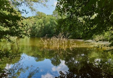
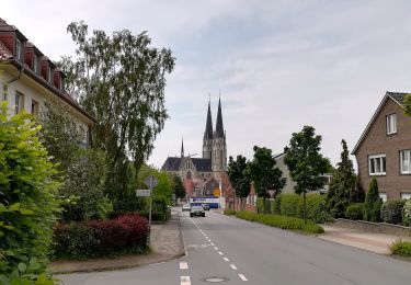
Trail Mountain bike Coesfeld - m-duitsland-sprakelschitzelmitkartoffelnsalattour - Photo

m-duitsland-sprakelschitzelmitkartoffelnsalattour

© OpenStreetMap contributors
Length
Length
99 km
Max alt
Max alt
173 m
Uphill gradient
Uphill gradient
925 m
Km-Effort
Km-Effort  
111 km
Min alt
Min alt
35 m
Downhill gradient
Downhill gradient
945 m
Boucle
Boucle
No
Creation date :
2014-12-10 00:00:00.0
Updated on :
2014-12-10 00:00:00.0

(0 Reviews)

Mountain bike
Mountain bike
--
Difficulty : Unknown

Scan this QR Code to open this trail in the SityTrail application

FREE GPS app for hiking

Logo SityTrail SityTrail

IGN / Geographical institutes

Download SityTrail from the App Store Download SityTrail from Google Play

Logo SityTrail SityTrail World

The world is yours!

Download SityTrail from the App Store Download SityTrail from Google Play Download SityTrail on Huawei AppGallery

About

Trail Mountain bike of 99 km to be discovered at North Rhine-Westphalia, Kreis Coesfeld, Coesfeld. This trail is proposed by gpstracks.

Description

More information on GPStracks.nl : http://www.gpstracks.nl

Elevation profile

Points of interest

Point of interest Reken - 1e stop bakker - Photo
gpstracks
Point of interest Gescher - 2e stop Gescher - Photo
gpstracks
Point of interest Heek - 3e stop Ahle - Photo
gpstracks
Point of interest Gronau - 4e Finish - Photo
gpstracks
GRONAU 
Point of interest Dülmen - baumberge - Photo
gpstracks
DÜLMEN 
Point of interest Gronau - geen pad - Photo
gpstracks
GRONAU 
Point of interest Gescher - Gescher - Photo
gpstracks
GESCHER 
Point of interest Ahaus - Graes - Photo
gpstracks
AHAUS 
Point of interest Coesfeld - Hünsberg (106m) - Photo
gpstracks
Point of interest Stadtlohn - kerk buren - Photo
gpstracks
STADTLOHN 
Point of interest Coesfeld - klim - Photo
gpstracks
COESFELD 
Point of interest Billerbeck - kloster - Photo
gpstracks
BILLERBECK 
Point of interest Legden - Koffie met LWC - Photo
gpstracks
Point of interest Ahaus - Liesner Wald - Photo
gpstracks
Point of interest Coesfeld - op top - Photo
gpstracks
COESFELD 
Point of interest Haltern am See - over Bahn - Photo
gpstracks
HALTERN AM SEE 
Point of interest Coesfeld - positivo - Photo
gpstracks
COESFELD 
Point of interest Reken - Reken - Photo
gpstracks
REKEN 
Point of interest Dülmen - roel in klim - Photo
gpstracks
DÜLMEN 
Point of interest Rosendahl - schloss - Photo
gpstracks
ROSENDAHL 
Point of interest Stadtlohn - spaggethi - Photo
gpstracks
STADTLOHN 
Point of interest Enschede - sprakel - Photo
gpstracks
ENSCHEDE 
Point of interest Coesfeld - Start - Photo
gpstracks
COESFELD 
Point of interest Coesfeld - treinstatoion - Photo
gpstracks
COESFELD 
Point of interest Gronau - watermolen epe - Photo
gpstracks
Point of interest Ahaus - Westmünsterland Rte - Photo
gpstracks

Positioning

Country:
Germany
Region :
North Rhine-Westphalia
Department/Province :
Kreis Coesfeld
Municipality :
Coesfeld
Location:
Unknown
Start:(UTM)
375268 ; 5750654 (32U) N.

Trails nearby

Trail On foot Haltern am See - Hohe Mark Steig (Wesel - Olfen) - Photo
On foot
GUIDE+

On foot

Medium
Haltern am See, North Rhine-Westphalia, Kreis Recklinghausen, Germany
18.9 km | 23 km-effort
5h 8min
No
Trail On foot Rosendahl - Darfelder Rundweg D1 - Photo
On foot
GUIDE+

On foot

Easy
Rosendahl, North Rhine-Westphalia, Kreis Coesfeld, Germany
3.4 km | 3.7 km-effort
50min
Yes
Trail On foot Billerbeck - Wanderweg Aulendorf A1 - Photo
On foot
GUIDE+

On foot

Easy
Billerbeck, North Rhine-Westphalia, Kreis Coesfeld, Germany
4.4 km | 4.7 km-effort
1h 3min
Yes
Trail On foot Billerbeck - Billerbeck Rundweg B1 - Photo
On foot
GUIDE+

On foot

Easy
Billerbeck, North Rhine-Westphalia, Kreis Coesfeld, Germany
12 km | 13.6 km-effort
3h 5min
Yes
Trail On foot Billerbeck - Billerbeck Rundweg B2 - Photo
On foot
GUIDE+

On foot

Easy
Billerbeck, North Rhine-Westphalia, Kreis Coesfeld, Germany
6.6 km | 7.5 km-effort
1h 41min
Yes
Trail On foot Billerbeck - Billerbeck Rundweg B3 - Photo
On foot
GUIDE+

On foot

Easy
Billerbeck, North Rhine-Westphalia, Kreis Coesfeld, Germany
12.1 km | 13.8 km-effort
3h 7min
Yes
Trail On foot Billerbeck - Billerbeck Rundweg B7 - Photo
On foot
GUIDE+

On foot

Easy
Billerbeck, North Rhine-Westphalia, Kreis Coesfeld, Germany
7.3 km | 8.5 km-effort
1h 56min
No
Trail On foot Billerbeck - Billerbeck Rundweg B9 - Photo
On foot
GUIDE+

On foot

Easy
Billerbeck, North Rhine-Westphalia, Kreis Coesfeld, Germany
13.6 km | 16.3 km-effort
3h 41min
No
Trail On foot Billerbeck - Billerbeck Rundweg B10 - Photo
On foot
GUIDE+

On foot

Easy
Billerbeck, North Rhine-Westphalia, Kreis Coesfeld, Germany
8.3 km | 9.7 km-effort
2h 12min
No


Close
My subscriptions