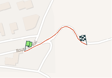
Trail Walking Saint-Laurent-de-Cerdans - boucle du mont Capell  - Photo
© OpenStreetMap contributors
Length
Length
111 m
Max alt
Max alt
685 m
Uphill gradient
Uphill gradient
3 m
Km-Effort
Km-Effort  
141 m
Min alt
Min alt
678 m
Downhill gradient
Downhill gradient
0 m
Boucle
Boucle
No
Creation date :
2021-05-21 06:42:27.829
Updated on :
2021-05-21 17:47:53.011

(0 Reviews)

Walking
Walking
6h30
Difficulty : Easy

Scan this QR Code to open this trail in the SityTrail application

FREE GPS app for hiking

Logo SityTrail SityTrail

IGN / Geographical institutes

Download SityTrail from the App Store Download SityTrail from Google Play

Logo SityTrail SityTrail World

The world is yours!

Download SityTrail from the App Store Download SityTrail from Google Play Download SityTrail on Huawei AppGallery

About

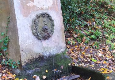
Trail Walking of 111 m to be discovered at Occitania, Pyrénées-Orientales, Saint-Laurent-de-Cerdans. This trail is proposed by HENRYLESTEL.

Description

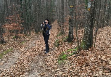
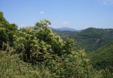
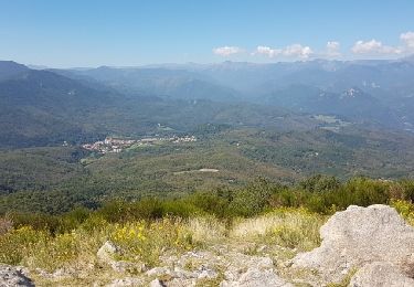
jolie rando accessible à tout le monde

Elevation profile

Positioning

Country:
France
Region :
Occitania
Department/Province :
Pyrénées-Orientales
Municipality :
Saint-Laurent-de-Cerdans
Location:
Unknown
Start:(UTM)
468629 ; 4692622 (31T) N.

Trails nearby

Trail Walking Saint-Laurent-de-Cerdans - St laurent de cerdans - Photo
Walking
peillo

Walking

Very easy
Saint-Laurent-de-Cerdans, Occitania, Pyrénées-Orientales, France
10.2 km | 13.9 km-effort
3h 6min
No
Trail Walking Saint-Laurent-de-Cerdans - Cami_Retirade-Aigua_T - Photo
Walking
force

Walking

Medium
Saint-Laurent-de-Cerdans, Occitania, Pyrénées-Orientales, France
11.3 km | 16.8 km-effort
3h 39min
Yes
Trail Walking Saint-Laurent-de-Cerdans - De St Laurent de Cerdans au col de Malrens - Photo
Walking
tracegps

Walking

Difficult
Saint-Laurent-de-Cerdans, Occitania, Pyrénées-Orientales, France
19 km | 31 km-effort
6h 30min
No
Trail Mountain bike Saint-Laurent-de-Cerdans - Vallespir St laurent de Cerdans - Photo
Mountain bike
tracegps

Mountain bike

Difficult
Saint-Laurent-de-Cerdans, Occitania, Pyrénées-Orientales, France
32 km | 44 km-effort
3h 15min
Yes
Trail Walking Saint-Laurent-de-Cerdans - MtCapel-Bolet_T - Photo
Walking
force

Walking

Very easy
Saint-Laurent-de-Cerdans, Occitania, Pyrénées-Orientales, France
10.8 km | 17.7 km-effort
4h 10min
Yes
Trail Walking Saint-Laurent-de-Cerdans - Sentier des Fontaines - St Laurent de Cerdans - Photo
Walking
tracegps

Walking

Medium
Saint-Laurent-de-Cerdans, Occitania, Pyrénées-Orientales, France
11.8 km | 18 km-effort
4h 30min
Yes
Trail Walking Saint-Laurent-de-Cerdans - st laurent fontaines courtes - Photo
Walking
66Gribouille83

Walking

Difficult
Saint-Laurent-de-Cerdans, Occitania, Pyrénées-Orientales, France
9.7 km | 15.1 km-effort
5h 53min
Yes
Trail Walking Saint-Laurent-de-Cerdans - st laurent de cerdan les fontaines - Photo
Walking
patio

Walking

Easy
Saint-Laurent-de-Cerdans, Occitania, Pyrénées-Orientales, France
13.4 km | 19.3 km-effort
4h 47min
Yes
Trail Walking Saint-Laurent-de-Cerdans - Saint Laurent de Cerdans 07 10 2020 - Photo
Walking
andre66

Walking

Easy
Saint-Laurent-de-Cerdans, Occitania, Pyrénées-Orientales, France
10.4 km | 14.1 km-effort
3h 4min
Yes


Close
My subscriptions