![](/images/other/stat-length.png)
![Trail Walking Gedinne - SMA_Parcours-complet_2021-02-04 - Photo](https://media.geolcdn.com/t/1900/400/ext.pjpeg?maxdim=2&url=https%3A%2F%2Fstatic1.geolcdn.com%2Fsiteimages%2Fupload%2Ffiles%2F1553511878bg_sport_marche.png)
SMA_Parcours-complet_2021-02-04
ramagufa
User
![Length](/images/other/stat-length.png)
Length
230 km
![Max alt](https://static1.geolcdn.com/siteimages/upload/files/1508320355ic_sort_altitude_max_24dp.png)
Max alt
699 m
![Uphill gradient](https://static1.geolcdn.com/siteimages/upload/files/1508320355ic_sort_den_pos_24dp.png)
Uphill gradient
5290 m
![Km-Effort](/images/other/stat-length.png)
Km-Effort
300 km
![Min alt](https://static1.geolcdn.com/siteimages/upload/files/1508320355ic_sort_altitude_min_24dp.png)
Min alt
150 m
![Downhill gradient](https://static1.geolcdn.com/siteimages/upload/files/1508320355ic_sort_den_neg_24dp.png)
Downhill gradient
5094 m
![Boucle](https://static1.geolcdn.com/siteimages/upload/files/16400158638029165_repeat_loop_refresh_sync_direction_icon.png)
Boucle
No
Creation date :
2021-05-18 19:11:07.062
Updated on :
2021-05-21 15:59:51.191
![Walking](https://static1.geolcdn.com/sitytour/trail-icons/101.png)
66h31
Difficulty : Very difficult
![Scan this QR Code to open this trail in the SityTrail application](https://capi.geolives.com/qq0zvz2zws4bq2lad0pu/sitytour/trails/2792251/qr.png?size=200)
FREE GPS app for hiking
About
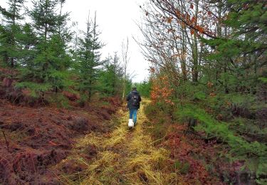
Trail Walking of 230 km to be discovered at Wallonia, Namur, Gedinne. This trail is proposed by ramagufa.
Description
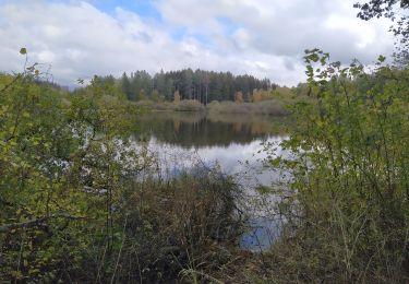
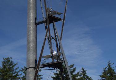
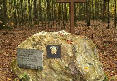
Au départ de la tour du millénaire à Louette-Saint-Pierre, un petit détour vers les les fagnes de l'abîme (en longeant la frontière avec la France) pour revenir au vrai point de départ de la Croix Scaille pour ce long périple.
Positioning
Country:
Belgium
Region :
Wallonia
Department/Province :
Namur
Municipality :
Gedinne
Location:
Unknown
Start:(Dec)
Start:(UTM)
632208 ; 5534986 (31U) N.
Comments
Trails nearby
![Walking Walking](https://static1.geolcdn.com/sitytour/trail-icons/101.png)
RB-Na-30-La Croix-Scaille
Walking
Very difficult
(3)
Gedinne,
Wallonia,
Namur,
Belgium
![](/images/other/stat-length.png)
23 km | 30 km-effort
6h 47min
![](https://static1.geolcdn.com/siteimages/upload/files/16400158638029165_repeat_loop_refresh_sync_direction_icon.png)
Yes
![Trail Walking Gedinne - Gedinne - Circuit Natura 2000](https://media.geolcdn.com/t/375/260/ext.jpg?maxdim=2&url=https%3A%2F%2Fservices.sitytrail.com%2FGeolivesWS%2FDownloadMedia.ashx%3FTrailID%3D472278%26Media%3Dd7fd7a8f-ff34-456c-92bf-c54889e59e75.jpg)
![Walking Walking](https://static1.geolcdn.com/sitytour/trail-icons/101.png)
Gedinne - Circuit Natura 2000 "des sites qui valent le détour" - Na10
Walking
Medium
(3)
Gedinne,
Wallonia,
Namur,
Belgium
![](/images/other/stat-length.png)
9 km | 11.9 km-effort
1h 30min
![](https://static1.geolcdn.com/siteimages/upload/files/16400158638029165_repeat_loop_refresh_sync_direction_icon.png)
No
![Trail Walking Gedinne - RB-Na-08 Dans la vallée de la Houille - Photo](https://media.geolcdn.com/t/375/260/ext.jpg?maxdim=2&url=https%3A%2F%2Fservices.sitytrail.com%2FGeolivesWS%2FDownloadMedia.ashx%3FTrailID%3D179634%26Media%3D50c146e4-51ae-4441-b546-c84e45c04bf9.jpg)
![Walking Walking](https://static1.geolcdn.com/sitytour/trail-icons/101.png)
RB-Na-08 Dans la vallée de la Houille
Walking
Medium
(5)
Gedinne,
Wallonia,
Namur,
Belgium
![](/images/other/stat-length.png)
22 km | 28 km-effort
6h 0min
![](https://static1.geolcdn.com/siteimages/upload/files/16400158638029165_repeat_loop_refresh_sync_direction_icon.png)
Yes
![Trail Walking Gedinne - La vallée de la Houille - Rienne - Photo](https://media.geolcdn.com/t/375/260/ext.jpg?maxdim=2&url=https%3A%2F%2Fstatic1.geolcdn.com%2Fsiteimages%2Fupload%2Ffiles%2F1553511878bg_sport_marche.png)
![Walking Walking](https://static1.geolcdn.com/sitytour/trail-icons/101.png)
La vallée de la Houille - Rienne
Walking
Medium
(1)
Gedinne,
Wallonia,
Namur,
Belgium
![](/images/other/stat-length.png)
22 km | 28 km-effort
5h 30min
![](https://static1.geolcdn.com/siteimages/upload/files/16400158638029165_repeat_loop_refresh_sync_direction_icon.png)
Yes
![Trail Walking Gedinne - Balade à Willerzie - Gedinne - Photo](https://media.geolcdn.com/t/375/260/5ec22972-002a-40e1-b0ee-bd3232993f27.jpeg&format=jpg&maxdim=2)
![Walking Walking](https://static1.geolcdn.com/sitytour/trail-icons/101.png)
Balade à Willerzie - Gedinne
Walking
Difficult
Gedinne,
Wallonia,
Namur,
Belgium
![](/images/other/stat-length.png)
10.9 km | 13 km-effort
2h 57min
![](https://static1.geolcdn.com/siteimages/upload/files/16400158638029165_repeat_loop_refresh_sync_direction_icon.png)
Yes
![Trail On foot Gedinne - L'Ange Gardien 47 - Photo](https://media.geolcdn.com/t/375/260/ext.jpg?maxdim=2&url=https%3A%2F%2Fpivotmedia.tourismewallonie.be%2FOTH-A0-0062-3FPM%2FOTH-A0-0062-3FPM.jpg)
![On foot On foot](https://static1.geolcdn.com/sitytour/trail-icons/100.png)
L'Ange Gardien 47
On foot
Easy
Gedinne,
Wallonia,
Namur,
Belgium
![](/images/other/stat-length.png)
5.7 km | 6.8 km-effort
1h 32min
![](https://static1.geolcdn.com/siteimages/upload/files/16400158638029165_repeat_loop_refresh_sync_direction_icon.png)
Yes
![Trail Walking Gedinne - Balade à la Croix-Scaille - Les Fanges de l'Abîme - Photo](https://media.geolcdn.com/t/375/260/90477e17-0e05-4a6f-bcf1-b60967f06656.jpeg&format=jpg&maxdim=2)
![Walking Walking](https://static1.geolcdn.com/sitytour/trail-icons/101.png)
Balade à la Croix-Scaille - Les Fanges de l'Abîme
Walking
Medium
(2)
Gedinne,
Wallonia,
Namur,
Belgium
![](/images/other/stat-length.png)
6.6 km | 8.7 km-effort
1h 58min
![](https://static1.geolcdn.com/siteimages/upload/files/16400158638029165_repeat_loop_refresh_sync_direction_icon.png)
Yes
![Trail Walking Gedinne - Espace liberté 44 - Photo](https://media.geolcdn.com/t/375/260/bba44172-4661-46c9-9ee8-3e242016800f.jpg&format=jpg&maxdim=2)
![Walking Walking](https://static1.geolcdn.com/sitytour/trail-icons/101.png)
Espace liberté 44
Walking
Very easy
Gedinne,
Wallonia,
Namur,
Belgium
![](/images/other/stat-length.png)
5.5 km | 6.7 km-effort
1h 15min
![](https://static1.geolcdn.com/siteimages/upload/files/16400158638029165_repeat_loop_refresh_sync_direction_icon.png)
Yes
![Trail Walking Gedinne - Ange gardien - Photo](https://media.geolcdn.com/t/375/260/754ed601-b24d-44d7-8a04-d7dd06597edc.jpg&format=jpg&maxdim=2)
![Walking Walking](https://static1.geolcdn.com/sitytour/trail-icons/101.png)