Trail Walking Bad Bentheim - w-law-3-2-marskramerpad - Photo
© OpenStreetMap contributors
Length
Length
358 km
Max alt
Max alt
98 m
Uphill gradient
Uphill gradient
2233 m
Km-Effort
Km-Effort  
388 km
Min alt
Min alt
-8 m
Downhill gradient
Downhill gradient
2306 m
Boucle
Boucle
No
Creation date :
2014-12-10 00:00:00.0
Updated on :
2014-12-10 00:00:00.0

(0 Reviews)

Walking
Walking
--
Difficulty : Unknown

Scan this QR Code to open this trail in the SityTrail application

FREE GPS app for hiking

Logo SityTrail SityTrail

IGN / Geographical institutes

Download SityTrail from the App Store Download SityTrail from Google Play

Logo SityTrail SityTrail World

The world is yours!

Download SityTrail from the App Store Download SityTrail from Google Play Download SityTrail on Huawei AppGallery

About

Trail Walking of 358 km to be discovered at Lower Saxony, Landkreis Grafschaft Bentheim, Bad Bentheim. This trail is proposed by gpstracks.

Description

More information on GPStracks.nl : http://www.gpstracks.nl

Elevation profile

Positioning

Country:
Germany
Region :
Lower Saxony
Department/Province :
Landkreis Grafschaft Bentheim
Municipality :
Bad Bentheim
Location:
Unknown
Start:(Dec)
Start:(UTM)
374403 ; 5796293 (32U) N.

Trails nearby

Trail Motor Bad Bentheim - a-duitsland-rondrit-teutoburgerwald - Photo
Motor
gpstracks

Motor

Very easy
Bad Bentheim, Lower Saxony, Landkreis Grafschaft Bentheim, Germany
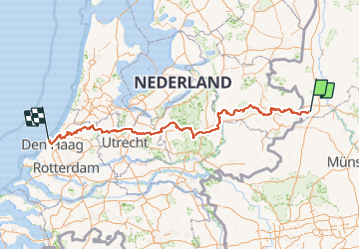
258 km | 300 km-effort
Unknown
Yes
Trail Cycle Bad Bentheim - Duitsland - Bentheimroute - Photo
Cycle
gpstracks

Cycle

Very easy
Bad Bentheim, Lower Saxony, Landkreis Grafschaft Bentheim, Germany
42 km | 46 km-effort
Unknown
Yes


Close
My subscriptions