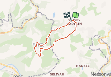

22 km | 29 km-effort


User GUIDE


FREE GPS app for hiking
 SityTrail
IGN / Geographical institutes
SityTrail World
The world is yours!
Trail Walking of 5.6 km to be discovered at Wallonia, Liège, Olne. This trail is proposed by pierreh01.
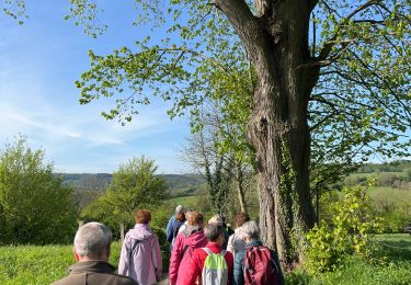
Balade de ce lundi 17 mai 2021 en petit comité.
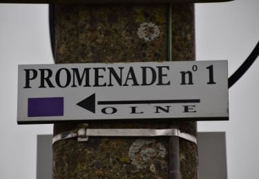
Circuit en boucle, sans balisage, librement inspiré des promenades balisées de la Maison du Tourisme de Olne; au départ de l'église de Saint-Hadelin.
Début de balade assez glissant dans le bois.
S'équiper de bonnes chaussures de marche ou de bottes.


Walking

Walking

Walking

Walking

Walking

Walking

Walking
Walking