11.8 km | 17.2 km-effort
w-duitsland-klettersteig
gpstracks
User
Length
8.1 km
Max alt
244 m
Uphill gradient
269 m
Km-Effort
11.8 km
Min alt
71 m
Downhill gradient
279 m
Boucle
No
Creation date :
2014-12-10 00:00:00.0
Updated on :
2014-12-10 00:00:00.0
--
Difficulty : Unknown
FREE GPS app for hiking
About
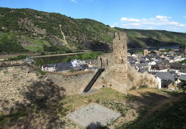
Trail Walking of 8.1 km to be discovered at Rhineland-Palatinate, Rhein-Hunsrück-Kreis, Oberwesel. This trail is proposed by gpstracks.
Description
More information on GPStracks.nl : http://www.gpstracks.nl
Positioning
Country:
Germany
Region :
Rhineland-Palatinate
Department/Province :
Rhein-Hunsrück-Kreis
Municipality :
Oberwesel
Location:
Unknown
Start:(Dec)
Start:(UTM)
408882 ; 5551435 (32U) N.
Comments
Trails nearby
Schwede-Bure-Tour
On foot
Easy
Oberwesel,
Rhineland-Palatinate,
Rhein-Hunsrück-Kreis,
Germany
3h 54min
Yes
Rheinsteig Loreley-Extratour
On foot
Medium
Bornich,
Rhineland-Palatinate,
Rhein-Lahn-Kreis,
Germany
14.3 km | 20 km-effort
4h 38min
Yes
Wanderweg orange Verschlingung auf blau
On foot
Easy
Oberwesel,
Rhineland-Palatinate,
Rhein-Hunsrück-Kreis,
Germany
3.5 km | 5.9 km-effort
1h 20min
No
Rheinsteig [Kaub - Lorch]
On foot
Medium
Kaub,
Rhineland-Palatinate,
Rhein-Lahn-Kreis,
Germany
13.7 km | 21 km-effort
4h 41min
No
Stationswandeling Oberwesel - Bacharrach
On foot
Easy
Oberwesel,
Rhineland-Palatinate,
Rhein-Hunsrück-Kreis,
Germany
10.9 km | 14.6 km-effort
3h 12min
No
Al - Loreley
Walking
Very easy
Bornich,
Rhineland-Palatinate,
Rhein-Lahn-Kreis,
Germany
1.8 km | 2.4 km-effort
1h 46min
Yes